BL5 3BF maps, stats, and open data
BL5 3BF is located in the Westhoughton North & Hunger Hill electoral ward, within the metropolitan district of Bolton and the English Parliamentary constituency of Bolton West. The Sub Integrated Care Board (ICB) Location is NHS Greater Manchester ICB - 00T and the police force is Greater Manchester. This postcode has been in use since September 2018.
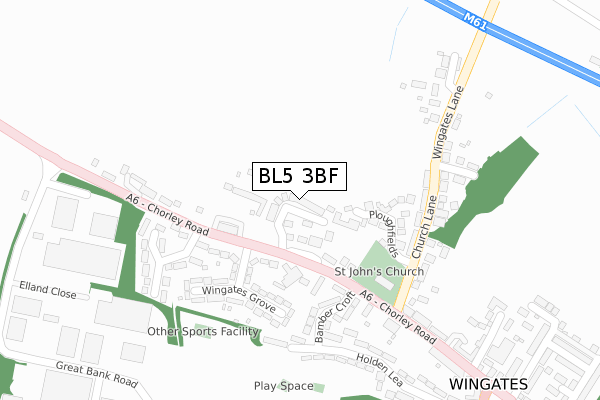
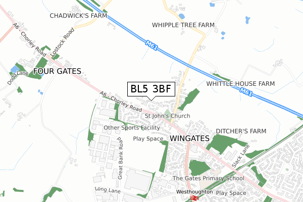
BL5 3BF maps


Licence: Open Government Licence (requires attribution)
Attribution: Contains OS data © Crown copyright and database right 2025
Source: Open Postcode Geo
Licence: Open Government Licence (requires attribution)
Attribution: Contains OS data © Crown copyright and database right 2025; Contains Royal Mail data © Royal Mail copyright and database right 2025; Source: Office for National Statistics licensed under the Open Government Licence v.3.0
BL5 3BF geodata
| Easting | 365055 |
| Northing | 407495 |
| Latitude | 53.562915 |
| Longitude | -2.529055 |
Where is BL5 3BF?
| Country | England |
| Postcode District | BL5 |
Politics
| Ward | Westhoughton North & Hunger Hill |
|---|---|
| Constituency | Bolton West |
House Prices
Sales of detached houses in BL5 3BF
1, PENNINE VIEW, WESTHOUGHTON, BOLTON, BL5 3BF 2020 12 FEB £385,000 |
1, PENNINE VIEW, WESTHOUGHTON, BOLTON, BL5 3BF 2020 12 FEB £385,000 |
21, PENNINE VIEW, WESTHOUGHTON, BOLTON, BL5 3BF 2020 10 JAN £392,000 |
23, PENNINE VIEW, WESTHOUGHTON, BOLTON, BL5 3BF 2019 15 AUG £395,000 |
3, PENNINE VIEW, WESTHOUGHTON, BOLTON, BL5 3BF 2019 8 MAR £388,000 |
5, PENNINE VIEW, WESTHOUGHTON, BOLTON, BL5 3BF 2019 22 FEB £385,000 |
19, PENNINE VIEW, WESTHOUGHTON, BOLTON, BL5 3BF 2019 5 FEB £377,000 |
9, PENNINE VIEW, WESTHOUGHTON, BOLTON, BL5 3BF 2018 14 DEC £378,000 |
7, PENNINE VIEW, WESTHOUGHTON, BOLTON, BL5 3BF 2018 30 NOV £373,000 |
17, PENNINE VIEW, WESTHOUGHTON, BOLTON, BL5 3BF 2018 31 OCT £371,250 |
Licence: Contains HM Land Registry data © Crown copyright and database right 2025. This data is licensed under the Open Government Licence v3.0.
Transport
Nearest bus stops to BL5 3BF
| Chorley Rd/St Johns Ave (Chorley Rd) | Wingates | 104m |
| Chorley Rd/St Johns Ave (Chorley Rd) | Wingates | 145m |
| Chorley Rd/Church Ln (Chorley Rd) | Wingates | 194m |
| Chorley Rd/Church Ln (Chorley Rd) | Wingates | 219m |
| Church St/Chorley Rd (Church St) | Wingates | 483m |
Nearest railway stations to BL5 3BF
| Westhoughton Station | 0.9km |
| Horwich Parkway Station | 1.8km |
| Lostock Station | 2.6km |
Broadband
Broadband access in BL5 3BF (2020 data)
| Percentage of properties with Next Generation Access | 100.0% |
| Percentage of properties with Superfast Broadband | 100.0% |
| Percentage of properties with Ultrafast Broadband | 0.0% |
| Percentage of properties with Full Fibre Broadband | 0.0% |
Superfast Broadband is between 30Mbps and 300Mbps
Ultrafast Broadband is > 300Mbps
Broadband speed in BL5 3BF (2019 data)
Download
| Median download speed | 12.7Mbps |
| Average download speed | 13.8Mbps |
| Maximum download speed | 18.41Mbps |
Upload
| Median upload speed | 1.1Mbps |
| Average upload speed | 1.1Mbps |
| Maximum upload speed | 1.28Mbps |
Broadband limitations in BL5 3BF (2020 data)
| Percentage of properties unable to receive 2Mbps | 0.0% |
| Percentage of properties unable to receive 5Mbps | 0.0% |
| Percentage of properties unable to receive 10Mbps | 0.0% |
| Percentage of properties unable to receive 30Mbps | 0.0% |
Deprivation
34.1% of English postcodes are less deprived than BL5 3BF:Food Standards Agency
Three nearest food hygiene ratings to BL5 3BF (metres)


➜ Get more ratings from the Food Standards Agency
Nearest post box to BL5 3BF
| Last Collection | |||
|---|---|---|---|
| Location | Mon-Fri | Sat | Distance |
| 2 Lord Street | 17:30 | 11:25 | 1,267m |
| Central Drive | 17:30 | 11:20 | 1,514m |
| Bolton Road Westhoughton | 18:30 | 11:10 | 1,577m |
BL5 3BF ITL and BL5 3BF LAU
The below table lists the International Territorial Level (ITL) codes (formerly Nomenclature of Territorial Units for Statistics (NUTS) codes) and Local Administrative Units (LAU) codes for BL5 3BF:
| ITL 1 Code | Name |
|---|---|
| TLD | North West (England) |
| ITL 2 Code | Name |
| TLD3 | Greater Manchester |
| ITL 3 Code | Name |
| TLD36 | Greater Manchester North West |
| LAU 1 Code | Name |
| E08000001 | Bolton |
BL5 3BF census areas
The below table lists the Census Output Area (OA), Lower Layer Super Output Area (LSOA), and Middle Layer Super Output Area (MSOA) for BL5 3BF:
| Code | Name | |
|---|---|---|
| OA | E00024228 | |
| LSOA | E01004775 | Bolton 014A |
| MSOA | E02000997 | Bolton 014 |
Nearest postcodes to BL5 3BF
| BL5 3PL | Chorley Road | 81m |
| BL5 3PW | Ryecroft Drive | 92m |
| BL5 3PG | Chorley Road | 127m |
| BL5 3LG | Ploughfields | 131m |
| BL5 3PQ | St Johns Avenue | 160m |
| BL5 3PJ | Chorley Road | 169m |
| BL5 3PH | Wingates Grove | 201m |
| BL5 3PE | Bamber Croft | 202m |
| BL5 3PP | Church Lane | 202m |
| BL5 3PN | Chorley Road | 206m |