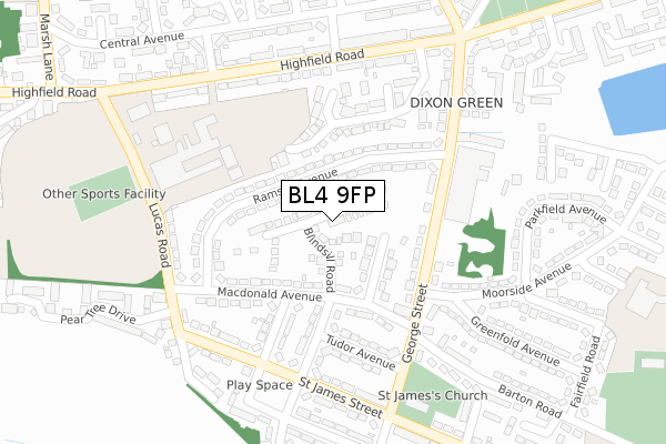
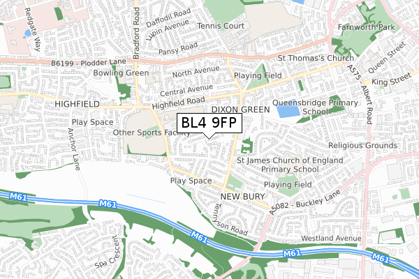
BL4 9FP is located in the Farnworth South electoral ward, within the metropolitan district of Bolton and the English Parliamentary constituency of Bolton South East. The Sub Integrated Care Board (ICB) Location is NHS Greater Manchester ICB - 00T and the police force is Greater Manchester. This postcode has been in use since December 2018.


GetTheData
Source: OS Open Zoomstack (Ordnance Survey)
Licence: Open Government Licence (requires attribution)
Attribution: Contains OS data © Crown copyright and database right 2025
Source: Open Postcode Geo
Licence: Open Government Licence (requires attribution)
Attribution: Contains OS data © Crown copyright and database right 2025; Contains Royal Mail data © Royal Mail copyright and database right 2025; Source: Office for National Statistics licensed under the Open Government Licence v.3.0
| Easting | 372697 |
| Northing | 405440 |
| Latitude | 53.544899 |
| Longitude | -2.413501 |
GetTheData
Source: Open Postcode Geo
Licence: Open Government Licence
| Country | England |
| Postcode District | BL4 |
➜ See where BL4 is on a map ➜ Where is Farnworth? | |
GetTheData
Source: Land Registry Price Paid Data
Licence: Open Government Licence
| Ward | Farnworth South |
| Constituency | Bolton South East |
GetTheData
Source: ONS Postcode Database
Licence: Open Government Licence
71, BLINDSILL ROAD, FARNWORTH, BOLTON, BL4 9FP 2021 31 MAR £192,995 |
73, BLINDSILL ROAD, FARNWORTH, BOLTON, BL4 9FP 2021 31 MAR £172,995 |
75, BLINDSILL ROAD, FARNWORTH, BOLTON, BL4 9FP 2021 30 MAR £163,995 |
81, BLINDSILL ROAD, FARNWORTH, BOLTON, BL4 9FP 2021 5 FEB £164,995 |
57, BLINDSILL ROAD, FARNWORTH, BOLTON, BL4 9FP 2020 17 DEC £192,995 |
87, BLINDSILL ROAD, FARNWORTH, BOLTON, BL4 9FP 2020 30 SEP £154,995 |
47, BLINDSILL ROAD, FARNWORTH, BOLTON, BL4 9FP 2020 31 JUL £147,995 |
43, BLINDSILL ROAD, FARNWORTH, BOLTON, BL4 9FP 2020 1 MAY £179,995 |
97, BLINDSILL ROAD, FARNWORTH, BOLTON, BL4 9FP 2020 31 MAR £174,995 |
45, BLINDSILL ROAD, FARNWORTH, BOLTON, BL4 9FP 2020 26 MAR £175,995 |
GetTheData
Source: HM Land Registry Price Paid Data
Licence: Contains HM Land Registry data © Crown copyright and database right 2025. This data is licensed under the Open Government Licence v3.0.
| George St/Macdonald Ave (George St) | New Bury | 150m |
| George St/Ramsay Ave (George St) | New Bury | 175m |
| George St/Ramsay Ave (George St) | New Bury | 178m |
| George St/Macdonald Ave (George St) | New Bury | 183m |
| Highfield Rd/Fir Rd (Highfield Rd) | Highfield | 235m |
| Moses Gate Station | 1.5km |
| Farnworth Station | 1.8km |
| Kearsley Station | 2.5km |
GetTheData
Source: NaPTAN
Licence: Open Government Licence
| Percentage of properties with Next Generation Access | 100.0% |
| Percentage of properties with Superfast Broadband | 100.0% |
| Percentage of properties with Ultrafast Broadband | 91.7% |
| Percentage of properties with Full Fibre Broadband | 91.7% |
Superfast Broadband is between 30Mbps and 300Mbps
Ultrafast Broadband is > 300Mbps
| Percentage of properties unable to receive 2Mbps | 0.0% |
| Percentage of properties unable to receive 5Mbps | 0.0% |
| Percentage of properties unable to receive 10Mbps | 0.0% |
| Percentage of properties unable to receive 30Mbps | 0.0% |
GetTheData
Source: Ofcom
Licence: Ofcom Terms of Use (requires attribution)
GetTheData
Source: ONS Postcode Database
Licence: Open Government Licence


➜ Get more ratings from the Food Standards Agency
GetTheData
Source: Food Standards Agency
Licence: FSA terms & conditions
| Last Collection | |||
|---|---|---|---|
| Location | Mon-Fri | Sat | Distance |
| Bolton Mail Centre | 19:30 | 13:00 | 534m |
| Manchester Road Kearsley | 17:30 | 11:20 | 874m |
| Egerton Street/Gladstone Road | 17:50 | 11:55 | 946m |
GetTheData
Source: Dracos
Licence: Creative Commons Attribution-ShareAlike
The below table lists the International Territorial Level (ITL) codes (formerly Nomenclature of Territorial Units for Statistics (NUTS) codes) and Local Administrative Units (LAU) codes for BL4 9FP:
| ITL 1 Code | Name |
|---|---|
| TLD | North West (England) |
| ITL 2 Code | Name |
| TLD3 | Greater Manchester |
| ITL 3 Code | Name |
| TLD36 | Greater Manchester North West |
| LAU 1 Code | Name |
| E08000001 | Bolton |
GetTheData
Source: ONS Postcode Directory
Licence: Open Government Licence
The below table lists the Census Output Area (OA), Lower Layer Super Output Area (LSOA), and Middle Layer Super Output Area (MSOA) for BL4 9FP:
| Code | Name | |
|---|---|---|
| OA | E00024606 | |
| LSOA | E01004861 | Bolton 033A |
| MSOA | E02001016 | Bolton 033 |
GetTheData
Source: ONS Postcode Directory
Licence: Open Government Licence
| BL4 9RL | Gorton Street | 71m |
| BL4 9RA | Ramsay Avenue | 82m |
| BL4 9RJ | George Street | 108m |
| BL4 9RB | Ramsay Avenue | 109m |
| BL4 9RE | Macdonald Avenue | 161m |
| BL4 0AG | Brindley Close | 165m |
| BL4 9RQ | Stewart Avenue | 190m |
| BL4 9RH | Tudor Avenue | 219m |
| BL4 0AH | Highfield Road | 235m |
| BL4 9QX | George Street | 235m |
GetTheData
Source: Open Postcode Geo; Land Registry Price Paid Data
Licence: Open Government Licence