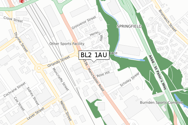
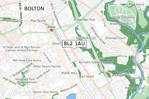
BL2 1AU is located in the Queens Park & Central electoral ward, within the metropolitan district of Bolton and the English Parliamentary constituency of Bolton South East. The Sub Integrated Care Board (ICB) Location is NHS Greater Manchester ICB - 00T and the police force is Greater Manchester. This postcode has been in use since November 2019.


GetTheData
Source: OS Open Zoomstack (Ordnance Survey)
Licence: Open Government Licence (requires attribution)
Attribution: Contains OS data © Crown copyright and database right 2025
Source: Open Postcode Geo
Licence: Open Government Licence (requires attribution)
Attribution: Contains OS data © Crown copyright and database right 2025; Contains Royal Mail data © Royal Mail copyright and database right 2025; Source: Office for National Statistics licensed under the Open Government Licence v.3.0
| Easting | 372233 |
| Northing | 408407 |
| Latitude | 53.571542 |
| Longitude | -2.420768 |
GetTheData
Source: Open Postcode Geo
Licence: Open Government Licence
| Country | England |
| Postcode District | BL2 |
➜ See where BL2 is on a map ➜ Where is Bolton? | |
GetTheData
Source: Land Registry Price Paid Data
Licence: Open Government Licence
| Ward | Queens Park & Central |
| Constituency | Bolton South East |
GetTheData
Source: ONS Postcode Database
Licence: Open Government Licence
| Manchester Rd/Orlando St (Manchester Rd) | Rose Hill | 108m |
| Manchester Road/Orlando Street (Manchester Road) | Rose Hill | 109m |
| Manchester Rd/Lever St (Manchester Rd) | Rose Hill | 110m |
| Manchester Rd/Lever St (Manchester Rd) | Rose Hill | 117m |
| Manchester Road/Grosvenor Street (Manchester Road) | Rose Hill | 266m |
| Bolton Station | 0.4km |
| Moses Gate Station | 2.2km |
| Hall i' th' Wood Station | 2.9km |
GetTheData
Source: NaPTAN
Licence: Open Government Licence
GetTheData
Source: ONS Postcode Database
Licence: Open Government Licence


➜ Get more ratings from the Food Standards Agency
GetTheData
Source: Food Standards Agency
Licence: FSA terms & conditions
| Last Collection | |||
|---|---|---|---|
| Location | Mon-Fri | Sat | Distance |
| Bradford Ave | 16:40 | 12:00 | 444m |
| Newport Street P O | 18:45 | 12:10 | 681m |
| Bihe Great Moor Street | 18:40 | 11:30 | 701m |
GetTheData
Source: Dracos
Licence: Creative Commons Attribution-ShareAlike
The below table lists the International Territorial Level (ITL) codes (formerly Nomenclature of Territorial Units for Statistics (NUTS) codes) and Local Administrative Units (LAU) codes for BL2 1AU:
| ITL 1 Code | Name |
|---|---|
| TLD | North West (England) |
| ITL 2 Code | Name |
| TLD3 | Greater Manchester |
| ITL 3 Code | Name |
| TLD36 | Greater Manchester North West |
| LAU 1 Code | Name |
| E08000001 | Bolton |
GetTheData
Source: ONS Postcode Directory
Licence: Open Government Licence
The below table lists the Census Output Area (OA), Lower Layer Super Output Area (LSOA), and Middle Layer Super Output Area (MSOA) for BL2 1AU:
| Code | Name | |
|---|---|---|
| OA | E00024376 | |
| LSOA | E01004817 | Bolton 022E |
| MSOA | E02001005 | Bolton 022 |
GetTheData
Source: ONS Postcode Directory
Licence: Open Government Licence
| BL2 1ET | Manchester Road | 46m |
| BL2 1EW | Dunlin Close | 74m |
| BL2 1EX | Herons Way | 89m |
| BL2 1ES | Manchester Road | 163m |
| BL2 1HE | Manchester Road | 175m |
| BL3 2AD | Victory Trading Estate | 244m |
| BL3 2AB | Lever Street | 341m |
| BL3 6BD | Thynne Street | 345m |
| BL2 1LE | Bedworth Close | 373m |
| BL2 1EH | Manchester Road | 384m |
GetTheData
Source: Open Postcode Geo; Land Registry Price Paid Data
Licence: Open Government Licence