Property/Postcode Data Search:
BL0 0AF maps, stats, and open data
BL0 0AF is located in the Eden electoral ward, within the local authority district of Rossendale and the English Parliamentary constituency of Rossendale and Darwen. The Sub Integrated Care Board (ICB) Location is NHS Lancashire and South Cumbria ICB - 01A and the police force is Lancashire. This postcode has been in use since July 2019.
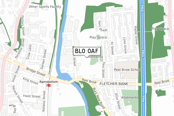
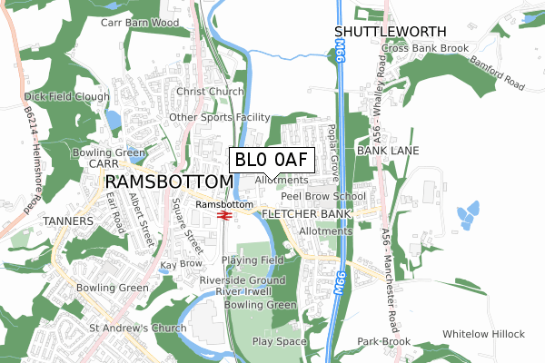
BL0 0AF maps


Source: OS Open Zoomstack (Ordnance Survey)
Licence: Open Government Licence (requires attribution)
Attribution: Contains OS data © Crown copyright and database right 2025
Source: Open Postcode Geo
Licence: Open Government Licence (requires attribution)
Attribution: Contains OS data © Crown copyright and database right 2025; Contains Royal Mail data © Royal Mail copyright and database right 2025; Source: Office for National Statistics licensed under the Open Government Licence v.3.0
Licence: Open Government Licence (requires attribution)
Attribution: Contains OS data © Crown copyright and database right 2025
Source: Open Postcode Geo
Licence: Open Government Licence (requires attribution)
Attribution: Contains OS data © Crown copyright and database right 2025; Contains Royal Mail data © Royal Mail copyright and database right 2025; Source: Office for National Statistics licensed under the Open Government Licence v.3.0
BL0 0AF geodata
| Easting | 379408 |
| Northing | 418134 |
| Latitude | 53.659301 |
| Longitude | -2.313070 |
Where is BL0 0AF?
| Country | England |
| Postcode District | BL0 |
Politics
| Ward | Eden |
|---|---|
| Constituency | Rossendale And Darwen |
Transport
Nearest bus stops to BL0 0AF
| Rose Bank (Bolton Road North) | Stubbins | 27m |
| Rose Bank (Bolton Road North) | Stubbins | 38m |
| Industrial Estate (Bolton Road North) | Stubbins | 192m |
| Industrial Estate (Bolton Road North) | Stubbins | 229m |
| Primary School (Bolton Road North) | Stubbins | 295m |
Nearest underground/metro/tram to BL0 0AF
| Ramsbottom (East Lancashire Railway) | Ramsbottom | 1,284m |
Deprivation
52.8% of English postcodes are less deprived than BL0 0AF:Food Standards Agency
Three nearest food hygiene ratings to BL0 0AF (metres)
Wax and Beans

16 Market Street
133m
AMB Catering Ltd @ The Cottons

Stubbins Lane
165m
Ramsbottom Starbucks

Stubbins Lane
165m
➜ Get more ratings from the Food Standards Agency
Nearest post box to BL0 0AF
| Last Collection | |||
|---|---|---|---|
| Location | Mon-Fri | Sat | Distance |
| Bridge Street | 18:45 | 11:00 | 1,253m |
| Ramsbottom P O | 19:00 | 11:30 | 1,349m |
| Eliza Street | 17:10 | 11:20 | 1,538m |
BL0 0AF ITL and BL0 0AF LAU
The below table lists the International Territorial Level (ITL) codes (formerly Nomenclature of Territorial Units for Statistics (NUTS) codes) and Local Administrative Units (LAU) codes for BL0 0AF:
| ITL 1 Code | Name |
|---|---|
| TLD | North West (England) |
| ITL 2 Code | Name |
| TLD4 | Lancashire |
| ITL 3 Code | Name |
| TLD46 | East Lancashire |
| LAU 1 Code | Name |
| E07000125 | Rossendale |
BL0 0AF census areas
The below table lists the Census Output Area (OA), Lower Layer Super Output Area (LSOA), and Middle Layer Super Output Area (MSOA) for BL0 0AF:
| Code | Name | |
|---|---|---|
| OA | E00128699 | |
| LSOA | E01025357 | Rossendale 008A |
| MSOA | E02005285 | Rossendale 008 |
Nearest postcodes to BL0 0AF
| BL0 0NB | Bolton Road North | 94m |
| BL0 0PY | Rosebank | 110m |
| BL0 0NF | Dale Street | 143m |
| BL0 0NQ | Robert Street | 157m |
| BL0 0SA | Bolton Road North | 158m |
| BL0 0PL | Gilbert Street | 164m |
| BL0 0NG | Bolton Road North | 183m |
| BL0 0NA | Bolton Road North | 183m |
| BL0 0PN | Meadway | 210m |
| BL0 0PJ | Alderway | 225m |