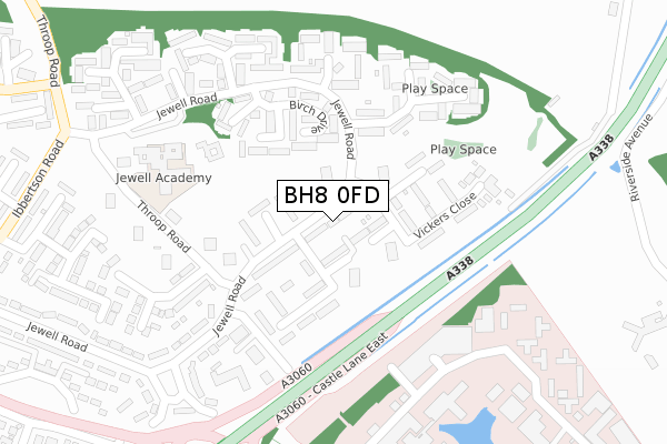
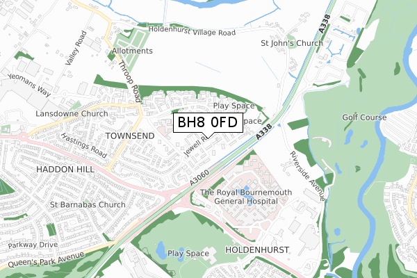
BH8 0FD is located in the Muscliff & Strouden Park electoral ward, within the unitary authority of Bournemouth, Christchurch and Poole and the English Parliamentary constituency of Bournemouth East. The Sub Integrated Care Board (ICB) Location is NHS Dorset ICB - 11J and the police force is Dorset. This postcode has been in use since September 2017.


GetTheData
Source: OS Open Zoomstack (Ordnance Survey)
Licence: Open Government Licence (requires attribution)
Attribution: Contains OS data © Crown copyright and database right 2025
Source: Open Postcode Geo
Licence: Open Government Licence (requires attribution)
Attribution: Contains OS data © Crown copyright and database right 2025; Contains Royal Mail data © Royal Mail copyright and database right 2025; Source: Office for National Statistics licensed under the Open Government Licence v.3.0
| Easting | 412424 |
| Northing | 94621 |
| Latitude | 50.751049 |
| Longitude | -1.825247 |
GetTheData
Source: Open Postcode Geo
Licence: Open Government Licence
| Country | England |
| Postcode District | BH8 |
➜ See where BH8 is on a map ➜ Where is Bournemouth? | |
GetTheData
Source: Land Registry Price Paid Data
Licence: Open Government Licence
| Ward | Muscliff & Strouden Park |
| Constituency | Bournemouth East |
GetTheData
Source: ONS Postcode Database
Licence: Open Government Licence
| Cheshire Drive (Jewell Road) | Strouden | 15m |
| Wilkinson Drive (Jewell Road) | Strouden | 24m |
| Cheshire Drive (Jewell Road) | Strouden | 109m |
| Hopkins Close | Strouden | 214m |
| Birch Drive (Jewell Road) | Strouden | 219m |
| Pokesdown Station | 2.2km |
| Christchurch Station | 3.2km |
| Bournemouth Station | 3.8km |
GetTheData
Source: NaPTAN
Licence: Open Government Licence
| Percentage of properties with Next Generation Access | 100.0% |
| Percentage of properties with Superfast Broadband | 80.0% |
| Percentage of properties with Ultrafast Broadband | 40.0% |
| Percentage of properties with Full Fibre Broadband | 0.0% |
Superfast Broadband is between 30Mbps and 300Mbps
Ultrafast Broadband is > 300Mbps
| Percentage of properties unable to receive 2Mbps | 0.0% |
| Percentage of properties unable to receive 5Mbps | 0.0% |
| Percentage of properties unable to receive 10Mbps | 0.0% |
| Percentage of properties unable to receive 30Mbps | 20.0% |
GetTheData
Source: Ofcom
Licence: Ofcom Terms of Use (requires attribution)
GetTheData
Source: ONS Postcode Database
Licence: Open Government Licence


➜ Get more ratings from the Food Standards Agency
GetTheData
Source: Food Standards Agency
Licence: FSA terms & conditions
| Last Collection | |||
|---|---|---|---|
| Location | Mon-Fri | Sat | Distance |
| Townsend P.o. | 17:30 | 11:45 | 299m |
| Ibbertson Road | 17:30 | 12:00 | 685m |
| Holdenhurst Village | 17:30 | 11:45 | 741m |
GetTheData
Source: Dracos
Licence: Creative Commons Attribution-ShareAlike
The below table lists the International Territorial Level (ITL) codes (formerly Nomenclature of Territorial Units for Statistics (NUTS) codes) and Local Administrative Units (LAU) codes for BH8 0FD:
| ITL 1 Code | Name |
|---|---|
| TLK | South West (England) |
| ITL 2 Code | Name |
| TLK2 | Dorset and Somerset |
| ITL 3 Code | Name |
| TLK24 | Bournemouth, Christchurch and Poole |
| LAU 1 Code | Name |
| E06000058 | Bournemouth, Christchurch and Poole |
GetTheData
Source: ONS Postcode Directory
Licence: Open Government Licence
The below table lists the Census Output Area (OA), Lower Layer Super Output Area (LSOA), and Middle Layer Super Output Area (MSOA) for BH8 0FD:
| Code | Name | |
|---|---|---|
| OA | E00077564 | |
| LSOA | E01015341 | Bournemouth 008D |
| MSOA | E02003179 | Bournemouth 008 |
GetTheData
Source: ONS Postcode Directory
Licence: Open Government Licence
| BH8 0JS | Jewell Road | 12m |
| BH8 0JY | Wilkinson Drive | 66m |
| BH8 0JP | Jewell Road | 77m |
| BH8 0JX | Wilkinson Drive | 96m |
| BH8 0JW | Jewell Road | 116m |
| BH8 0JT | Cheshire Drive | 117m |
| BH8 0JR | Jewell Road | 119m |
| BH8 0JU | Cheshire Drive | 124m |
| BH8 0LR | Birch Drive | 159m |
| BH8 0JZ | Noyce Gardens | 165m |
GetTheData
Source: Open Postcode Geo; Land Registry Price Paid Data
Licence: Open Government Licence