BH24 3FN maps, stats, and open data
BH24 3FN is located in the Ringwood North & Ellingham electoral ward, within the local authority district of New Forest and the English Parliamentary constituency of New Forest West. The Sub Integrated Care Board (ICB) Location is NHS Hampshire and Isle of Wight ICB - D9Y0V and the police force is Hampshire. This postcode has been in use since September 2017.
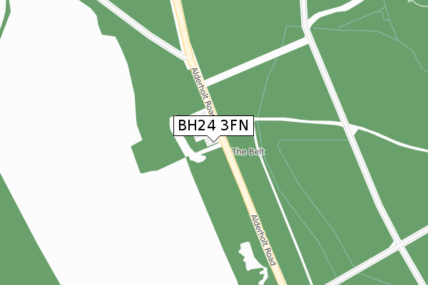
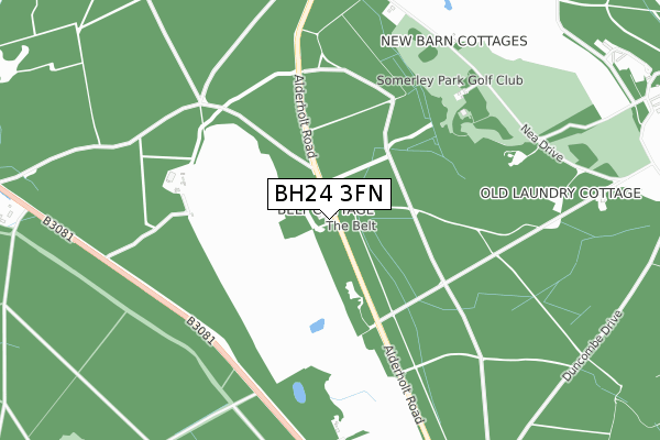
BH24 3FN maps


Licence: Open Government Licence (requires attribution)
Attribution: Contains OS data © Crown copyright and database right 2025
Source: Open Postcode Geo
Licence: Open Government Licence (requires attribution)
Attribution: Contains OS data © Crown copyright and database right 2025; Contains Royal Mail data © Royal Mail copyright and database right 2025; Source: Office for National Statistics licensed under the Open Government Licence v.3.0
BH24 3FN geodata
| Easting | 412093 |
| Northing | 107640 |
| Latitude | 50.868131 |
| Longitude | -1.829514 |
Where is BH24 3FN?
| Country | England |
| Postcode District | BH24 |
Politics
| Ward | Ringwood North & Ellingham |
|---|---|
| Constituency | New Forest West |
Transport
Nearest bus stops to BH24 3FN
| Ebblake House (B3081 Ringwood Road) | Ringwood Forest | 1,239m |
| Ebblake House (B3081) | Ringwood Forest | 1,245m |
| Somerley House (Ellingham Drive) | Somerley | 1,389m |
| Ebblake Bridge (Ringwood Road) | Ebblake | 1,401m |
| Ebblake Bridge (Ringwood Road) | Ebblake | 1,404m |
Broadband
Broadband access in BH24 3FN (2020 data)
| Percentage of properties with Next Generation Access | 100.0% |
| Percentage of properties with Superfast Broadband | 0.0% |
| Percentage of properties with Ultrafast Broadband | 0.0% |
| Percentage of properties with Full Fibre Broadband | 0.0% |
Superfast Broadband is between 30Mbps and 300Mbps
Ultrafast Broadband is > 300Mbps
Broadband limitations in BH24 3FN (2020 data)
| Percentage of properties unable to receive 2Mbps | 100.0% |
| Percentage of properties unable to receive 5Mbps | 100.0% |
| Percentage of properties unable to receive 10Mbps | 100.0% |
| Percentage of properties unable to receive 30Mbps | 100.0% |
Deprivation
56.9% of English postcodes are less deprived than BH24 3FN:Food Standards Agency
Three nearest food hygiene ratings to BH24 3FN (metres)


➜ Get more ratings from the Food Standards Agency
Nearest post box to BH24 3FN
| Last Collection | |||
|---|---|---|---|
| Location | Mon-Fri | Sat | Distance |
| Nea Farm | 16:00 | 10:00 | 1,196m |
| Blackmoor Road | 17:00 | 08:00 | 1,554m |
| The Chase | 16:30 | 12:00 | 1,979m |
BH24 3FN ITL and BH24 3FN LAU
The below table lists the International Territorial Level (ITL) codes (formerly Nomenclature of Territorial Units for Statistics (NUTS) codes) and Local Administrative Units (LAU) codes for BH24 3FN:
| ITL 1 Code | Name |
|---|---|
| TLJ | South East (England) |
| ITL 2 Code | Name |
| TLJ3 | Hampshire and Isle of Wight |
| ITL 3 Code | Name |
| TLJ36 | Central Hampshire |
| LAU 1 Code | Name |
| E07000091 | New Forest |
BH24 3FN census areas
The below table lists the Census Output Area (OA), Lower Layer Super Output Area (LSOA), and Middle Layer Super Output Area (MSOA) for BH24 3FN:
| Code | Name | |
|---|---|---|
| OA | E00116997 | |
| LSOA | E01023026 | New Forest 010A |
| MSOA | E02004788 | New Forest 010 |
Nearest postcodes to BH24 3FN
| BH24 3QE | 827m | |
| BH24 3QG | Harbridge Court | 1188m |
| BH31 7AS | Ringwood Road | 1202m |
| BH24 3QD | 1271m | |
| BH31 7NS | Parkland Close | 1365m |
| BH31 6DE | Forest Close | 1371m |
| BH31 6AX | Black Moor Road | 1507m |
| BH31 7AG | Ringwood Road | 1538m |
| BH31 6AZ | Bessemer Close | 1560m |
| BH31 6BD | Black Moor Road | 1592m |