Property/Postcode Data Search:
BH21 4FN maps, stats, and open data
BH21 4FN is located in the Wimborne Minster electoral ward, within the unitary authority of Dorset and the English Parliamentary constituency of Mid Dorset and North Poole. The Sub Integrated Care Board (ICB) Location is NHS Dorset ICB - 11J and the police force is Dorset. This postcode has been in use since December 2019.
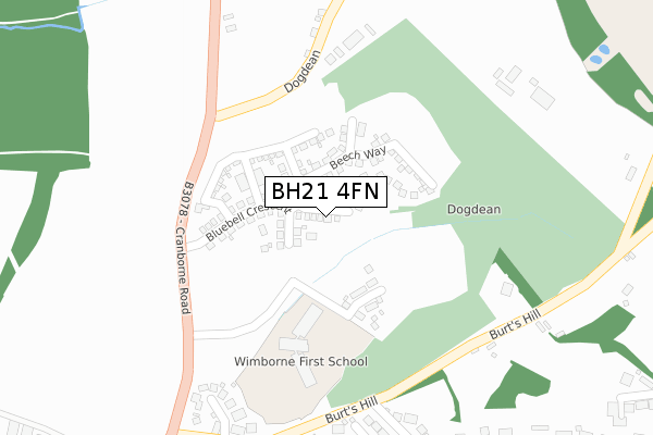
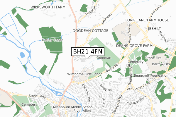
BH21 4FN maps


Source: OS Open Zoomstack (Ordnance Survey)
Licence: Open Government Licence (requires attribution)
Attribution: Contains OS data © Crown copyright and database right 2025
Source: Open Postcode Geo
Licence: Open Government Licence (requires attribution)
Attribution: Contains OS data © Crown copyright and database right 2025; Contains Royal Mail data © Royal Mail copyright and database right 2025; Source: Office for National Statistics licensed under the Open Government Licence v.3.0
Licence: Open Government Licence (requires attribution)
Attribution: Contains OS data © Crown copyright and database right 2025
Source: Open Postcode Geo
Licence: Open Government Licence (requires attribution)
Attribution: Contains OS data © Crown copyright and database right 2025; Contains Royal Mail data © Royal Mail copyright and database right 2025; Source: Office for National Statistics licensed under the Open Government Licence v.3.0
BH21 4FN geodata
| Easting | 401295 |
| Northing | 101161 |
| Latitude | 50.809991 |
| Longitude | -1.982980 |
Where is BH21 4FN?
| Country | England |
| Postcode District | BH21 |
Politics
| Ward | Wimborne Minster |
|---|---|
| Constituency | Mid Dorset And North Poole |
House Prices
Sales of detached houses in BH21 4FN
2023 14 AUG £629,000 |
13, BUTTERCUP CLOSE, WIMBORNE MINSTER, WIMBORNE, BH21 4FN 2020 30 SEP £550,000 |
2020 18 MAR £540,000 |
7, BUTTERCUP CLOSE, WIMBORNE MINSTER, WIMBORNE, BH21 4FN 2020 28 FEB £400,000 |
1, BUTTERCUP CLOSE, WIMBORNE MINSTER, WIMBORNE, BH21 4FN 2020 14 FEB £500,000 |
12, BUTTERCUP CLOSE, WIMBORNE MINSTER, WIMBORNE, BH21 4FN 2020 31 JAN £402,500 |
2, BUTTERCUP CLOSE, WIMBORNE MINSTER, WIMBORNE, BH21 4FN 2020 9 JAN £440,000 |
6, BUTTERCUP CLOSE, WIMBORNE MINSTER, WIMBORNE, BH21 4FN 2019 30 DEC £450,000 |
4, BUTTERCUP CLOSE, WIMBORNE MINSTER, WIMBORNE, BH21 4FN 2019 20 DEC £450,000 |
9, BUTTERCUP CLOSE, WIMBORNE MINSTER, WIMBORNE, BH21 4FN 2019 13 DEC £405,000 |
➜ Wimborne Minster house prices
Source: HM Land Registry Price Paid Data
Licence: Contains HM Land Registry data © Crown copyright and database right 2025. This data is licensed under the Open Government Licence v3.0.
Licence: Contains HM Land Registry data © Crown copyright and database right 2025. This data is licensed under the Open Government Licence v3.0.
Transport
Nearest bus stops to BH21 4FN
| Lacy Drive (Allenview Road) | Wimborne Minster | 489m |
| Lacy Drive (Allenview Road) | Wimborne Minster | 494m |
| Highland Road (Rowlands Hill) | Wimborne Minster | 756m |
| Onslow Gardens (Rowlands Hill) | Wimborne Minster | 768m |
| Allenbourn School | Wimborne Minster | 774m |
Deprivation
0.3% of English postcodes are less deprived than BH21 4FN:Food Standards Agency
Three nearest food hygiene ratings to BH21 4FN (metres)
The Log Cabin B&B

12 Dogdean
357m
The Horns Inn

The Horns Inn Burts Hill
559m
River House Nursery

Crown House 6 Wimborne Road
588m
➜ Get more ratings from the Food Standards Agency
Nearest post box to BH21 4FN
| Last Collection | |||
|---|---|---|---|
| Location | Mon-Fri | Sat | Distance |
| Walford | 17:00 | 12:00 | 432m |
| Horns In Colehill | 10:00 | 09:00 | 573m |
| Woodleaze | 11:00 | 09:00 | 678m |
BH21 4FN ITL and BH21 4FN LAU
The below table lists the International Territorial Level (ITL) codes (formerly Nomenclature of Territorial Units for Statistics (NUTS) codes) and Local Administrative Units (LAU) codes for BH21 4FN:
| ITL 1 Code | Name |
|---|---|
| TLK | South West (England) |
| ITL 2 Code | Name |
| TLK2 | Dorset and Somerset |
| ITL 3 Code | Name |
| TLK25 | Dorset |
| LAU 1 Code | Name |
| E06000059 | Dorset |
BH21 4FN census areas
The below table lists the Census Output Area (OA), Lower Layer Super Output Area (LSOA), and Middle Layer Super Output Area (MSOA) for BH21 4FN:
| Code | Name | |
|---|---|---|
| OA | E00103269 | |
| LSOA | E01020380 | East Dorset 007C |
| MSOA | E02004249 | East Dorset 007 |
Nearest postcodes to BH21 4FN
| BH21 1PH | Walford Close | 350m |
| BH21 1NS | Burts Hill | 353m |
| BH21 7AD | Burts Hill | 369m |
| BH21 1DQ | Venator Place | 382m |
| BH21 2QU | Giddy Lake | 429m |
| BH21 1NT | Tennyson Road | 436m |
| BH21 1NP | Wimborne Road | 445m |
| BH21 1NY | Milton Road | 452m |
| BH21 1DP | Chaucer Close | 465m |
| BH21 4HA | Dogdean | 489m |