Property/Postcode Data Search:
BH19 3BN maps, stats, and open data
BH19 3BN is located in the South East Purbeck electoral ward, within the unitary authority of Dorset and the English Parliamentary constituency of South Dorset. The Sub Integrated Care Board (ICB) Location is NHS Dorset ICB - 11J and the police force is Dorset. This postcode has been in use since May 2019.
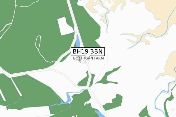
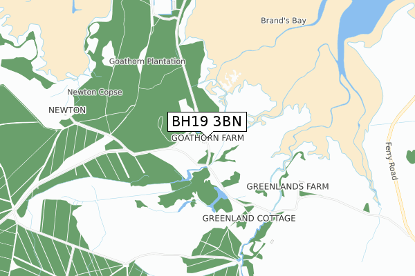
BH19 3BN maps


Source: OS Open Zoomstack (Ordnance Survey)
Licence: Open Government Licence (requires attribution)
Attribution: Contains OS data © Crown copyright and database right 2025
Source: Open Postcode Geo
Licence: Open Government Licence (requires attribution)
Attribution: Contains OS data © Crown copyright and database right 2025; Contains Royal Mail data © Royal Mail copyright and database right 2025; Source: Office for National Statistics licensed under the Open Government Licence v.3.0
Licence: Open Government Licence (requires attribution)
Attribution: Contains OS data © Crown copyright and database right 2025
Source: Open Postcode Geo
Licence: Open Government Licence (requires attribution)
Attribution: Contains OS data © Crown copyright and database right 2025; Contains Royal Mail data © Royal Mail copyright and database right 2025; Source: Office for National Statistics licensed under the Open Government Licence v.3.0
BH19 3BN geodata
| Easting | 399181 |
| Northing | 78525 |
| Latitude | 50.606430 |
| Longitude | -2.012928 |
Where is BH19 3BN?
| Country | England |
| Postcode District | BH19 |
Politics
| Ward | South East Purbeck |
|---|---|
| Constituency | South Dorset |
Transport
Nearest bus stops to BH19 3BN
| Capston Field (High Street) | Langton Matravers | 291m |
| Capstan Field (High Street) | Langton Matravers | 302m |
| Acton Lane (B3069) | Langton Matravers | 338m |
| Acton Lane (B3069) | Langton Matravers | 343m |
| Durnford Drove (High Street) | Langton Matravers | 650m |
Nearest underground/metro/tram to BH19 3BN
| Harman's Cross (Swanage Railway) (Haycrafts Lane) | Harman's Cross | 1,790m |
Deprivation
31.7% of English postcodes are less deprived than BH19 3BN:Food Standards Agency
Three nearest food hygiene ratings to BH19 3BN (metres)
The Sprout & Bean

Toms Field Camping Site Toms Field Road
332m
Toms Field Campsite & Shop

Toms Field Camping Site Toms Field Road
332m
Maycroft Bed and Breakfast

Maycroft Old Malthouse Lane
543m
➜ Get more ratings from the Food Standards Agency
Nearest post box to BH19 3BN
| Last Collection | |||
|---|---|---|---|
| Location | Mon-Fri | Sat | Distance |
| Acton Langton Matravers | 16:15 | 07:30 | 287m |
| West End | 16:30 | 09:30 | 304m |
| Langton Matravers | 16:30 | 09:45 | 823m |
BH19 3BN ITL and BH19 3BN LAU
The below table lists the International Territorial Level (ITL) codes (formerly Nomenclature of Territorial Units for Statistics (NUTS) codes) and Local Administrative Units (LAU) codes for BH19 3BN:
| ITL 1 Code | Name |
|---|---|
| TLK | South West (England) |
| ITL 2 Code | Name |
| TLK2 | Dorset and Somerset |
| ITL 3 Code | Name |
| TLK25 | Dorset |
| LAU 1 Code | Name |
| E06000059 | Dorset |
BH19 3BN census areas
The below table lists the Census Output Area (OA), Lower Layer Super Output Area (LSOA), and Middle Layer Super Output Area (MSOA) for BH19 3BN:
| Code | Name | |
|---|---|---|
| OA | E00103765 | |
| LSOA | E01020468 | Purbeck 005C |
| MSOA | E02004267 | Purbeck 005 |
Nearest postcodes to BH19 3BN
| BH19 3HS | West Acton Field | 35m |
| BH19 3HR | East Acton Field | 52m |
| BH19 3JZ | Acton | 191m |
| BH19 3JY | Acton | 224m |
| BH19 3JN | Kingston Road | 246m |
| BH19 3LA | Highland Cottages | 259m |
| BH19 3HP | Capston Field | 272m |
| BH19 3JX | The Lane | 278m |
| BH19 3JS | Acton | 283m |
| BH19 3LB | Alma Cottages | 321m |