Property/Postcode Data Search:
BD5 8FF maps, stats, and open data
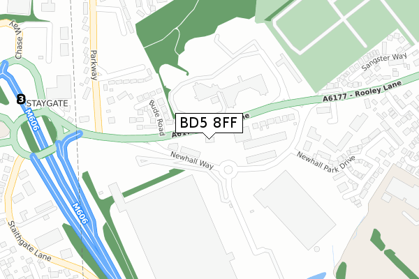
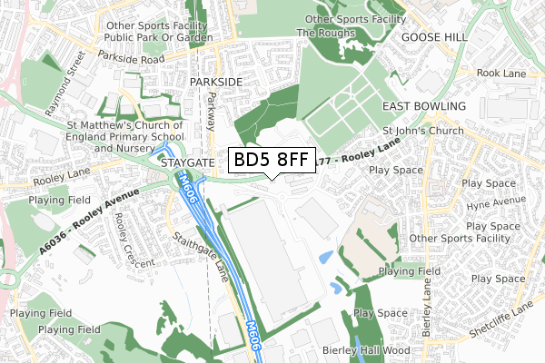
BD5 8FF is located in the Tong electoral ward, within the metropolitan district of Bradford and the English Parliamentary constituency of Bradford South. The Sub Integrated Care Board (ICB) Location is NHS West Yorkshire ICB - 36J and the police force is West Yorkshire. This postcode has been in use since March 2018.
BD5 8FF maps


Source: OS Open Zoomstack (Ordnance Survey)
Licence: Open Government Licence (requires attribution)
Attribution: Contains OS data © Crown copyright and database right 2025
Source: Open Postcode Geo
Licence: Open Government Licence (requires attribution)
Attribution: Contains OS data © Crown copyright and database right 2025; Contains Royal Mail data © Royal Mail copyright and database right 2025; Source: Office for National Statistics licensed under the Open Government Licence v.3.0
Licence: Open Government Licence (requires attribution)
Attribution: Contains OS data © Crown copyright and database right 2025
Source: Open Postcode Geo
Licence: Open Government Licence (requires attribution)
Attribution: Contains OS data © Crown copyright and database right 2025; Contains Royal Mail data © Royal Mail copyright and database right 2025; Source: Office for National Statistics licensed under the Open Government Licence v.3.0
BD5 8FF geodata
| Easting | 417031 |
| Northing | 430252 |
| Latitude | 53.768353 |
| Longitude | -1.743104 |
Where is BD5 8FF?
| Country | England |
| Postcode District | BD5 |
Politics
| Ward | Tong |
|---|---|
| Constituency | Bradford South |
Transport
Nearest bus stops to BD5 8FF
| Rooley Lane Bude Rd (Rooley Lane) | West Bowling | 40m |
| Rooley Lane Bude Rd (Rooley Lane) | West Bowling | 45m |
| Rooley Lane | West Bowling | 214m |
| Highbridge Terrace | West Bowling | 306m |
| Rooley Lane Croft Leigh Court (Rooley Lane) | Bierley | 358m |
Nearest railway stations to BD5 8FF
| Low Moor Station | 2.2km |
| Bradford Interchange Station | 2.6km |
| Bradford Forster Square Station | 3.2km |
Deprivation
52.1% of English postcodes are less deprived than BD5 8FF:Food Standards Agency
Three nearest food hygiene ratings to BD5 8FF (metres)
Gather & Gather at Yorkshire Building Society

Yokshire House
149m
Baxer Storey at M&S Prologis Park

Marks and Spencers Prologis Park
260m
Toby Carvery

244-246 Rooley Lane
273m
➜ Get more ratings from the Food Standards Agency
Nearest post box to BD5 8FF
| Last Collection | |||
|---|---|---|---|
| Location | Mon-Fri | Sat | Distance |
| 100 Parkway | 17:30 | 12:00 | 275m |
| Bierley Church | 18:15 | 13:15 | 738m |
| Bierley P.o. Box | 18:15 | 12:00 | 852m |
BD5 8FF ITL and BD5 8FF LAU
The below table lists the International Territorial Level (ITL) codes (formerly Nomenclature of Territorial Units for Statistics (NUTS) codes) and Local Administrative Units (LAU) codes for BD5 8FF:
| ITL 1 Code | Name |
|---|---|
| TLE | Yorkshire and The Humber |
| ITL 2 Code | Name |
| TLE4 | West Yorkshire |
| ITL 3 Code | Name |
| TLE41 | Bradford |
| LAU 1 Code | Name |
| E08000032 | Bradford |
BD5 8FF census areas
The below table lists the Census Output Area (OA), Lower Layer Super Output Area (LSOA), and Middle Layer Super Output Area (MSOA) for BD5 8FF:
| Code | Name | |
|---|---|---|
| OA | E00054532 | |
| LSOA | E01010818 | Bradford 057E |
| MSOA | E02002239 | Bradford 057 |
Nearest postcodes to BD5 8FF
| BD5 8LJ | Yorkshire Drive | 151m |
| BD5 8JZ | Rooley Lane | 153m |
| BD5 8LA | Bude Road | 160m |
| BD5 8LB | Rooley Lane | 172m |
| BD5 8PT | Highbridge Terrace | 232m |
| BD5 8FA | Newhall Park Drive | 235m |
| BD5 8PS | Parkway | 275m |
| BD5 8LH | Croft Leigh Court | 319m |
| BD5 8JY | Rooley Lane | 347m |
| BD5 8BR | Newhall Park Drive | 347m |