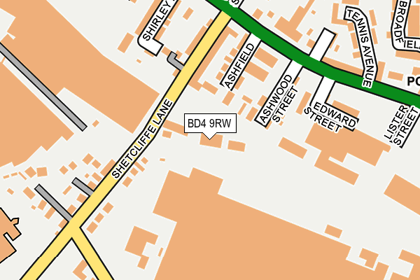
BD4 9RW is located in the Tong electoral ward, within the metropolitan district of Bradford and the English Parliamentary constituency of Bradford South. The Sub Integrated Care Board (ICB) Location is NHS West Yorkshire ICB - 36J and the police force is West Yorkshire. This postcode has been in use since June 2017.


GetTheData
Source: OS OpenMap – Local (Ordnance Survey)
Source: OS VectorMap District (Ordnance Survey)
Licence: Open Government Licence (requires attribution)
| Easting | 418853 |
| Northing | 430166 |
| Latitude | 53.767518 |
| Longitude | -1.715468 |
GetTheData
Source: Open Postcode Geo
Licence: Open Government Licence
| Country | England |
| Postcode District | BD4 |
➜ See where BD4 is on a map ➜ Where is Bradford? | |
GetTheData
Source: Land Registry Price Paid Data
Licence: Open Government Licence
| Ward | Tong |
| Constituency | Bradford South |
GetTheData
Source: ONS Postcode Database
Licence: Open Government Licence
| Edward Street (Tong Street) | Tong Street | 204m |
| Tong St Avenue St (Tong Street) | Tong Street | 207m |
| Tennis Avenue (Tong Street) | Tong Street | 242m |
| Highfield (Tong Street) | Tong Street | 273m |
| Highfield (Tong Street) | Tong Street | 296m |
| Low Moor Station | 3.2km |
| Bradford Interchange Station | 3.5km |
| Bradford Forster Square Station | 4.1km |
GetTheData
Source: NaPTAN
Licence: Open Government Licence
GetTheData
Source: ONS Postcode Database
Licence: Open Government Licence


➜ Get more ratings from the Food Standards Agency
GetTheData
Source: Food Standards Agency
Licence: FSA terms & conditions
| Last Collection | |||
|---|---|---|---|
| Location | Mon-Fri | Sat | Distance |
| Shetcliffe Lane | 17:00 | 13:00 | 175m |
| Tong Street P.o. Box | 17:00 | 10:15 | 322m |
| Toftshaw Lane | 17:15 | 13:00 | 564m |
GetTheData
Source: Dracos
Licence: Creative Commons Attribution-ShareAlike
The below table lists the International Territorial Level (ITL) codes (formerly Nomenclature of Territorial Units for Statistics (NUTS) codes) and Local Administrative Units (LAU) codes for BD4 9RW:
| ITL 1 Code | Name |
|---|---|
| TLE | Yorkshire and The Humber |
| ITL 2 Code | Name |
| TLE4 | West Yorkshire |
| ITL 3 Code | Name |
| TLE41 | Bradford |
| LAU 1 Code | Name |
| E08000032 | Bradford |
GetTheData
Source: ONS Postcode Directory
Licence: Open Government Licence
The below table lists the Census Output Area (OA), Lower Layer Super Output Area (LSOA), and Middle Layer Super Output Area (MSOA) for BD4 9RW:
| Code | Name | |
|---|---|---|
| OA | E00054528 | |
| LSOA | E01010815 | Bradford 057B |
| MSOA | E02002239 | Bradford 057 |
GetTheData
Source: ONS Postcode Directory
Licence: Open Government Licence
| BD4 9RN | Glenhurst | 75m |
| BD4 9RL | Ashfield | 90m |
| BD4 9RP | Ashwood Street | 117m |
| BD4 9RH | Shetcliffe Lane | 122m |
| BD4 9RS | Edward Street | 177m |
| BD4 9PU | Tong Street | 191m |
| BD4 9PX | Shirley Road | 197m |
| BD4 6QU | Faye Gardens | 202m |
| BD4 9QY | Tong Street | 204m |
| BD4 9QZ | Horsman Street | 216m |
GetTheData
Source: Open Postcode Geo; Land Registry Price Paid Data
Licence: Open Government Licence