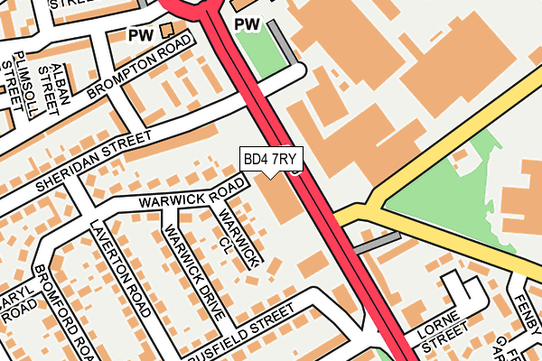
BD4 7RY is located in the Bowling and Barkerend electoral ward, within the metropolitan district of Bradford and the English Parliamentary constituency of Bradford East. The Sub Integrated Care Board (ICB) Location is NHS West Yorkshire ICB - 36J and the police force is West Yorkshire. This postcode has been in use since April 2017.


GetTheData
Source: OS OpenMap – Local (Ordnance Survey)
Source: OS VectorMap District (Ordnance Survey)
Licence: Open Government Licence (requires attribution)
| Easting | 417406 |
| Northing | 431438 |
| Latitude | 53.779000 |
| Longitude | -1.737349 |
GetTheData
Source: Open Postcode Geo
Licence: Open Government Licence
| Country | England |
| Postcode District | BD4 |
➜ See where BD4 is on a map ➜ Where is Bradford? | |
GetTheData
Source: Land Registry Price Paid Data
Licence: Open Government Licence
| Ward | Bowling And Barkerend |
| Constituency | Bradford East |
GetTheData
Source: ONS Postcode Database
Licence: Open Government Licence
| Bowling Hall Road Flockton Dr (Bowling Hall Road) | East Bowling | 213m |
| Lister Avenue Flockton Rd (Lister Avenue) | East Bowling | 222m |
| Bowling Hall Road Lister Ave (Bowling Hall Road) | East Bowling | 223m |
| Bowling Hall Road Flockton Dr (Bowling Hall Road) | East Bowling | 239m |
| Bowling Hall Road Lister Ave (Bowling Hall Road) | East Bowling | 248m |
| Bradford Interchange Station | 1.6km |
| Bradford Forster Square Station | 2.2km |
| Low Moor Station | 3.4km |
GetTheData
Source: NaPTAN
Licence: Open Government Licence
GetTheData
Source: ONS Postcode Database
Licence: Open Government Licence


➜ Get more ratings from the Food Standards Agency
GetTheData
Source: Food Standards Agency
Licence: FSA terms & conditions
| Last Collection | |||
|---|---|---|---|
| Location | Mon-Fri | Sat | Distance |
| Brompton Avenue | 18:30 | 12:45 | 331m |
| 10 Lister Avenue | 18:30 | 12:30 | 434m |
| St Johns P.o. Box | 18:30 | 11:45 | 443m |
GetTheData
Source: Dracos
Licence: Creative Commons Attribution-ShareAlike
The below table lists the International Territorial Level (ITL) codes (formerly Nomenclature of Territorial Units for Statistics (NUTS) codes) and Local Administrative Units (LAU) codes for BD4 7RY:
| ITL 1 Code | Name |
|---|---|
| TLE | Yorkshire and The Humber |
| ITL 2 Code | Name |
| TLE4 | West Yorkshire |
| ITL 3 Code | Name |
| TLE41 | Bradford |
| LAU 1 Code | Name |
| E08000032 | Bradford |
GetTheData
Source: ONS Postcode Directory
Licence: Open Government Licence
The below table lists the Census Output Area (OA), Lower Layer Super Output Area (LSOA), and Middle Layer Super Output Area (MSOA) for BD4 7RY:
| Code | Name | |
|---|---|---|
| OA | E00053571 | |
| LSOA | E01010613 | Bradford 045B |
| MSOA | E02002227 | Bradford 045 |
GetTheData
Source: ONS Postcode Directory
Licence: Open Government Licence
| BD4 7RQ | Caryl Road | 95m |
| BD4 7RG | Old Farm Crescent | 107m |
| BD4 7LP | Brompton Avenue | 144m |
| BD4 7RE | Bromford Road | 144m |
| BD4 7RF | Bromford Road | 156m |
| BD4 7RH | Flockton Road | 168m |
| BD4 7LL | Flockton Drive | 170m |
| BD4 7RL | Sheridan Street | 187m |
| BD4 7LN | Bowling Hall Road | 196m |
| BD4 7QU | Lister Avenue | 207m |
GetTheData
Source: Open Postcode Geo; Land Registry Price Paid Data
Licence: Open Government Licence