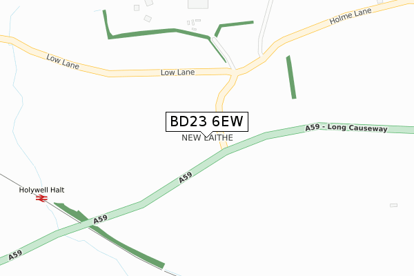
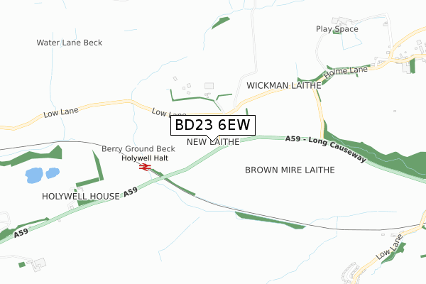
BD23 6EW is located in the Wharfedale electoral ward, within the unitary authority of North Yorkshire and the English Parliamentary constituency of Skipton and Ripon. The Sub Integrated Care Board (ICB) Location is NHS West Yorkshire ICB - 36J and the police force is North Yorkshire. This postcode has been in use since December 2017.


GetTheData
Source: OS Open Zoomstack (Ordnance Survey)
Licence: Open Government Licence (requires attribution)
Attribution: Contains OS data © Crown copyright and database right 2025
Source: Open Postcode Geo
Licence: Open Government Licence (requires attribution)
Attribution: Contains OS data © Crown copyright and database right 2025; Contains Royal Mail data © Royal Mail copyright and database right 2025; Source: Office for National Statistics licensed under the Open Government Licence v.3.0
| Easting | 403095 |
| Northing | 453467 |
| Latitude | 53.977271 |
| Longitude | -1.954304 |
GetTheData
Source: Open Postcode Geo
Licence: Open Government Licence
| Country | England |
| Postcode District | BD23 |
➜ See where BD23 is on a map | |
GetTheData
Source: Land Registry Price Paid Data
Licence: Open Government Licence
| Ward | Wharfedale |
| Constituency | Skipton And Ripon |
GetTheData
Source: ONS Postcode Database
Licence: Open Government Licence
| West View (Main Street) | Draughton | 1,415m |
| The Masons Arms (Barden Road) | Embsay | 1,421m |
| The Masons Arms (Barden Road) | Embsay | 1,426m |
| Post Box (Barden Road) | Embsay | 1,576m |
| Post Box (Barden Road) | Embsay | 1,580m |
| Skipton Station | 5.1km |
GetTheData
Source: NaPTAN
Licence: Open Government Licence
| Percentage of properties with Next Generation Access | 100.0% |
| Percentage of properties with Superfast Broadband | 0.0% |
| Percentage of properties with Ultrafast Broadband | 0.0% |
| Percentage of properties with Full Fibre Broadband | 0.0% |
Superfast Broadband is between 30Mbps and 300Mbps
Ultrafast Broadband is > 300Mbps
| Percentage of properties unable to receive 2Mbps | 0.0% |
| Percentage of properties unable to receive 5Mbps | 100.0% |
| Percentage of properties unable to receive 10Mbps | 100.0% |
| Percentage of properties unable to receive 30Mbps | 100.0% |
GetTheData
Source: Ofcom
Licence: Ofcom Terms of Use (requires attribution)
GetTheData
Source: ONS Postcode Database
Licence: Open Government Licence


➜ Get more ratings from the Food Standards Agency
GetTheData
Source: Food Standards Agency
Licence: FSA terms & conditions
| Last Collection | |||
|---|---|---|---|
| Location | Mon-Fri | Sat | Distance |
| Draughton P.o. Box | 16:15 | 11:00 | 1,521m |
| Eastby | 16:30 | 12:00 | 1,564m |
| Fell View Embsay | 16:30 | 11:15 | 1,975m |
GetTheData
Source: Dracos
Licence: Creative Commons Attribution-ShareAlike
The below table lists the International Territorial Level (ITL) codes (formerly Nomenclature of Territorial Units for Statistics (NUTS) codes) and Local Administrative Units (LAU) codes for BD23 6EW:
| ITL 1 Code | Name |
|---|---|
| TLE | Yorkshire and The Humber |
| ITL 2 Code | Name |
| TLE2 | North Yorkshire |
| ITL 3 Code | Name |
| TLE22 | North Yorkshire CC |
| LAU 1 Code | Name |
| E07000163 | Craven |
GetTheData
Source: ONS Postcode Directory
Licence: Open Government Licence
The below table lists the Census Output Area (OA), Lower Layer Super Output Area (LSOA), and Middle Layer Super Output Area (MSOA) for BD23 6EW:
| Code | Name | |
|---|---|---|
| OA | E00140267 | |
| LSOA | E01027557 | Craven 004A |
| MSOA | E02005745 | Craven 004 |
GetTheData
Source: ONS Postcode Directory
Licence: Open Government Licence
| BD23 6EG | Meadowcroft | 1124m |
| BD23 6EF | South View Cottages | 1181m |
| BD23 6EE | Low Lane | 1204m |
| BD23 6ED | 1212m | |
| BD23 6EB | 1217m | |
| BD23 6DZ | The Croft | 1224m |
| BD23 6EH | 1240m | |
| BD23 6EQ | The Spinney | 1346m |
| BD23 6EA | 1360m | |
| BD23 6DU | 1409m |
GetTheData
Source: Open Postcode Geo; Land Registry Price Paid Data
Licence: Open Government Licence