BD22 8SE maps, stats, and open data
BD22 8SE is located in the Worth Valley electoral ward, within the metropolitan district of Bradford and the English Parliamentary constituency of Keighley. The Sub Integrated Care Board (ICB) Location is NHS West Yorkshire ICB - 36J and the police force is West Yorkshire. This postcode has been in use since May 2018.
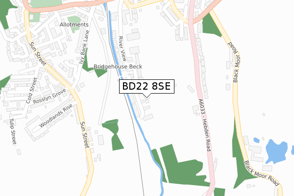
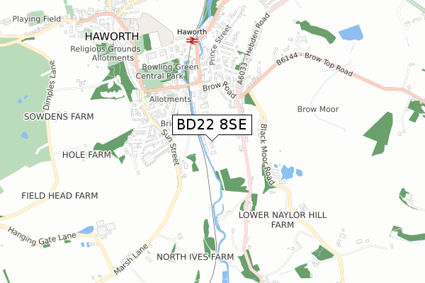
BD22 8SE maps


Licence: Open Government Licence (requires attribution)
Attribution: Contains OS data © Crown copyright and database right 2025
Source: Open Postcode Geo
Licence: Open Government Licence (requires attribution)
Attribution: Contains OS data © Crown copyright and database right 2025; Contains Royal Mail data © Royal Mail copyright and database right 2025; Source: Office for National Statistics licensed under the Open Government Licence v.3.0
BD22 8SE geodata
| Easting | 403586 |
| Northing | 436631 |
| Latitude | 53.825950 |
| Longitude | -1.947007 |
Where is BD22 8SE?
| Country | England |
| Postcode District | BD22 |
Politics
| Ward | Worth Valley |
|---|---|
| Constituency | Keighley |
House Prices
Sales of detached houses in BD22 8SE
2, HEPWORTH COURT, HAWORTH, KEIGHLEY, BD22 8SE 2019 26 APR £324,950 |
5, HEPWORTH COURT, HAWORTH, KEIGHLEY, BD22 8SE 2019 15 MAR £329,950 |
6, HEPWORTH COURT, HAWORTH, KEIGHLEY, BD22 8SE 2019 28 FEB £324,950 |
4, HEPWORTH COURT, HAWORTH, KEIGHLEY, BD22 8SE 2019 28 FEB £324,950 |
3, HEPWORTH COURT, HAWORTH, KEIGHLEY, BD22 8SE 2019 31 JAN £274,950 |
1, HEPWORTH COURT, HAWORTH, KEIGHLEY, BD22 8SE 2019 25 JAN £274,950 |
Licence: Contains HM Land Registry data © Crown copyright and database right 2025. This data is licensed under the Open Government Licence v3.0.
Transport
Nearest bus stops to BD22 8SE
| Sun Street Woodlands Rise (Sun Street) | Haworth | 231m |
| Sun Street Woodlands Rise (Sun Street) | Haworth | 239m |
| Hebden Road Brow Top Rd (Hebden Road) | Haworth | 265m |
| Hebden Road Brow Top Rd (Hebden Road) | Haworth | 269m |
| Moor End Farm (Black Moor Road) | Lees | 314m |
Nearest underground/metro/tram to BD22 8SE
| Haworth (Keighley & Worth Valley Railway) | Haworth | 602m |
| Oxenhope (Keighley & Worth Valley Railway) | Oxenhope | 1,287m |
Nearest railway stations to BD22 8SE
| Keighley Station | 5.5km |
Broadband
Broadband access in BD22 8SE (2020 data)
| Percentage of properties with Next Generation Access | 100.0% |
| Percentage of properties with Superfast Broadband | 100.0% |
| Percentage of properties with Ultrafast Broadband | 100.0% |
| Percentage of properties with Full Fibre Broadband | 100.0% |
Superfast Broadband is between 30Mbps and 300Mbps
Ultrafast Broadband is > 300Mbps
Broadband limitations in BD22 8SE (2020 data)
| Percentage of properties unable to receive 2Mbps | 0.0% |
| Percentage of properties unable to receive 5Mbps | 0.0% |
| Percentage of properties unable to receive 10Mbps | 0.0% |
| Percentage of properties unable to receive 30Mbps | 0.0% |
Deprivation
54.1% of English postcodes are less deprived than BD22 8SE:Food Standards Agency
Three nearest food hygiene ratings to BD22 8SE (metres)


➜ Get more ratings from the Food Standards Agency
Nearest post box to BD22 8SE
| Last Collection | |||
|---|---|---|---|
| Location | Mon-Fri | Sat | Distance |
| Haworth Brow P.o. Box | 17:15 | 11:15 | 606m |
| Lees Hill | 17:15 | 11:15 | 1,168m |
| Cross Roads P.o. Box | 17:15 | 11:00 | 1,555m |
BD22 8SE ITL and BD22 8SE LAU
The below table lists the International Territorial Level (ITL) codes (formerly Nomenclature of Territorial Units for Statistics (NUTS) codes) and Local Administrative Units (LAU) codes for BD22 8SE:
| ITL 1 Code | Name |
|---|---|
| TLE | Yorkshire and The Humber |
| ITL 2 Code | Name |
| TLE4 | West Yorkshire |
| ITL 3 Code | Name |
| TLE41 | Bradford |
| LAU 1 Code | Name |
| E08000032 | Bradford |
BD22 8SE census areas
The below table lists the Census Output Area (OA), Lower Layer Super Output Area (LSOA), and Middle Layer Super Output Area (MSOA) for BD22 8SE:
| Code | Name | |
|---|---|---|
| OA | E00054719 | |
| LSOA | E01010857 | Bradford 023D |
| MSOA | E02002205 | Bradford 023 |
Nearest postcodes to BD22 8SE
| BD22 8BU | Ivy Bank Lane | 223m |
| BD22 8RS | Hebden Road | 224m |
| BD22 8AH | Sun Street | 239m |
| BD22 8AF | Balme Terrace | 248m |
| BD22 8RL | Fairway Crescent | 261m |
| BD22 8AL | Sun Street | 264m |
| BD22 8RN | Fallwood Street | 276m |
| BD22 8NX | Surgery Street | 277m |
| BD22 8PF | Ghyll Drive | 299m |
| BD22 8AP | Alice Street | 300m |