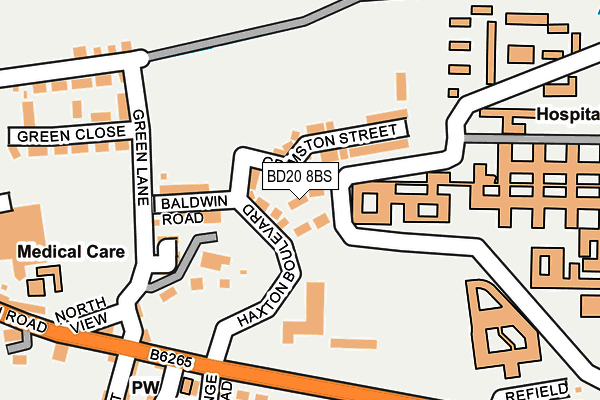
BD20 8BS is located in the Craven electoral ward, within the metropolitan district of Bradford and the English Parliamentary constituency of Keighley. The Sub Integrated Care Board (ICB) Location is NHS West Yorkshire ICB - 36J and the police force is West Yorkshire. This postcode has been in use since July 2017.


GetTheData
Source: OS OpenMap – Local (Ordnance Survey)
Source: OS VectorMap District (Ordnance Survey)
Licence: Open Government Licence (requires attribution)
| Easting | 402209 |
| Northing | 444622 |
| Latitude | 53.897779 |
| Longitude | -1.967872 |
GetTheData
Source: Open Postcode Geo
Licence: Open Government Licence
| Country | England |
| Postcode District | BD20 |
➜ See where BD20 is on a map | |
GetTheData
Source: Land Registry Price Paid Data
Licence: Open Government Licence
| Ward | Craven |
| Constituency | Keighley |
GetTheData
Source: ONS Postcode Database
Licence: Open Government Licence
| Airedale Hospital (Airedale Hospital Grounds) | Eastburn | 108m |
| Main Rd Grange Road (Main Road) | Eastburn | 197m |
| Main Rd Grange Road (Main Road) | Eastburn | 198m |
| Airedale Hospital (Airedale Hospital Grounds) | Airedale Hospital | 287m |
| Main Road Mill Row (Main Road) | Eastburn | 381m |
| Steeton & Silsden Station | 1.5km |
| Cononley Station | 3.6km |
| Keighley Station | 5.5km |
GetTheData
Source: NaPTAN
Licence: Open Government Licence
| Percentage of properties with Next Generation Access | 71.4% |
| Percentage of properties with Superfast Broadband | 71.4% |
| Percentage of properties with Ultrafast Broadband | 71.4% |
| Percentage of properties with Full Fibre Broadband | 0.0% |
Superfast Broadband is between 30Mbps and 300Mbps
Ultrafast Broadband is > 300Mbps
| Median download speed | 50.0Mbps |
| Average download speed | 82.4Mbps |
| Maximum download speed | 200.00Mbps |
| Median upload speed | 0.9Mbps |
| Average upload speed | 0.9Mbps |
| Maximum upload speed | 1.10Mbps |
| Percentage of properties unable to receive 2Mbps | 0.0% |
| Percentage of properties unable to receive 5Mbps | 0.0% |
| Percentage of properties unable to receive 10Mbps | 0.0% |
| Percentage of properties unable to receive 30Mbps | 0.0% |
GetTheData
Source: Ofcom
Licence: Ofcom Terms of Use (requires attribution)
GetTheData
Source: ONS Postcode Database
Licence: Open Government Licence


➜ Get more ratings from the Food Standards Agency
GetTheData
Source: Food Standards Agency
Licence: FSA terms & conditions
| Last Collection | |||
|---|---|---|---|
| Location | Mon-Fri | Sat | Distance |
| Eastburn P.o. Box | 17:15 | 11:45 | 224m |
| 2 Gamel View Steeton | 17:45 | 12:15 | 586m |
| Thornhill Road | 17:45 | 11:45 | 815m |
GetTheData
Source: Dracos
Licence: Creative Commons Attribution-ShareAlike
The below table lists the International Territorial Level (ITL) codes (formerly Nomenclature of Territorial Units for Statistics (NUTS) codes) and Local Administrative Units (LAU) codes for BD20 8BS:
| ITL 1 Code | Name |
|---|---|
| TLE | Yorkshire and The Humber |
| ITL 2 Code | Name |
| TLE4 | West Yorkshire |
| ITL 3 Code | Name |
| TLE41 | Bradford |
| LAU 1 Code | Name |
| E08000032 | Bradford |
GetTheData
Source: ONS Postcode Directory
Licence: Open Government Licence
The below table lists the Census Output Area (OA), Lower Layer Super Output Area (LSOA), and Middle Layer Super Output Area (MSOA) for BD20 8BS:
| Code | Name | |
|---|---|---|
| OA | E00053736 | |
| LSOA | E01010644 | Bradford 004G |
| MSOA | E02002186 | Bradford 004 |
GetTheData
Source: ONS Postcode Directory
Licence: Open Government Licence
| BD20 8UT | Green Lane | 112m |
| BD20 8UU | East View | 201m |
| BD20 8UH | Grange Terrace | 205m |
| BD20 8UA | Main Road | 221m |
| BD20 8UD | Vincent Avenue | 228m |
| BD20 8TZ | Main Road | 238m |
| BD20 8UL | Moor Lane | 238m |
| BD20 8UX | Green Close | 245m |
| BD20 8UB | Grange Road | 251m |
| BD20 8TY | North View | 256m |
GetTheData
Source: Open Postcode Geo; Land Registry Price Paid Data
Licence: Open Government Licence