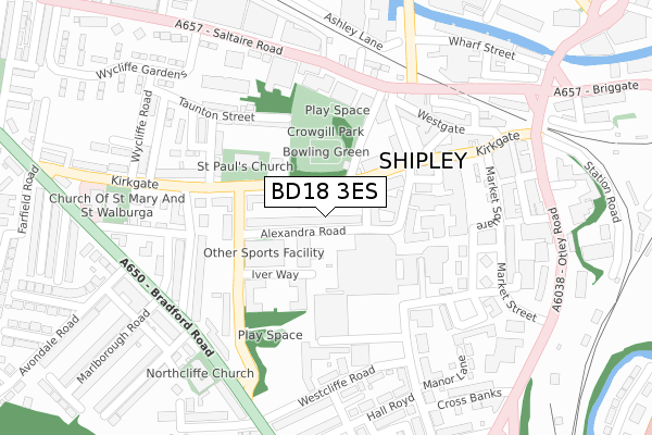
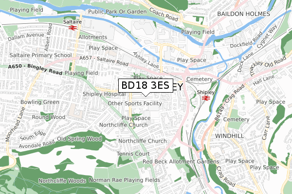
BD18 3ES is located in the Shipley electoral ward, within the metropolitan district of Bradford and the English Parliamentary constituency of Shipley. The Sub Integrated Care Board (ICB) Location is NHS West Yorkshire ICB - 36J and the police force is West Yorkshire. This postcode has been in use since August 2017.


GetTheData
Source: OS Open Zoomstack (Ordnance Survey)
Licence: Open Government Licence (requires attribution)
Attribution: Contains OS data © Crown copyright and database right 2025
Source: Open Postcode Geo
Licence: Open Government Licence (requires attribution)
Attribution: Contains OS data © Crown copyright and database right 2025; Contains Royal Mail data © Royal Mail copyright and database right 2025; Source: Office for National Statistics licensed under the Open Government Licence v.3.0
| Easting | 414518 |
| Northing | 437450 |
| Latitude | 53.833123 |
| Longitude | -1.780892 |
GetTheData
Source: Open Postcode Geo
Licence: Open Government Licence
| Country | England |
| Postcode District | BD18 |
➜ See where BD18 is on a map ➜ Where is Shipley? | |
GetTheData
Source: Land Registry Price Paid Data
Licence: Open Government Licence
| Ward | Shipley |
| Constituency | Shipley |
GetTheData
Source: ONS Postcode Database
Licence: Open Government Licence
| Kirkgate St Pauls Road (Kirkgate) | Shipley | 141m |
| Kirkgate St Pauls Road (Kirkgate) | Shipley | 173m |
| Saltaire Rd Murgatroyd Street (Saltaire Road) | Shipley | 218m |
| Market Square | Shipley | 255m |
| Market Square | Shipley | 255m |
| Shipley Station | 0.5km |
| Saltaire Station | 0.9km |
| Frizinghall Station | 1.6km |
GetTheData
Source: NaPTAN
Licence: Open Government Licence
| Percentage of properties with Next Generation Access | 100.0% |
| Percentage of properties with Superfast Broadband | 100.0% |
| Percentage of properties with Ultrafast Broadband | 100.0% |
| Percentage of properties with Full Fibre Broadband | 0.0% |
Superfast Broadband is between 30Mbps and 300Mbps
Ultrafast Broadband is > 300Mbps
| Percentage of properties unable to receive 2Mbps | 0.0% |
| Percentage of properties unable to receive 5Mbps | 0.0% |
| Percentage of properties unable to receive 10Mbps | 0.0% |
| Percentage of properties unable to receive 30Mbps | 0.0% |
GetTheData
Source: Ofcom
Licence: Ofcom Terms of Use (requires attribution)
GetTheData
Source: ONS Postcode Database
Licence: Open Government Licence


➜ Get more ratings from the Food Standards Agency
GetTheData
Source: Food Standards Agency
Licence: FSA terms & conditions
| Last Collection | |||
|---|---|---|---|
| Location | Mon-Fri | Sat | Distance |
| Kirklees House | 18:30 | 12:30 | 170m |
| Market Square | 18:00 | 12:30 | 258m |
| St Pauls Road P.o. Box | 17:45 | 11:45 | 279m |
GetTheData
Source: Dracos
Licence: Creative Commons Attribution-ShareAlike
The below table lists the International Territorial Level (ITL) codes (formerly Nomenclature of Territorial Units for Statistics (NUTS) codes) and Local Administrative Units (LAU) codes for BD18 3ES:
| ITL 1 Code | Name |
|---|---|
| TLE | Yorkshire and The Humber |
| ITL 2 Code | Name |
| TLE4 | West Yorkshire |
| ITL 3 Code | Name |
| TLE41 | Bradford |
| LAU 1 Code | Name |
| E08000032 | Bradford |
GetTheData
Source: ONS Postcode Directory
Licence: Open Government Licence
The below table lists the Census Output Area (OA), Lower Layer Super Output Area (LSOA), and Middle Layer Super Output Area (MSOA) for BD18 3ES:
| Code | Name | |
|---|---|---|
| OA | E00054427 | |
| LSOA | E01010788 | Bradford 020D |
| MSOA | E02002202 | Bradford 020 |
GetTheData
Source: ONS Postcode Directory
Licence: Open Government Licence
| BD18 3ER | Alexandra Road | 36m |
| BD18 3EL | Kirkgate | 37m |
| BD18 3EQ | Windsor Road | 76m |
| BD18 3EH | Kirkgate | 112m |
| BD18 3EP | St Pauls Road | 115m |
| BD18 3QH | Wellcroft | 140m |
| BD18 3SX | Cross Rosse Street | 155m |
| BD18 3EN | Kirkgate | 168m |
| BD18 3EW | St Pauls Road | 195m |
| BD18 3PH | Wellington Crescent | 202m |
GetTheData
Source: Open Postcode Geo; Land Registry Price Paid Data
Licence: Open Government Licence