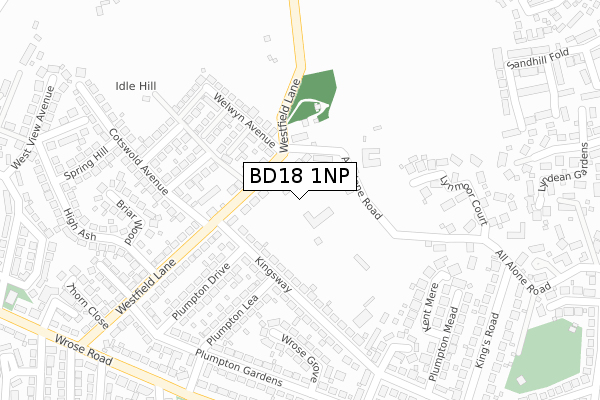
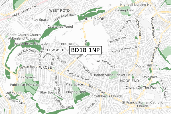
BD18 1NP is located in the Windhill and Wrose electoral ward, within the metropolitan district of Bradford and the English Parliamentary constituency of Shipley. The Sub Integrated Care Board (ICB) Location is NHS West Yorkshire ICB - 36J and the police force is West Yorkshire. This postcode has been in use since April 2018.


GetTheData
Source: OS Open Zoomstack (Ordnance Survey)
Licence: Open Government Licence (requires attribution)
Attribution: Contains OS data © Crown copyright and database right 2025
Source: Open Postcode Geo
Licence: Open Government Licence (requires attribution)
Attribution: Contains OS data © Crown copyright and database right 2025; Contains Royal Mail data © Royal Mail copyright and database right 2025; Source: Office for National Statistics licensed under the Open Government Licence v.3.0
| Easting | 416739 |
| Northing | 437112 |
| Latitude | 53.830019 |
| Longitude | -1.747165 |
GetTheData
Source: Open Postcode Geo
Licence: Open Government Licence
| Country | England |
| Postcode District | BD18 |
➜ See where BD18 is on a map ➜ Where is Bradford? | |
GetTheData
Source: Land Registry Price Paid Data
Licence: Open Government Licence
| Ward | Windhill And Wrose |
| Constituency | Shipley |
GetTheData
Source: ONS Postcode Database
Licence: Open Government Licence
| Kingsway Plumpton Drive (Kingsway) | Wrose | 116m |
| Kingsway Plumpton Drive (Kingsway) | Wrose | 125m |
| Cotswold Avenue Westfield Ln (Cotswold Avenue) | Wrose | 168m |
| Cotswold Avenue Westfield Ln (Cotswold Avenue) | Wrose | 174m |
| Kingsway Plumpton Walk (Kingsway) | Wrose | 282m |
| Shipley Station | 1.8km |
| Frizinghall Station | 1.8km |
| Baildon Station | 2.3km |
GetTheData
Source: NaPTAN
Licence: Open Government Licence
GetTheData
Source: ONS Postcode Database
Licence: Open Government Licence


➜ Get more ratings from the Food Standards Agency
GetTheData
Source: Food Standards Agency
Licence: FSA terms & conditions
| Last Collection | |||
|---|---|---|---|
| Location | Mon-Fri | Sat | Distance |
| Welwyn Estate | 18:15 | 10:30 | 93m |
| 130 Wrose Road | 18:15 | 10:30 | 367m |
| 2 Kingsway | 17:30 | 10:15 | 436m |
GetTheData
Source: Dracos
Licence: Creative Commons Attribution-ShareAlike
The below table lists the International Territorial Level (ITL) codes (formerly Nomenclature of Territorial Units for Statistics (NUTS) codes) and Local Administrative Units (LAU) codes for BD18 1NP:
| ITL 1 Code | Name |
|---|---|
| TLE | Yorkshire and The Humber |
| ITL 2 Code | Name |
| TLE4 | West Yorkshire |
| ITL 3 Code | Name |
| TLE41 | Bradford |
| LAU 1 Code | Name |
| E08000032 | Bradford |
GetTheData
Source: ONS Postcode Directory
Licence: Open Government Licence
The below table lists the Census Output Area (OA), Lower Layer Super Output Area (LSOA), and Middle Layer Super Output Area (MSOA) for BD18 1NP:
| Code | Name | |
|---|---|---|
| OA | E00053542 | |
| LSOA | E01010604 | Bradford 024B |
| MSOA | E02002206 | Bradford 024 |
GetTheData
Source: ONS Postcode Directory
Licence: Open Government Licence
| BD18 1LH | Westfield Lane | 62m |
| BD10 8TX | All Alone Road | 76m |
| BD10 8TY | Starting Post | 103m |
| BD2 1PN | Kingsway | 144m |
| BD18 1LP | Moorview Drive | 158m |
| BD18 1LW | Welwyn Drive | 179m |
| BD2 1PL | Kingsway | 179m |
| BD18 1LL | Welwyn Avenue | 181m |
| BD18 1LU | Bredon Avenue | 196m |
| BD2 1PP | Plumpton Lea | 214m |
GetTheData
Source: Open Postcode Geo; Land Registry Price Paid Data
Licence: Open Government Licence