Property/Postcode Data Search:
BD15 0FP maps, stats, and open data
BD15 0FP is located in the Bingley Rural electoral ward, within the metropolitan district of Bradford and the English Parliamentary constituency of Shipley. The Sub Integrated Care Board (ICB) Location is NHS West Yorkshire ICB - 36J and the police force is West Yorkshire. This postcode has been in use since April 2020.
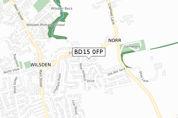
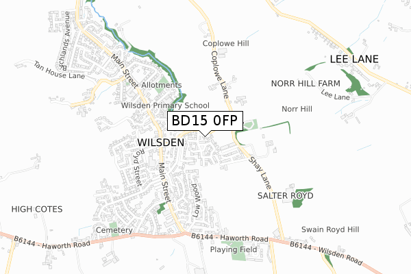
BD15 0FP maps


Source: OS Open Zoomstack (Ordnance Survey)
Licence: Open Government Licence (requires attribution)
Attribution: Contains OS data © Crown copyright and database right 2025
Source: Open Postcode Geo
Licence: Open Government Licence (requires attribution)
Attribution: Contains OS data © Crown copyright and database right 2025; Contains Royal Mail data © Royal Mail copyright and database right 2025; Source: Office for National Statistics licensed under the Open Government Licence v.3.0
Licence: Open Government Licence (requires attribution)
Attribution: Contains OS data © Crown copyright and database right 2025
Source: Open Postcode Geo
Licence: Open Government Licence (requires attribution)
Attribution: Contains OS data © Crown copyright and database right 2025; Contains Royal Mail data © Royal Mail copyright and database right 2025; Source: Office for National Statistics licensed under the Open Government Licence v.3.0
BD15 0FP geodata
| Easting | 408939 |
| Northing | 435855 |
| Latitude | 53.818912 |
| Longitude | -1.865707 |
Where is BD15 0FP?
| Country | England |
| Postcode District | BD15 |
Politics
| Ward | Bingley Rural |
|---|---|
| Constituency | Shipley |
House Prices
Sales of detached houses in BD15 0FP
2025 19 JUN £545,000 |
2025 30 MAY £575,000 |
2024 1 MAR £460,000 |
2022 22 SEP £585,000 |
14, MOORSIDE VIEW, WILSDEN, BRADFORD, BD15 0FP 2021 2 DEC £600,000 |
11, MOORSIDE VIEW, WILSDEN, BRADFORD, BD15 0FP 2021 5 NOV £495,000 |
12, MOORSIDE VIEW, WILSDEN, BRADFORD, BD15 0FP 2021 28 SEP £520,000 |
10, MOORSIDE VIEW, WILSDEN, BRADFORD, BD15 0FP 2021 11 JUN £570,000 |
9, MOORSIDE VIEW, WILSDEN, BRADFORD, BD15 0FP 2021 29 MAR £470,000 |
6, MOORSIDE VIEW, WILSDEN, BRADFORD, BD15 0FP 2021 8 JAN £400,000 |
Source: HM Land Registry Price Paid Data
Licence: Contains HM Land Registry data © Crown copyright and database right 2025. This data is licensed under the Open Government Licence v3.0.
Licence: Contains HM Land Registry data © Crown copyright and database right 2025. This data is licensed under the Open Government Licence v3.0.
Transport
Nearest bus stops to BD15 0FP
| Haworth Rd Lane Ends House (Haworth Road) | Wilsden | 296m |
| Haworth Road Horseshoe Court (Haworth Road) | Wilsden | 299m |
| Main Street Crooke Ln (Main Street) | Wilsden | 450m |
| Main St Royd Street (Main Street) | Wilsden | 450m |
| Main Street Crooke Ln (Main Street) | Wilsden | 452m |
Nearest railway stations to BD15 0FP
| Bingley Station | 3.8km |
| Crossflatts Station | 4.6km |
| Saltaire Station | 5.4km |
Deprivation
37.6% of English postcodes are less deprived than BD15 0FP:Food Standards Agency
Three nearest food hygiene ratings to BD15 0FP (metres)
Wilsden Conservative Club

Wellington Street
390m
The Villager

Peel Street
403m
Co Op

1 Royd Street
408m
➜ Get more ratings from the Food Standards Agency
Nearest post box to BD15 0FP
| Last Collection | |||
|---|---|---|---|
| Location | Mon-Fri | Sat | Distance |
| Fieldhead Estate | 17:00 | 12:00 | 1,574m |
| Harden P.o. Box | 17:15 | 11:45 | 2,521m |
| Allerton Franchise P.o. Box | 17:15 | 12:15 | 3,246m |
BD15 0FP ITL and BD15 0FP LAU
The below table lists the International Territorial Level (ITL) codes (formerly Nomenclature of Territorial Units for Statistics (NUTS) codes) and Local Administrative Units (LAU) codes for BD15 0FP:
| ITL 1 Code | Name |
|---|---|
| TLE | Yorkshire and The Humber |
| ITL 2 Code | Name |
| TLE4 | West Yorkshire |
| ITL 3 Code | Name |
| TLE41 | Bradford |
| LAU 1 Code | Name |
| E08000032 | Bradford |
BD15 0FP census areas
The below table lists the Census Output Area (OA), Lower Layer Super Output Area (LSOA), and Middle Layer Super Output Area (MSOA) for BD15 0FP:
| Code | Name | |
|---|---|---|
| OA | E00053456 | |
| LSOA | E01010593 | Bradford 022F |
| MSOA | E02002204 | Bradford 022 |
Nearest postcodes to BD15 0FP
| BD15 0LG | St Matthews Close | 48m |
| BD15 0LF | St Matthews Grove | 133m |
| BD15 0LX | Wellington Road | 149m |
| BD15 0NL | Horseshoe Court | 192m |
| BD15 0LZ | Lane Side | 192m |
| BD15 0LU | Hornsea Drive | 233m |
| BD15 0LW | Farndale Road | 235m |
| BD15 0LY | Derwent Avenue | 258m |
| BD15 0LT | Royd Street | 268m |
| BD15 0NA | Greenley Hill | 279m |