BD14 6FF maps, stats, and open data
BD14 6FF is located in the Clayton and Fairweather Green electoral ward, within the metropolitan district of Bradford and the English Parliamentary constituency of Bradford West. The Sub Integrated Care Board (ICB) Location is NHS West Yorkshire ICB - 36J and the police force is West Yorkshire. This postcode has been in use since June 2019.
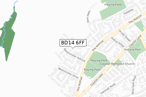
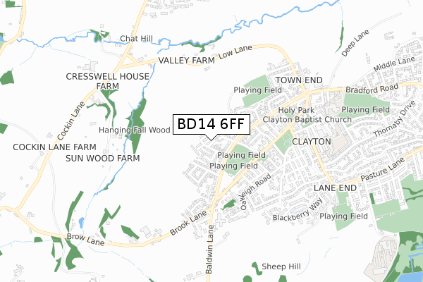
BD14 6FF maps


Licence: Open Government Licence (requires attribution)
Attribution: Contains OS data © Crown copyright and database right 2025
Source: Open Postcode Geo
Licence: Open Government Licence (requires attribution)
Attribution: Contains OS data © Crown copyright and database right 2025; Contains Royal Mail data © Royal Mail copyright and database right 2025; Source: Office for National Statistics licensed under the Open Government Licence v.3.0
BD14 6FF geodata
| Easting | 411428 |
| Northing | 431765 |
| Latitude | 53.782103 |
| Longitude | -1.828051 |
Where is BD14 6FF?
| Country | England |
| Postcode District | BD14 |
Politics
| Ward | Clayton And Fairweather Green |
|---|---|
| Constituency | Bradford West |
House Prices
Sales of detached houses in BD14 6FF
1, REDPOLL CLOSE, CLAYTON, BRADFORD, BD14 6FF 2022 16 DEC £429,995 |
15, REDPOLL CLOSE, CLAYTON, BRADFORD, BD14 6FF 2020 30 OCT £299,995 |
9, REDPOLL CLOSE, CLAYTON, BRADFORD, BD14 6FF 2019 27 SEP £239,696 |
7, REDPOLL CLOSE, CLAYTON, BRADFORD, BD14 6FF 2019 28 JUN £209,995 |
11, REDPOLL CLOSE, CLAYTON, BRADFORD, BD14 6FF 2019 14 JUN £261,995 |
Licence: Contains HM Land Registry data © Crown copyright and database right 2025. This data is licensed under the Open Government Licence v3.0.
Transport
Nearest bus stops to BD14 6FF
| The Avenue Harry La (The Avenue) | Clayton | 145m |
| The Avenue Harry La (The Avenue) | Clayton | 150m |
| The Avenue Westminster Dr (The Avenue) | Clayton | 183m |
| The Avenue Westminster Dr (The Avenue) | Clayton | 236m |
| The Avenue Brook Ln (The Avenue) | Clayton | 295m |
Nearest railway stations to BD14 6FF
| Bradford Forster Square Station | 5.2km |
| Frizinghall Station | 5.8km |
| Low Moor Station | 6.1km |
Broadband
Broadband access in BD14 6FF (2020 data)
| Percentage of properties with Next Generation Access | 100.0% |
| Percentage of properties with Superfast Broadband | 100.0% |
| Percentage of properties with Ultrafast Broadband | 100.0% |
| Percentage of properties with Full Fibre Broadband | 66.7% |
Superfast Broadband is between 30Mbps and 300Mbps
Ultrafast Broadband is > 300Mbps
Broadband limitations in BD14 6FF (2020 data)
| Percentage of properties unable to receive 2Mbps | 0.0% |
| Percentage of properties unable to receive 5Mbps | 0.0% |
| Percentage of properties unable to receive 10Mbps | 0.0% |
| Percentage of properties unable to receive 30Mbps | 0.0% |
Deprivation
49.2% of English postcodes are less deprived than BD14 6FF:Food Standards Agency
Three nearest food hygiene ratings to BD14 6FF (metres)


➜ Get more ratings from the Food Standards Agency
Nearest post box to BD14 6FF
| Last Collection | |||
|---|---|---|---|
| Location | Mon-Fri | Sat | Distance |
| 61 The Avenue Clayton | 17:45 | 12:00 | 353m |
| Baldwin Lane | 17:15 | 12:00 | 363m |
| Clayton P.o. Box | 17:00 | 12:15 | 467m |
BD14 6FF ITL and BD14 6FF LAU
The below table lists the International Territorial Level (ITL) codes (formerly Nomenclature of Territorial Units for Statistics (NUTS) codes) and Local Administrative Units (LAU) codes for BD14 6FF:
| ITL 1 Code | Name |
|---|---|
| TLE | Yorkshire and The Humber |
| ITL 2 Code | Name |
| TLE4 | West Yorkshire |
| ITL 3 Code | Name |
| TLE41 | Bradford |
| LAU 1 Code | Name |
| E08000032 | Bradford |
BD14 6FF census areas
The below table lists the Census Output Area (OA), Lower Layer Super Output Area (LSOA), and Middle Layer Super Output Area (MSOA) for BD14 6FF:
| Code | Name | |
|---|---|---|
| OA | E00053656 | |
| LSOA | E01010634 | Bradford 047B |
| MSOA | E02002229 | Bradford 047 |
Nearest postcodes to BD14 6FF
| BD14 6SQ | Westminster Avenue | 39m |
| BD14 6SD | Harry Lane | 73m |
| BD14 6SH | Westminster Crescent | 88m |
| BD14 6SE | The Avenue | 99m |
| BD14 6SB | Delph Terrace | 127m |
| BD14 6SJ | The Avenue | 134m |
| BD14 6RT | The Avenue | 150m |
| BD14 6SA | Delph Drive | 159m |
| BD14 6SL | Westminster Drive | 178m |
| BD14 6SN | Westminster Gardens | 224m |