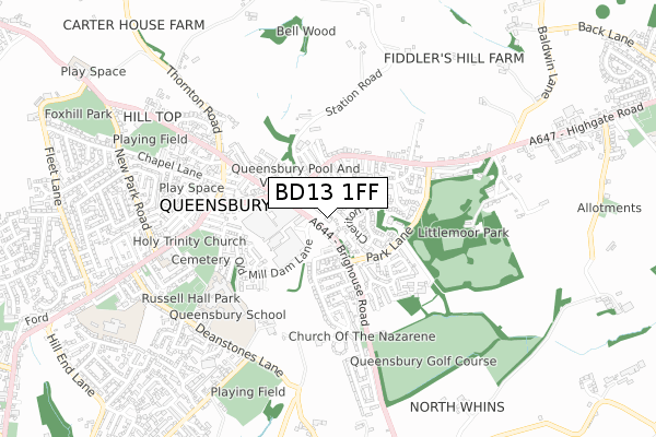
BD13 1FF is located in the Queensbury electoral ward, within the metropolitan district of Bradford and the English Parliamentary constituency of Bradford South. The Sub Integrated Care Board (ICB) Location is NHS West Yorkshire ICB - 36J and the police force is West Yorkshire. This postcode has been in use since September 2018.


GetTheData
Source: OS Open Zoomstack (Ordnance Survey)
Licence: Open Government Licence (requires attribution)
Attribution: Contains OS data © Crown copyright and database right 2025
Source: Open Postcode Geo
Licence: Open Government Licence (requires attribution)
Attribution: Contains OS data © Crown copyright and database right 2025; Contains Royal Mail data © Royal Mail copyright and database right 2025; Source: Office for National Statistics licensed under the Open Government Licence v.3.0
| Easting | 410598 |
| Northing | 430160 |
| Latitude | 53.767695 |
| Longitude | -1.840702 |
GetTheData
Source: Open Postcode Geo
Licence: Open Government Licence
| Country | England |
| Postcode District | BD13 |
➜ See where BD13 is on a map ➜ Where is Queensbury? | |
GetTheData
Source: Land Registry Price Paid Data
Licence: Open Government Licence
| Ward | Queensbury |
| Constituency | Bradford South |
GetTheData
Source: ONS Postcode Database
Licence: Open Government Licence
| Brighouse Road Sandbeds (Brighouse Road) | Queensbury | 44m |
| Brighouse Road Sandbeds (Brighouse Road) | Queensbury | 124m |
| Sand Beds Raglan Street (Sand Beds) | Queensbury | 164m |
| Sand Beds Station Road (Sand Beds) | Queensbury | 181m |
| Brighouse Road Ridgeway (Brighouse Road) | Queensbury | 234m |
GetTheData
Source: NaPTAN
Licence: Open Government Licence
| Percentage of properties with Next Generation Access | 100.0% |
| Percentage of properties with Superfast Broadband | 100.0% |
| Percentage of properties with Ultrafast Broadband | 100.0% |
| Percentage of properties with Full Fibre Broadband | 0.0% |
Superfast Broadband is between 30Mbps and 300Mbps
Ultrafast Broadband is > 300Mbps
| Percentage of properties unable to receive 2Mbps | 0.0% |
| Percentage of properties unable to receive 5Mbps | 0.0% |
| Percentage of properties unable to receive 10Mbps | 0.0% |
| Percentage of properties unable to receive 30Mbps | 0.0% |
GetTheData
Source: Ofcom
Licence: Ofcom Terms of Use (requires attribution)
GetTheData
Source: ONS Postcode Database
Licence: Open Government Licence


➜ Get more ratings from the Food Standards Agency
GetTheData
Source: Food Standards Agency
Licence: FSA terms & conditions
| Last Collection | |||
|---|---|---|---|
| Location | Mon-Fri | Sat | Distance |
| 2 Park Lane Queensbury | 17:45 | 12:00 | 431m |
| Baldwin Lane | 17:15 | 12:00 | 1,495m |
| 61 The Avenue Clayton | 17:45 | 12:00 | 2,121m |
GetTheData
Source: Dracos
Licence: Creative Commons Attribution-ShareAlike
The below table lists the International Territorial Level (ITL) codes (formerly Nomenclature of Territorial Units for Statistics (NUTS) codes) and Local Administrative Units (LAU) codes for BD13 1FF:
| ITL 1 Code | Name |
|---|---|
| TLE | Yorkshire and The Humber |
| ITL 2 Code | Name |
| TLE4 | West Yorkshire |
| ITL 3 Code | Name |
| TLE41 | Bradford |
| LAU 1 Code | Name |
| E08000032 | Bradford |
GetTheData
Source: ONS Postcode Directory
Licence: Open Government Licence
The below table lists the Census Output Area (OA), Lower Layer Super Output Area (LSOA), and Middle Layer Super Output Area (MSOA) for BD13 1FF:
| Code | Name | |
|---|---|---|
| OA | E00054256 | |
| LSOA | E01010756 | Bradford 058D |
| MSOA | E02002240 | Bradford 058 |
GetTheData
Source: ONS Postcode Directory
Licence: Open Government Licence
| BD13 1AU | Regent Street | 71m |
| BD13 1QD | Brighouse Road | 73m |
| BD13 1AT | Albert Street | 98m |
| BD13 1QS | Cheriton Drive | 109m |
| BD13 1QT | Langport Close | 117m |
| BD13 1AR | Victoria Street | 121m |
| BD13 1QX | Dunbar Croft | 122m |
| BD13 1AP | Wellington Street | 124m |
| BD13 2QP | Hunger Hill | 126m |
| BD13 1AW | Brunswick Street | 152m |
GetTheData
Source: Open Postcode Geo; Land Registry Price Paid Data
Licence: Open Government Licence