BD1 4AZ maps, stats, and open data
- Home
- Postcode
- BD
- BD1
- BD1 4
BD1 4AZ is located in the City electoral ward, within the metropolitan district of Bradford and the English Parliamentary constituency of Bradford West. The Sub Integrated Care Board (ICB) Location is NHS West Yorkshire ICB - 36J and the police force is West Yorkshire. This postcode has been in use since August 2017.
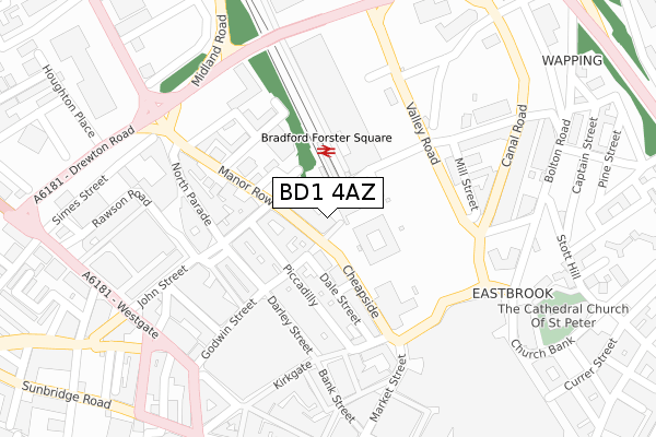
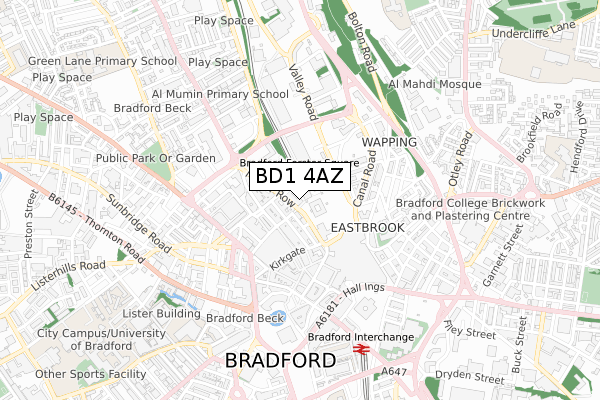
BD1 4AZ maps


Source: OS Open Zoomstack (Ordnance Survey)
Licence: Open Government Licence (requires attribution)
Attribution: Contains OS data © Crown copyright and database right 2025
Source: Open Postcode GeoLicence: Open Government Licence (requires attribution)
Attribution: Contains OS data © Crown copyright and database right 2025; Contains Royal Mail data © Royal Mail copyright and database right 2025; Source: Office for National Statistics licensed under the Open Government Licence v.3.0
BD1 4AZ geodata
| Easting | 416348 |
| Northing | 433413 |
| Latitude | 53.796786 |
| Longitude | -1.753300 |
Where is BD1 4AZ?
| Country | England |
| Postcode District | BD1 |
Politics
| Ward | City |
|---|
| Constituency | Bradford West |
|---|
Transport
Nearest bus stops to BD1 4AZ
| Forster Square (St Blaise Way) | Bradford City Centre | 74m |
| Cheapside | Bradford City Centre | 123m |
| Cheapside | Bradford City Centre | 146m |
| Albion Street (Rawson Square) | Bradford City Centre | 181m |
| Manor Row | Bradford City Centre | 182m |
Nearest railway stations to BD1 4AZ
| Bradford Forster Square Station | 0km |
| Bradford Interchange Station | 0.7km |
| Frizinghall Station | 2.8km |
Broadband
Broadband access in BD1 4AZ (2020 data)
| Percentage of properties with Next Generation Access | 100.0% |
| Percentage of properties with Superfast Broadband | 100.0% |
| Percentage of properties with Ultrafast Broadband | 100.0% |
| Percentage of properties with Full Fibre Broadband | 100.0% |
Superfast Broadband is between 30Mbps and 300Mbps
Ultrafast Broadband is > 300Mbps
Broadband limitations in BD1 4AZ (2020 data)
| Percentage of properties unable to receive 2Mbps | 0.0% |
| Percentage of properties unable to receive 5Mbps | 0.0% |
| Percentage of properties unable to receive 10Mbps | 0.0% |
| Percentage of properties unable to receive 30Mbps | 0.0% |
Deprivation
80.5% of English postcodes are less deprived than
BD1 4AZ:
Food Standards Agency
Three nearest food hygiene ratings to BD1 4AZ (metres)
Intouch Cafe/Diner
Platform Bar
Refresh
➜ Get more ratings from the Food Standards Agency
Nearest post box to BD1 4AZ
| | Last Collection | |
|---|
| Location | Mon-Fri | Sat | Distance |
|---|
| 28 Manor Row | 18:30 | 12:30 | 136m |
| Darley Street P.o. Box | 18:30 | 12:45 | 138m |
| Bradford Mc Business Box | 19:15 | | 204m |
BD1 4AZ ITL and BD1 4AZ LAU
The below table lists the International Territorial Level (ITL) codes (formerly Nomenclature of Territorial Units for Statistics (NUTS) codes) and Local Administrative Units (LAU) codes for BD1 4AZ:
| ITL 1 Code | Name |
|---|
| TLE | Yorkshire and The Humber |
| ITL 2 Code | Name |
|---|
| TLE4 | West Yorkshire |
| ITL 3 Code | Name |
|---|
| TLE41 | Bradford |
| LAU 1 Code | Name |
|---|
| E08000032 | Bradford |
BD1 4AZ census areas
The below table lists the Census Output Area (OA), Lower Layer Super Output Area (LSOA), and Middle Layer Super Output Area (MSOA) for BD1 4AZ:
| Code | Name |
|---|
| OA | E00176109 | |
|---|
| LSOA | E01033690 | Bradford 039G |
|---|
| MSOA | E02002221 | Bradford 039 |
|---|
Nearest postcodes to BD1 4AZ


