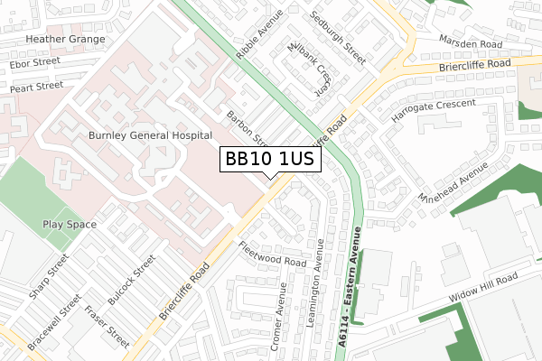
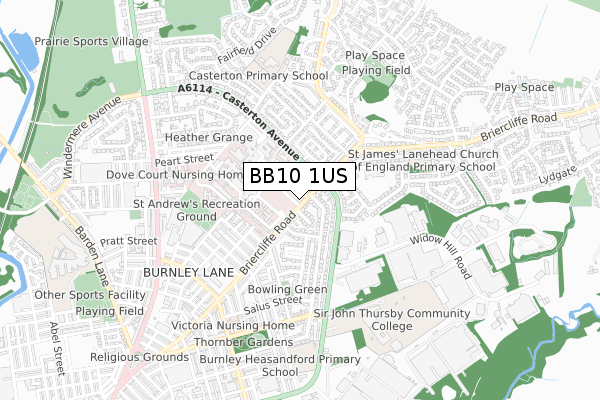
BB10 1US is located in the Queensgate electoral ward, within the local authority district of Burnley and the English Parliamentary constituency of Burnley. The Sub Integrated Care Board (ICB) Location is NHS Lancashire and South Cumbria ICB - 01A and the police force is Lancashire. This postcode has been in use since March 2019.


GetTheData
Source: OS Open Zoomstack (Ordnance Survey)
Licence: Open Government Licence (requires attribution)
Attribution: Contains OS data © Crown copyright and database right 2025
Source: Open Postcode Geo
Licence: Open Government Licence (requires attribution)
Attribution: Contains OS data © Crown copyright and database right 2025; Contains Royal Mail data © Royal Mail copyright and database right 2025; Source: Office for National Statistics licensed under the Open Government Licence v.3.0
| Easting | 385279 |
| Northing | 434661 |
| Latitude | 53.808043 |
| Longitude | -2.225027 |
GetTheData
Source: Open Postcode Geo
Licence: Open Government Licence
| Country | England |
| Postcode District | BB10 |
➜ See where BB10 is on a map ➜ Where is Burnley? | |
GetTheData
Source: Land Registry Price Paid Data
Licence: Open Government Licence
| Ward | Queensgate |
| Constituency | Burnley |
GetTheData
Source: ONS Postcode Database
Licence: Open Government Licence
| Casterton Avenue (Briercliffe Road) | Lane Head | 70m |
| Casterton Avenue (Briercliffe Road) | Lane Head | 96m |
| Burnley General Hospital (Briercliffe Road) | Browhead | 154m |
| Burnley General Hospital (Briercliffe Road) | Browhead | 168m |
| Hospital Grounds (Ebor Street) | Reedley Hallows | 188m |
| Brierfield Station | 1.9km |
| Burnley Central Station | 2.1km |
| Burnley Barracks Station | 2.9km |
GetTheData
Source: NaPTAN
Licence: Open Government Licence
GetTheData
Source: ONS Postcode Database
Licence: Open Government Licence


➜ Get more ratings from the Food Standards Agency
GetTheData
Source: Food Standards Agency
Licence: FSA terms & conditions
| Last Collection | |||
|---|---|---|---|
| Location | Mon-Fri | Sat | Distance |
| 340 Colne Road | 17:30 | 11:00 | 671m |
| Brunshaw Top | 16:00 | 11:00 | 1,581m |
| Brierfield Post Office | 17:30 | 11:00 | 1,940m |
GetTheData
Source: Dracos
Licence: Creative Commons Attribution-ShareAlike
The below table lists the International Territorial Level (ITL) codes (formerly Nomenclature of Territorial Units for Statistics (NUTS) codes) and Local Administrative Units (LAU) codes for BB10 1US:
| ITL 1 Code | Name |
|---|---|
| TLD | North West (England) |
| ITL 2 Code | Name |
| TLD4 | Lancashire |
| ITL 3 Code | Name |
| TLD46 | East Lancashire |
| LAU 1 Code | Name |
| E07000117 | Burnley |
GetTheData
Source: ONS Postcode Directory
Licence: Open Government Licence
The below table lists the Census Output Area (OA), Lower Layer Super Output Area (LSOA), and Middle Layer Super Output Area (MSOA) for BB10 1US:
| Code | Name | |
|---|---|---|
| OA | E00126359 | |
| LSOA | E01024897 | Burnley 002C |
| MSOA | E02005177 | Burnley 002 |
GetTheData
Source: ONS Postcode Directory
Licence: Open Government Licence
| BB10 1TX | Briercliffe Road | 44m |
| BB10 1TU | Briercliffe Road | 75m |
| BB10 3HJ | Matlock Grove | 92m |
| BB10 1TS | Barbon Street | 93m |
| BB10 1TR | Mansergh Street | 95m |
| BB10 3HH | Leamington Avenue | 97m |
| BB10 3HD | Fleetwood Road | 128m |
| BB10 1TT | Killington Street | 133m |
| BB10 2NN | Eastern Avenue | 138m |
| BB10 2PA | Casterton Avenue | 165m |
GetTheData
Source: Open Postcode Geo; Land Registry Price Paid Data
Licence: Open Government Licence