Property/Postcode Data Search:
BB1 8FG maps, stats, and open data
BB1 8FG is located in the Roe Lee electoral ward, within the unitary authority of Blackburn with Darwen and the English Parliamentary constituency of Blackburn. The Sub Integrated Care Board (ICB) Location is NHS Lancashire and South Cumbria ICB - 00Q and the police force is Lancashire. This postcode has been in use since December 2019.
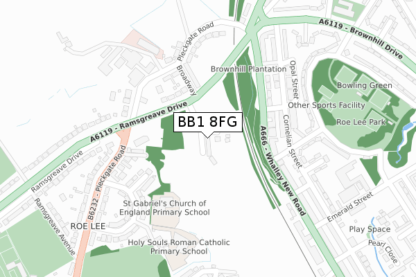
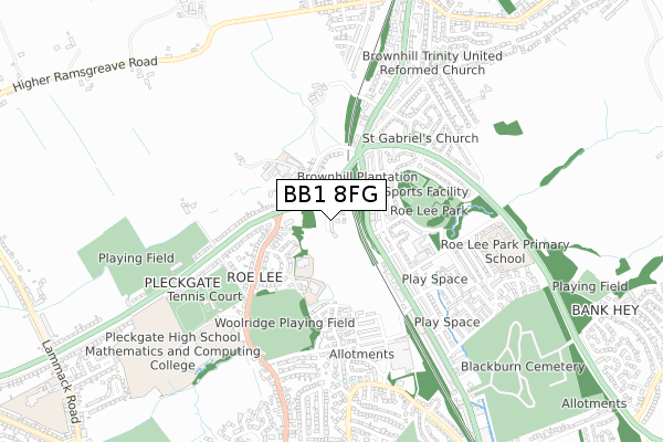
BB1 8FG maps


Source: OS Open Zoomstack (Ordnance Survey)
Licence: Open Government Licence (requires attribution)
Attribution: Contains OS data © Crown copyright and database right 2025
Source: Open Postcode Geo
Licence: Open Government Licence (requires attribution)
Attribution: Contains OS data © Crown copyright and database right 2025; Contains Royal Mail data © Royal Mail copyright and database right 2025; Source: Office for National Statistics licensed under the Open Government Licence v.3.0
Licence: Open Government Licence (requires attribution)
Attribution: Contains OS data © Crown copyright and database right 2025
Source: Open Postcode Geo
Licence: Open Government Licence (requires attribution)
Attribution: Contains OS data © Crown copyright and database right 2025; Contains Royal Mail data © Royal Mail copyright and database right 2025; Source: Office for National Statistics licensed under the Open Government Licence v.3.0
BB1 8FG geodata
| Easting | 368357 |
| Northing | 430641 |
| Latitude | 53.771156 |
| Longitude | -2.481571 |
Where is BB1 8FG?
| Country | England |
| Postcode District | BB1 |
Politics
| Ward | Roe Lee |
|---|---|
| Constituency | Blackburn |
House Prices
Sales of detached houses in BB1 8FG
45, CHESTNUT AVENUE, BLACKBURN, BB1 8FG 2024 20 DEC £232,750 |
53, CHESTNUT AVENUE, BLACKBURN, BB1 8FG 2024 20 DEC £275,000 |
43, CHESTNUT AVENUE, BLACKBURN, BB1 8FG 2024 18 DEC £245,000 |
49, CHESTNUT AVENUE, BLACKBURN, BB1 8FG 2024 18 DEC £270,750 |
47, CHESTNUT AVENUE, BLACKBURN, BB1 8FG 2024 16 DEC £294,500 |
2, CHESTNUT AVENUE, BLACKBURN, BB1 8FG 2024 16 AUG £270,750 |
2023 24 MAY £270,000 |
41, CHESTNUT AVENUE, BLACKBURN, BB1 8FG 2021 20 DEC £233,000 |
39, CHESTNUT AVENUE, BLACKBURN, BB1 8FG 2021 17 DEC £237,000 |
2021 30 SEP £230,000 |
Source: HM Land Registry Price Paid Data
Licence: Contains HM Land Registry data © Crown copyright and database right 2025. This data is licensed under the Open Government Licence v3.0.
Licence: Contains HM Land Registry data © Crown copyright and database right 2025. This data is licensed under the Open Government Licence v3.0.
Transport
Nearest bus stops to BB1 8FG
| Fern Bank (Whalley New Road) | Roe Lee | 141m |
| Fern Bank (Whalley New Road) | Brownhill | 224m |
| Knowles Arms (Pleckgate Road) | Pleckgate | 234m |
| Knowles Arms (Pleckgate Road) | Pleckgate | 249m |
| Brownhill (Whalley New Road) | Brownhill | 249m |
Nearest railway stations to BB1 8FG
| Ramsgreave & Wilpshire Station | 1km |
| Blackburn Station | 2.7km |
| Rishton Station | 4.1km |
Deprivation
62.1% of English postcodes are less deprived than BB1 8FG:Food Standards Agency
Three nearest food hygiene ratings to BB1 8FG (metres)
Haydock Nursing Home

Haydock Nursing Home
219m
ego@knowles arms

Knowles Arms
219m
Holy Souls R C Primary School (LCC)

Holy Souls Roman Catholic School
233m
➜ Get more ratings from the Food Standards Agency
Nearest post box to BB1 8FG
| Last Collection | |||
|---|---|---|---|
| Location | Mon-Fri | Sat | Distance |
| Shear Brow | 16:45 | 12:00 | 1,391m |
| 91 Preston New Road | 17:15 | 13:00 | 2,275m |
| Furthergate Ind Estate | 18:00 | 00:01 | 2,430m |
BB1 8FG ITL and BB1 8FG LAU
The below table lists the International Territorial Level (ITL) codes (formerly Nomenclature of Territorial Units for Statistics (NUTS) codes) and Local Administrative Units (LAU) codes for BB1 8FG:
| ITL 1 Code | Name |
|---|---|
| TLD | North West (England) |
| ITL 2 Code | Name |
| TLD4 | Lancashire |
| ITL 3 Code | Name |
| TLD41 | Blackburn with Darwen |
| LAU 1 Code | Name |
| E06000008 | Blackburn with Darwen |
BB1 8FG census areas
The below table lists the Census Output Area (OA), Lower Layer Super Output Area (LSOA), and Middle Layer Super Output Area (MSOA) for BB1 8FG:
| Code | Name | |
|---|---|---|
| OA | E00063700 | |
| LSOA | E01012633 | Blackburn with Darwen 001C |
| MSOA | E02002615 | Blackburn with Darwen 001 |
Nearest postcodes to BB1 8FG
| BB1 8QP | Further Wilworth | 196m |
| BB1 8ND | Ramsgreave Drive | 197m |
| BB1 9AY | Ruby Street | 209m |
| BB1 9AZ | Whalley New Road | 217m |
| BB1 8QZ | Broadway | 223m |
| BB1 8QW | Pleckgate Road | 227m |
| BB1 8QN | Wilworth Crescent | 233m |
| BB1 8QF | Lower Wilworth | 234m |
| BB1 9RY | Topaz Street | 237m |
| BB1 9QN | Cornelian Street | 247m |