Property/Postcode Data Search:
BB1 8FE maps, stats, and open data
BB1 8FE is located in the Roe Lee electoral ward, within the unitary authority of Blackburn with Darwen and the English Parliamentary constituency of Blackburn. The Sub Integrated Care Board (ICB) Location is NHS Lancashire and South Cumbria ICB - 00Q and the police force is Lancashire. This postcode has been in use since January 2020.
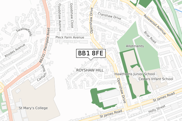
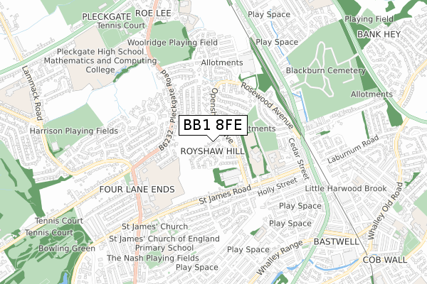
BB1 8FE maps


Source: OS Open Zoomstack (Ordnance Survey)
Licence: Open Government Licence (requires attribution)
Attribution: Contains OS data © Crown copyright and database right 2025
Source: Open Postcode Geo
Licence: Open Government Licence (requires attribution)
Attribution: Contains OS data © Crown copyright and database right 2025; Contains Royal Mail data © Royal Mail copyright and database right 2025; Source: Office for National Statistics licensed under the Open Government Licence v.3.0
Licence: Open Government Licence (requires attribution)
Attribution: Contains OS data © Crown copyright and database right 2025
Source: Open Postcode Geo
Licence: Open Government Licence (requires attribution)
Attribution: Contains OS data © Crown copyright and database right 2025; Contains Royal Mail data © Royal Mail copyright and database right 2025; Source: Office for National Statistics licensed under the Open Government Licence v.3.0
BB1 8FE geodata
| Easting | 368305 |
| Northing | 430612 |
| Latitude | 53.770892 |
| Longitude | -2.482357 |
Where is BB1 8FE?
| Country | England |
| Postcode District | BB1 |
Politics
| Ward | Roe Lee |
|---|---|
| Constituency | Blackburn |
House Prices
Sales of detached houses in BB1 8FE
36, THE LIMES, BLACKBURN, BB1 8FE 2023 10 NOV £245,000 |
42, THE LIMES, BLACKBURN, BB1 8FE 2023 27 OCT £220,000 |
44, THE LIMES, BLACKBURN, BB1 8FE 2023 20 OCT £270,000 |
30, THE LIMES, BLACKBURN, BB1 8FE 2023 30 JUN £239,000 |
18, THE LIMES, BLACKBURN, BB1 8FE 2023 28 APR £265,000 |
16, THE LIMES, BLACKBURN, BB1 8FE 2023 31 MAR £245,000 |
28, THE LIMES, BLACKBURN, BB1 8FE 2023 31 MAR £265,000 |
26, THE LIMES, BLACKBURN, BB1 8FE 2023 31 MAR £210,000 |
20, THE LIMES, BLACKBURN, BB1 8FE 2023 31 MAR £210,000 |
14, THE LIMES, BLACKBURN, BB1 8FE 2022 25 NOV £229,000 |
Source: HM Land Registry Price Paid Data
Licence: Contains HM Land Registry data © Crown copyright and database right 2025. This data is licensed under the Open Government Licence v3.0.
Licence: Contains HM Land Registry data © Crown copyright and database right 2025. This data is licensed under the Open Government Licence v3.0.
Transport
Nearest bus stops to BB1 8FE
| Knowles Arms (Pleckgate Road) | Pleckgate | 188m |
| Fern Bank (Whalley New Road) | Roe Lee | 196m |
| Knowles Arms (Pleckgate Road) | Pleckgate | 202m |
| Pleckgate Road (Ramsgreave Drive) | Roe Lee | 238m |
| Fern Bank (Whalley New Road) | Brownhill | 275m |
Nearest railway stations to BB1 8FE
| Ramsgreave & Wilpshire Station | 1km |
| Blackburn Station | 2.7km |
| Mill Hill (Lancs) Station | 4.1km |
Deprivation
62.1% of English postcodes are less deprived than BB1 8FE:Food Standards Agency
Three nearest food hygiene ratings to BB1 8FE (metres)
Haydock Nursing Home

Haydock Nursing Home
172m
ego@knowles arms

Knowles Arms
172m
SAS UK Group - Holy Souls Primary School

Holy Souls Roman Catholic School
174m
➜ Get more ratings from the Food Standards Agency
Nearest post box to BB1 8FE
| Last Collection | |||
|---|---|---|---|
| Location | Mon-Fri | Sat | Distance |
| Shear Brow | 16:45 | 12:00 | 1,349m |
| 91 Preston New Road | 17:15 | 13:00 | 2,231m |
| Furthergate Ind Estate | 18:00 | 00:01 | 2,433m |
BB1 8FE ITL and BB1 8FE LAU
The below table lists the International Territorial Level (ITL) codes (formerly Nomenclature of Territorial Units for Statistics (NUTS) codes) and Local Administrative Units (LAU) codes for BB1 8FE:
| ITL 1 Code | Name |
|---|---|
| TLD | North West (England) |
| ITL 2 Code | Name |
| TLD4 | Lancashire |
| ITL 3 Code | Name |
| TLD41 | Blackburn with Darwen |
| LAU 1 Code | Name |
| E06000008 | Blackburn with Darwen |
BB1 8FE census areas
The below table lists the Census Output Area (OA), Lower Layer Super Output Area (LSOA), and Middle Layer Super Output Area (MSOA) for BB1 8FE:
| Code | Name | |
|---|---|---|
| OA | E00063700 | |
| LSOA | E01012633 | Blackburn with Darwen 001C |
| MSOA | E02002615 | Blackburn with Darwen 001 |
Nearest postcodes to BB1 8FE
| BB1 8QP | Further Wilworth | 154m |
| BB1 8QN | Wilworth Crescent | 173m |
| BB1 8QW | Pleckgate Road | 178m |
| BB1 8QF | Lower Wilworth | 180m |
| BB1 8ND | Ramsgreave Drive | 202m |
| BB1 8QZ | Broadway | 244m |
| BB1 9AY | Ruby Street | 256m |
| BB1 8QR | Pleckgate Road | 270m |
| BB1 9AZ | Whalley New Road | 272m |
| BB1 8QJ | Sandringham Close | 278m |