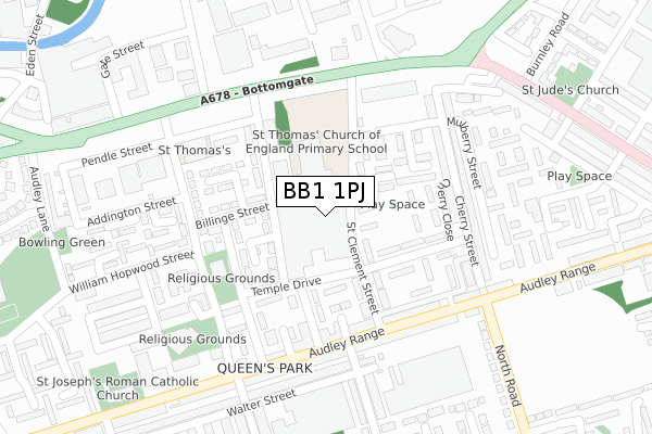
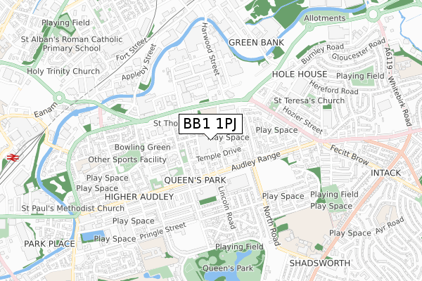
BB1 1PJ is located in the Audley & Queen's Park electoral ward, within the unitary authority of Blackburn with Darwen and the English Parliamentary constituency of Blackburn. The Sub Integrated Care Board (ICB) Location is NHS Lancashire and South Cumbria ICB - 00Q and the police force is Lancashire. This postcode has been in use since April 2019.


GetTheData
Source: OS Open Zoomstack (Ordnance Survey)
Licence: Open Government Licence (requires attribution)
Attribution: Contains OS data © Crown copyright and database right 2025
Source: Open Postcode Geo
Licence: Open Government Licence (requires attribution)
Attribution: Contains OS data © Crown copyright and database right 2025; Contains Royal Mail data © Royal Mail copyright and database right 2025; Source: Office for National Statistics licensed under the Open Government Licence v.3.0
| Easting | 369613 |
| Northing | 427976 |
| Latitude | 53.747279 |
| Longitude | -2.462252 |
GetTheData
Source: Open Postcode Geo
Licence: Open Government Licence
| Country | England |
| Postcode District | BB1 |
➜ See where BB1 is on a map ➜ Where is Blackburn? | |
GetTheData
Source: Land Registry Price Paid Data
Licence: Open Government Licence
| Ward | Audley & Queen's Park |
| Constituency | Blackburn |
GetTheData
Source: ONS Postcode Database
Licence: Open Government Licence
| Lincoln Close (Audley Range) | Queens Park | 206m |
| Lincoln Close (Audley Range) | Queens Park | 209m |
| St Thomas's Street (Audley Range) | Queens Park | 226m |
| Tesco (Bottomgate) | Blackburn | 227m |
| Ordnance Street (Bottomgate) | Blackburn | 238m |
| Blackburn Station | 1.1km |
| Mill Hill (Lancs) Station | 2.9km |
| Rishton Station | 3.3km |
GetTheData
Source: NaPTAN
Licence: Open Government Licence
GetTheData
Source: ONS Postcode Database
Licence: Open Government Licence


➜ Get more ratings from the Food Standards Agency
GetTheData
Source: Food Standards Agency
Licence: FSA terms & conditions
| Last Collection | |||
|---|---|---|---|
| Location | Mon-Fri | Sat | Distance |
| Longton Street | 17:15 | 13:15 | 558m |
| Furthergate Ind Estate | 18:00 | 13:00 | 597m |
| Furthergate Ind Estate | 18:00 | 00:01 | 599m |
GetTheData
Source: Dracos
Licence: Creative Commons Attribution-ShareAlike
The below table lists the International Territorial Level (ITL) codes (formerly Nomenclature of Territorial Units for Statistics (NUTS) codes) and Local Administrative Units (LAU) codes for BB1 1PJ:
| ITL 1 Code | Name |
|---|---|
| TLD | North West (England) |
| ITL 2 Code | Name |
| TLD4 | Lancashire |
| ITL 3 Code | Name |
| TLD41 | Blackburn with Darwen |
| LAU 1 Code | Name |
| E06000008 | Blackburn with Darwen |
GetTheData
Source: ONS Postcode Directory
Licence: Open Government Licence
The below table lists the Census Output Area (OA), Lower Layer Super Output Area (LSOA), and Middle Layer Super Output Area (MSOA) for BB1 1PJ:
| Code | Name | |
|---|---|---|
| OA | E00063402 | |
| LSOA | E01012575 | Blackburn with Darwen 007D |
| MSOA | E02002621 | Blackburn with Darwen 007 |
GetTheData
Source: ONS Postcode Directory
Licence: Open Government Licence
| BB1 1NE | Newton Street | 49m |
| BB1 1LE | Billinge Street | 98m |
| BB1 1PB | St Thomas Street | 112m |
| BB1 1NZ | Baker Street | 124m |
| BB1 1NW | St Clement Street | 132m |
| BB1 1NL | Temple Drive | 143m |
| BB1 1NY | Lincoln Close | 148m |
| BB1 1PA | Acorn Street | 172m |
| BB1 1NP | Cherry Close | 186m |
| BB1 1TH | Audley Range | 194m |
GetTheData
Source: Open Postcode Geo; Land Registry Price Paid Data
Licence: Open Government Licence