Property/Postcode Data Search:
BA7 7FX maps, stats, and open data
BA7 7FX is located in the Castle Cary electoral ward, within the unitary authority of Somerset and the English Parliamentary constituency of Somerton and Frome. The Sub Integrated Care Board (ICB) Location is NHS Somerset ICB - 11X and the police force is Avon and Somerset. This postcode has been in use since October 2019.
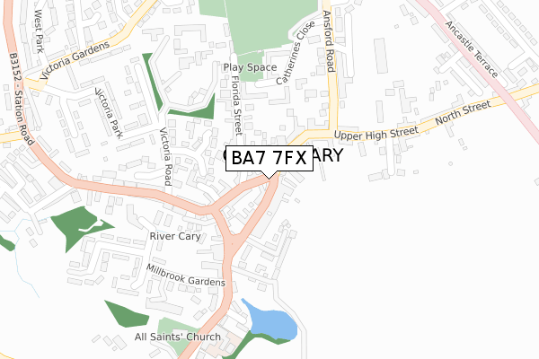
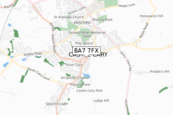
BA7 7FX maps


Source: OS Open Zoomstack (Ordnance Survey)
Licence: Open Government Licence (requires attribution)
Attribution: Contains OS data © Crown copyright and database right 2025
Source: Open Postcode Geo
Licence: Open Government Licence (requires attribution)
Attribution: Contains OS data © Crown copyright and database right 2025; Contains Royal Mail data © Royal Mail copyright and database right 2025; Source: Office for National Statistics licensed under the Open Government Licence v.3.0
Licence: Open Government Licence (requires attribution)
Attribution: Contains OS data © Crown copyright and database right 2025
Source: Open Postcode Geo
Licence: Open Government Licence (requires attribution)
Attribution: Contains OS data © Crown copyright and database right 2025; Contains Royal Mail data © Royal Mail copyright and database right 2025; Source: Office for National Statistics licensed under the Open Government Licence v.3.0
BA7 7FX geodata
| Easting | 364089 |
| Northing | 132343 |
| Latitude | 51.089262 |
| Longitude | -2.514124 |
Where is BA7 7FX?
| Country | England |
| Postcode District | BA7 |
Politics
| Ward | Castle Cary |
|---|---|
| Constituency | Somerton And Frome |
Transport
Nearest bus stops to BA7 7FX
| Town Hall (High Street) | Ansford | 35m |
| Horsepond Inn | Castle Cary | 118m |
| The Horsepond (Fore Street) | Castle Cary | 119m |
| Horse Pond Inn (Park Street) | Castle Cary | 149m |
| Florida Fields | Ansford | 385m |
Nearest railway stations to BA7 7FX
| Castle Cary Station | 1.3km |
| Bruton Station | 5.3km |
Deprivation
50.7% of English postcodes are less deprived than BA7 7FX:Food Standards Agency
Three nearest food hygiene ratings to BA7 7FX (metres)
Pinsents Deli

Market Place
27m
The Somerset Wine Company Limited

Market Place
27m
Miah's Castle Tandoori

Woodcock Street
29m
➜ Get more ratings from the Food Standards Agency
Nearest post box to BA7 7FX
| Last Collection | |||
|---|---|---|---|
| Location | Mon-Fri | Sat | Distance |
| Cumnock Crescent | 11:00 | 11:00 | 411m |
| Torbay Road | 11:10 | 09:30 | 635m |
| Clanville | 11:00 | 07:30 | 1,711m |
BA7 7FX ITL and BA7 7FX LAU
The below table lists the International Territorial Level (ITL) codes (formerly Nomenclature of Territorial Units for Statistics (NUTS) codes) and Local Administrative Units (LAU) codes for BA7 7FX:
| ITL 1 Code | Name |
|---|---|
| TLK | South West (England) |
| ITL 2 Code | Name |
| TLK2 | Dorset and Somerset |
| ITL 3 Code | Name |
| TLK23 | Somerset CC |
| LAU 1 Code | Name |
| E07000189 | South Somerset |
BA7 7FX census areas
The below table lists the Census Output Area (OA), Lower Layer Super Output Area (LSOA), and Middle Layer Super Output Area (MSOA) for BA7 7FX:
| Code | Name | |
|---|---|---|
| OA | E00148581 | |
| LSOA | E01029167 | South Somerset 002B |
| MSOA | E02006076 | South Somerset 002 |
Nearest postcodes to BA7 7FX
| BA7 7AL | Market Place | 16m |
| BA7 7FB | Whites Yard | 36m |
| BA7 7BG | Fore Street | 49m |
| BA7 7AA | Bailey Hill | 61m |
| BA7 7AD | Bailey Hill | 65m |
| BA7 7BJ | Woodcock Street | 68m |
| BA7 7BQ | Fore Street | 68m |
| BA7 7AW | High Street | 109m |
| BA7 7AN | High Street | 109m |
| BA7 7BH | Lower Woodcock Street | 116m |