BA6 9QW maps, stats, and open data
BA6 9QW is located in the Glastonbury electoral ward, within the unitary authority of Somerset and the English Parliamentary constituency of Wells. The Sub Integrated Care Board (ICB) Location is NHS Somerset ICB - 11X and the police force is Avon and Somerset. This postcode has been in use since May 2018.
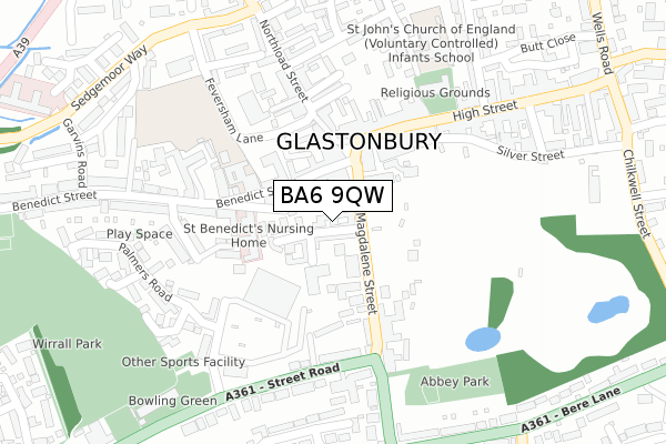
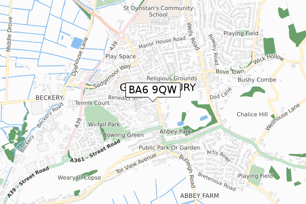
BA6 9QW maps


Licence: Open Government Licence (requires attribution)
Attribution: Contains OS data © Crown copyright and database right 2025
Source: Open Postcode Geo
Licence: Open Government Licence (requires attribution)
Attribution: Contains OS data © Crown copyright and database right 2025; Contains Royal Mail data © Royal Mail copyright and database right 2025; Source: Office for National Statistics licensed under the Open Government Licence v.3.0
BA6 9QW geodata
| Easting | 349848 |
| Northing | 138810 |
| Latitude | 51.146337 |
| Longitude | -2.718350 |
Where is BA6 9QW?
| Country | England |
| Postcode District | BA6 |
Politics
| Ward | Glastonbury |
|---|---|
| Constituency | Wells |
Transport
Nearest bus stops to BA6 9QW
| Magdalene Street | Glastonbury | 51m |
| Town Hall (Market Place) | Glastonbury | 72m |
| Town Hall (Market Place) | Glastonbury | 74m |
| Tmurco Garage (Street Road) | Glastonbury | 226m |
| Superstore (Street Road) | Glastonbury | 251m |
Broadband
Broadband access in BA6 9QW (2020 data)
| Percentage of properties with Next Generation Access | 100.0% |
| Percentage of properties with Superfast Broadband | 100.0% |
| Percentage of properties with Ultrafast Broadband | 0.0% |
| Percentage of properties with Full Fibre Broadband | 0.0% |
Superfast Broadband is between 30Mbps and 300Mbps
Ultrafast Broadband is > 300Mbps
Broadband limitations in BA6 9QW (2020 data)
| Percentage of properties unable to receive 2Mbps | 0.0% |
| Percentage of properties unable to receive 5Mbps | 0.0% |
| Percentage of properties unable to receive 10Mbps | 0.0% |
| Percentage of properties unable to receive 30Mbps | 0.0% |
Deprivation
89.7% of English postcodes are less deprived than BA6 9QW:Food Standards Agency
Three nearest food hygiene ratings to BA6 9QW (metres)


➜ Get more ratings from the Food Standards Agency
Nearest post box to BA6 9QW
| Last Collection | |||
|---|---|---|---|
| Location | Mon-Fri | Sat | Distance |
| Benedict Street | 17:30 | 12:15 | 133m |
| Glastonbury Post Office | 18:00 | 12:45 | 308m |
| Coursing Batch | 17:00 | 12:00 | 1,307m |
BA6 9QW ITL and BA6 9QW LAU
The below table lists the International Territorial Level (ITL) codes (formerly Nomenclature of Territorial Units for Statistics (NUTS) codes) and Local Administrative Units (LAU) codes for BA6 9QW:
| ITL 1 Code | Name |
|---|---|
| TLK | South West (England) |
| ITL 2 Code | Name |
| TLK2 | Dorset and Somerset |
| ITL 3 Code | Name |
| TLK23 | Somerset CC |
| LAU 1 Code | Name |
| E07000187 | Mendip |
BA6 9QW census areas
The below table lists the Census Output Area (OA), Lower Layer Super Output Area (LSOA), and Middle Layer Super Output Area (MSOA) for BA6 9QW:
| Code | Name | |
|---|---|---|
| OA | E00147924 | |
| LSOA | E01029046 | Mendip 011A |
| MSOA | E02006057 | Mendip 011 |
Nearest postcodes to BA6 9QW
| BA6 9EH | Magdalene Street | 27m |
| BA6 9ER | Magdalene Street | 35m |
| BA6 9NE | Benedict Street | 67m |
| BA6 9NA | St Benedicts Close | 77m |
| BA6 9GU | Mayfield Close | 81m |
| BA6 9FD | Magdalene Street | 81m |
| BA6 9HJ | Market Place | 81m |
| BA6 9EL | Magdalene Street | 85m |
| BA6 9EX | Benedict Street | 91m |
| BA6 9EU | Market Place | 97m |