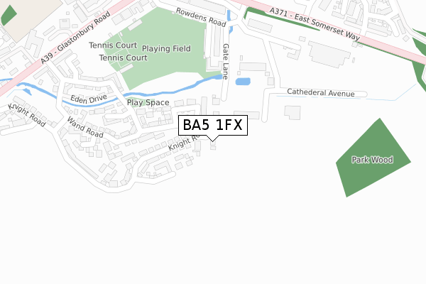
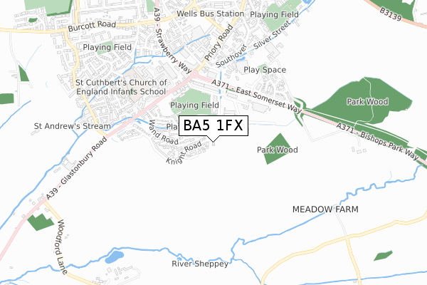
BA5 1FX is located in the Wells electoral ward, within the unitary authority of Somerset and the English Parliamentary constituency of Wells. The Sub Integrated Care Board (ICB) Location is NHS Somerset ICB - 11X and the police force is Avon and Somerset. This postcode has been in use since October 2017.


GetTheData
Source: OS Open Zoomstack (Ordnance Survey)
Licence: Open Government Licence (requires attribution)
Attribution: Contains OS data © Crown copyright and database right 2025
Source: Open Postcode Geo
Licence: Open Government Licence (requires attribution)
Attribution: Contains OS data © Crown copyright and database right 2025; Contains Royal Mail data © Royal Mail copyright and database right 2025; Source: Office for National Statistics licensed under the Open Government Licence v.3.0
| Easting | 354636 |
| Northing | 144796 |
| Latitude | 51.200561 |
| Longitude | -2.650662 |
GetTheData
Source: Open Postcode Geo
Licence: Open Government Licence
| Country | England |
| Postcode District | BA5 |
➜ See where BA5 is on a map ➜ Where is Wells? | |
GetTheData
Source: Land Registry Price Paid Data
Licence: Open Government Licence
| Ward | Wells |
| Constituency | Wells |
GetTheData
Source: ONS Postcode Database
Licence: Open Government Licence
12, MOSS CLOSE, WELLS, BA5 1FX 2019 3 JUL £375,000 |
11, MOSS CLOSE, WELLS, BA5 1FX 2017 31 OCT £480,000 |
GetTheData
Source: HM Land Registry Price Paid Data
Licence: Contains HM Land Registry data © Crown copyright and database right 2025. This data is licensed under the Open Government Licence v3.0.
| The Police Station (Glastonbury Road) | Wells | 397m |
| Cow And Gate Factory (Glastonbury Road) | Wells | 402m |
| Jocelyn Drive Turn (Glastonbury Road) | Wells | 596m |
| Jocelyn Drive Turn (Glastonbury Road) | Wells | 607m |
| Kenward Mill Trading Estate (Jocelyn Drive) | Wells | 752m |
GetTheData
Source: NaPTAN
Licence: Open Government Licence
| Percentage of properties with Next Generation Access | 100.0% |
| Percentage of properties with Superfast Broadband | 100.0% |
| Percentage of properties with Ultrafast Broadband | 100.0% |
| Percentage of properties with Full Fibre Broadband | 100.0% |
Superfast Broadband is between 30Mbps and 300Mbps
Ultrafast Broadband is > 300Mbps
| Percentage of properties unable to receive 2Mbps | 0.0% |
| Percentage of properties unable to receive 5Mbps | 0.0% |
| Percentage of properties unable to receive 10Mbps | 0.0% |
| Percentage of properties unable to receive 30Mbps | 0.0% |
GetTheData
Source: Ofcom
Licence: Ofcom Terms of Use (requires attribution)
GetTheData
Source: ONS Postcode Database
Licence: Open Government Licence


➜ Get more ratings from the Food Standards Agency
GetTheData
Source: Food Standards Agency
Licence: FSA terms & conditions
| Last Collection | |||
|---|---|---|---|
| Location | Mon-Fri | Sat | Distance |
| Wells Delivery Office | 18:00 | 12:45 | 701m |
| Priory Road Post Office, Closed | 17:30 | 12:45 | 771m |
| Tucker Street | 17:30 | 11:30 | 801m |
GetTheData
Source: Dracos
Licence: Creative Commons Attribution-ShareAlike
The below table lists the International Territorial Level (ITL) codes (formerly Nomenclature of Territorial Units for Statistics (NUTS) codes) and Local Administrative Units (LAU) codes for BA5 1FX:
| ITL 1 Code | Name |
|---|---|
| TLK | South West (England) |
| ITL 2 Code | Name |
| TLK2 | Dorset and Somerset |
| ITL 3 Code | Name |
| TLK23 | Somerset CC |
| LAU 1 Code | Name |
| E07000187 | Mendip |
GetTheData
Source: ONS Postcode Directory
Licence: Open Government Licence
The below table lists the Census Output Area (OA), Lower Layer Super Output Area (LSOA), and Middle Layer Super Output Area (MSOA) for BA5 1FX:
| Code | Name | |
|---|---|---|
| OA | E00148102 | |
| LSOA | E01029081 | Mendip 008D |
| MSOA | E02006054 | Mendip 008 |
GetTheData
Source: ONS Postcode Directory
Licence: Open Government Licence
| BA5 1DJ | Gate Lane | 173m |
| BA5 1TY | Alfred Street | 236m |
| BA5 1SX | Willson Close | 238m |
| BA5 1RN | Wand Road | 248m |
| BA5 1TX | Alfred Street | 269m |
| BA5 1WA | Bagot Walk | 270m |
| BA5 1WD | Wand Road | 311m |
| BA5 1WB | Eden Drive | 312m |
| BA5 1TU | Rowdens Road | 331m |
| BA5 1SS | Bradfield Close | 360m |
GetTheData
Source: Open Postcode Geo; Land Registry Price Paid Data
Licence: Open Government Licence