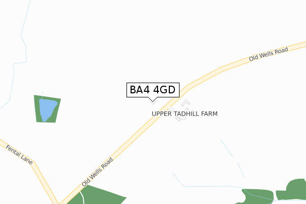
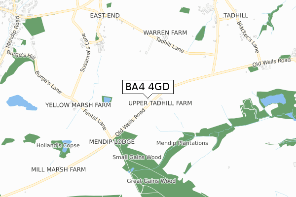
BA4 4GD is located in the Mendip Central and East electoral ward, within the unitary authority of Somerset and the English Parliamentary constituency of Somerton and Frome. The Sub Integrated Care Board (ICB) Location is NHS Somerset ICB - 11X and the police force is Avon and Somerset. This postcode has been in use since April 2020.


GetTheData
Source: OS Open Zoomstack (Ordnance Survey)
Licence: Open Government Licence (requires attribution)
Attribution: Contains OS data © Crown copyright and database right 2025
Source: Open Postcode Geo
Licence: Open Government Licence (requires attribution)
Attribution: Contains OS data © Crown copyright and database right 2025; Contains Royal Mail data © Royal Mail copyright and database right 2025; Source: Office for National Statistics licensed under the Open Government Licence v.3.0
| Easting | 367557 |
| Northing | 146150 |
| Latitude | 51.213618 |
| Longitude | -2.465856 |
GetTheData
Source: Open Postcode Geo
Licence: Open Government Licence
| Country | England |
| Postcode District | BA4 |
➜ See where BA4 is on a map | |
GetTheData
Source: Land Registry Price Paid Data
Licence: Open Government Licence
| Ward | Mendip Central And East |
| Constituency | Somerton And Frome |
GetTheData
Source: ONS Postcode Database
Licence: Open Government Licence
| Bridge House (The Bridge) | Stoke St Michael | 1,288m |
| Bridge House | Stoke St Michael | 1,289m |
| Vale View (Long Cross Bottom) | Stoke St Michael | 1,316m |
| Vale View (Long Cross Bottom) | Stoke St Michael | 1,325m |
| Bus Shelter (Church Street) | Stoke St Michael | 1,348m |
GetTheData
Source: NaPTAN
Licence: Open Government Licence
GetTheData
Source: ONS Postcode Database
Licence: Open Government Licence

➜ Get more ratings from the Food Standards Agency
GetTheData
Source: Food Standards Agency
Licence: FSA terms & conditions
| Last Collection | |||
|---|---|---|---|
| Location | Mon-Fri | Sat | Distance |
| Cranmore Railway Station | 15:30 | 08:30 | 3,253m |
| Holcombe Post Office | 16:45 | 12:00 | 3,443m |
| Cannards Grave | 12:30 | 09:45 | 6,490m |
GetTheData
Source: Dracos
Licence: Creative Commons Attribution-ShareAlike
The below table lists the International Territorial Level (ITL) codes (formerly Nomenclature of Territorial Units for Statistics (NUTS) codes) and Local Administrative Units (LAU) codes for BA4 4GD:
| ITL 1 Code | Name |
|---|---|
| TLK | South West (England) |
| ITL 2 Code | Name |
| TLK2 | Dorset and Somerset |
| ITL 3 Code | Name |
| TLK23 | Somerset CC |
| LAU 1 Code | Name |
| E07000187 | Mendip |
GetTheData
Source: ONS Postcode Directory
Licence: Open Government Licence
The below table lists the Census Output Area (OA), Lower Layer Super Output Area (LSOA), and Middle Layer Super Output Area (MSOA) for BA4 4GD:
| Code | Name | |
|---|---|---|
| OA | E00147801 | |
| LSOA | E01029020 | Mendip 010A |
| MSOA | E02006056 | Mendip 010 |
GetTheData
Source: ONS Postcode Directory
Licence: Open Government Licence
| BA4 4LF | Long Cross | 472m |
| BA3 5LA | East End | 672m |
| BA3 5JY | 754m | |
| BA3 5LB | East End | 765m |
| BA3 5LD | 922m | |
| BA3 5QT | Tadhill | 937m |
| BA3 5QU | Tadhill | 976m |
| BA3 5QX | Tadhill | 1031m |
| BA3 5QS | Townsend | 1135m |
| BA3 5TJ | The Batch | 1237m |
GetTheData
Source: Open Postcode Geo; Land Registry Price Paid Data
Licence: Open Government Licence