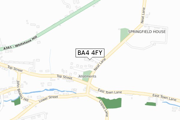
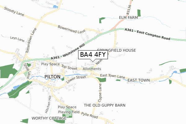
BA4 4FY is located in the Mendip South electoral ward, within the unitary authority of Somerset and the English Parliamentary constituency of Wells. The Sub Integrated Care Board (ICB) Location is NHS Somerset ICB - 11X and the police force is Avon and Somerset. This postcode has been in use since August 2017.


GetTheData
Source: OS Open Zoomstack (Ordnance Survey)
Licence: Open Government Licence (requires attribution)
Attribution: Contains OS data © Crown copyright and database right 2025
Source: Open Postcode Geo
Licence: Open Government Licence (requires attribution)
Attribution: Contains OS data © Crown copyright and database right 2025; Contains Royal Mail data © Royal Mail copyright and database right 2025; Source: Office for National Statistics licensed under the Open Government Licence v.3.0
| Easting | 359736 |
| Northing | 140987 |
| Latitude | 51.166695 |
| Longitude | -2.577243 |
GetTheData
Source: Open Postcode Geo
Licence: Open Government Licence
| Country | England |
| Postcode District | BA4 |
➜ See where BA4 is on a map ➜ Where is Pilton? | |
GetTheData
Source: Land Registry Price Paid Data
Licence: Open Government Licence
| Ward | Mendip South |
| Constituency | Wells |
GetTheData
Source: ONS Postcode Database
Licence: Open Government Licence
| Top Street (Whitstone Hill) | Pilton | 550m |
| Top Street (Whitstone Hill) | Pilton | 551m |
| Pilton Post Office (Whitstone Hill) | Pilton | 920m |
| The Crown Inn (Whitstone Hill) | Pilton | 926m |
| Sewage Works (Park Hill) | Pilton | 1,382m |
GetTheData
Source: NaPTAN
Licence: Open Government Licence
| Percentage of properties with Next Generation Access | 100.0% |
| Percentage of properties with Superfast Broadband | 100.0% |
| Percentage of properties with Ultrafast Broadband | 0.0% |
| Percentage of properties with Full Fibre Broadband | 0.0% |
Superfast Broadband is between 30Mbps and 300Mbps
Ultrafast Broadband is > 300Mbps
| Median download speed | 19.7Mbps |
| Average download speed | 25.0Mbps |
| Maximum download speed | 40.55Mbps |
| Median upload speed | 1.1Mbps |
| Average upload speed | 3.1Mbps |
| Maximum upload speed | 7.06Mbps |
| Percentage of properties unable to receive 2Mbps | 0.0% |
| Percentage of properties unable to receive 5Mbps | 0.0% |
| Percentage of properties unable to receive 10Mbps | 0.0% |
| Percentage of properties unable to receive 30Mbps | 0.0% |
GetTheData
Source: Ofcom
Licence: Ofcom Terms of Use (requires attribution)
GetTheData
Source: ONS Postcode Database
Licence: Open Government Licence


➜ Get more ratings from the Food Standards Agency
GetTheData
Source: Food Standards Agency
Licence: FSA terms & conditions
| Last Collection | |||
|---|---|---|---|
| Location | Mon-Fri | Sat | Distance |
| Cannards Grave | 12:30 | 09:45 | 3,055m |
| Wells Post Office | 17:30 | 12:30 | 6,712m |
| Priory Road Post Office, Closed | 17:30 | 12:45 | 6,728m |
GetTheData
Source: Dracos
Licence: Creative Commons Attribution-ShareAlike
The below table lists the International Territorial Level (ITL) codes (formerly Nomenclature of Territorial Units for Statistics (NUTS) codes) and Local Administrative Units (LAU) codes for BA4 4FY:
| ITL 1 Code | Name |
|---|---|
| TLK | South West (England) |
| ITL 2 Code | Name |
| TLK2 | Dorset and Somerset |
| ITL 3 Code | Name |
| TLK23 | Somerset CC |
| LAU 1 Code | Name |
| E07000187 | Mendip |
GetTheData
Source: ONS Postcode Directory
Licence: Open Government Licence
The below table lists the Census Output Area (OA), Lower Layer Super Output Area (LSOA), and Middle Layer Super Output Area (MSOA) for BA4 4FY:
| Code | Name | |
|---|---|---|
| OA | E00147998 | |
| LSOA | E01029059 | Mendip 013B |
| MSOA | E02006059 | Mendip 013 |
GetTheData
Source: ONS Postcode Directory
Licence: Open Government Licence
| BA4 4DF | Top Street | 203m |
| BA4 4DD | Lower Street | 258m |
| BA4 4DT | Whitstone Hill | 324m |
| BA4 4DG | Culverwell Cottages | 390m |
| BA4 4DB | John Beales Hill | 401m |
| BA4 4DQ | Top Street | 486m |
| BA4 4BL | Mount Pleasant | 523m |
| BA4 4BH | Barrow Lane | 537m |
| BA4 4BJ | 551m | |
| BA4 4DU | Top Street | 610m |
GetTheData
Source: Open Postcode Geo; Land Registry Price Paid Data
Licence: Open Government Licence