BA22 8FN maps, stats, and open data
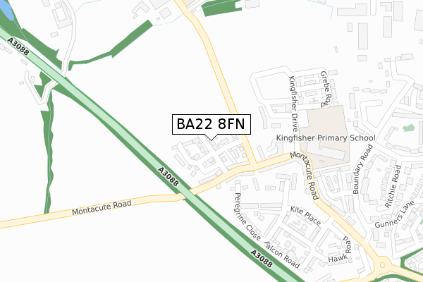
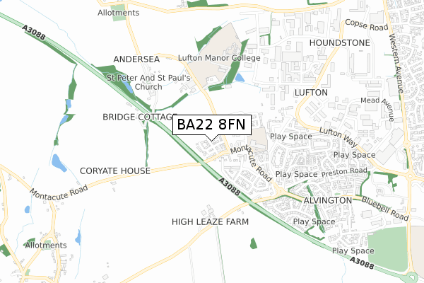
BA22 8FN is located in the Brympton electoral ward, within the unitary authority of Somerset and the English Parliamentary constituency of Yeovil. The Sub Integrated Care Board (ICB) Location is NHS Somerset ICB - 11X and the police force is Avon and Somerset. This postcode has been in use since December 2018.
BA22 8FN maps


Licence: Open Government Licence (requires attribution)
Attribution: Contains OS data © Crown copyright and database right 2025
Source: Open Postcode Geo
Licence: Open Government Licence (requires attribution)
Attribution: Contains OS data © Crown copyright and database right 2025; Contains Royal Mail data © Royal Mail copyright and database right 2025; Source: Office for National Statistics licensed under the Open Government Licence v.3.0
BA22 8FN geodata
| Easting | 351864 |
| Northing | 116522 |
| Latitude | 50.946107 |
| Longitude | -2.686559 |
Where is BA22 8FN?
| Country | England |
| Postcode District | BA22 |
Politics
| Ward | Brympton |
|---|---|
| Constituency | Yeovil |
Transport
Nearest bus stops to BA22 8FN
| Lufton College | Yeovil | 419m |
| Houndstone Corner (New Road) | Houndstone | 429m |
| Houndstone Corner (New Road) | Houndstone | 430m |
| George Smith Way | Houndstone | 458m |
| George Smith Way (Artillery Road) | Houndstone | 466m |
Broadband
Broadband access in BA22 8FN (2020 data)
| Percentage of properties with Next Generation Access | 100.0% |
| Percentage of properties with Superfast Broadband | 100.0% |
| Percentage of properties with Ultrafast Broadband | 100.0% |
| Percentage of properties with Full Fibre Broadband | 100.0% |
Superfast Broadband is between 30Mbps and 300Mbps
Ultrafast Broadband is > 300Mbps
Broadband limitations in BA22 8FN (2020 data)
| Percentage of properties unable to receive 2Mbps | 0.0% |
| Percentage of properties unable to receive 5Mbps | 0.0% |
| Percentage of properties unable to receive 10Mbps | 0.0% |
| Percentage of properties unable to receive 30Mbps | 0.0% |
Deprivation
6% of English postcodes are less deprived than BA22 8FN:Food Standards Agency
Three nearest food hygiene ratings to BA22 8FN (metres)


➜ Get more ratings from the Food Standards Agency
Nearest post box to BA22 8FN
| Last Collection | |||
|---|---|---|---|
| Location | Mon-Fri | Sat | Distance |
| Grove Avenue | 16:00 | 12:00 | 627m |
| Montacute Post Office | 16:15 | 10:00 | 2,059m |
| Hyde Road | 16:00 | 09:30 | 2,396m |
BA22 8FN ITL and BA22 8FN LAU
The below table lists the International Territorial Level (ITL) codes (formerly Nomenclature of Territorial Units for Statistics (NUTS) codes) and Local Administrative Units (LAU) codes for BA22 8FN:
| ITL 1 Code | Name |
|---|---|
| TLK | South West (England) |
| ITL 2 Code | Name |
| TLK2 | Dorset and Somerset |
| ITL 3 Code | Name |
| TLK23 | Somerset CC |
| LAU 1 Code | Name |
| E07000189 | South Somerset |
BA22 8FN census areas
The below table lists the Census Output Area (OA), Lower Layer Super Output Area (LSOA), and Middle Layer Super Output Area (MSOA) for BA22 8FN:
| Code | Name | |
|---|---|---|
| OA | E00148549 | |
| LSOA | E01029160 | South Somerset 012A |
| MSOA | E02006086 | South Somerset 012 |
Nearest postcodes to BA22 8FN
| BA22 8BR | Falcon Road | 267m |
| BA22 8FB | Harrier Drive | 315m |
| BA22 8SN | Buller Avenue | 359m |
| BA22 8SE | Boundary Road | 389m |
| BA22 8SU | 397m | |
| BA22 8SF | Boundary Road | 433m |
| BA22 8TF | 457m | |
| BA22 8TP | Clarks Close | 465m |
| BA22 8SH | Richie Road | 483m |
| BA22 8SW | Clayton Close | 489m |