Property/Postcode Data Search:
BA22 7FR maps, stats, and open data
BA22 7FR is located in the Castle Cary electoral ward, within the unitary authority of Somerset and the English Parliamentary constituency of Somerton and Frome. The Sub Integrated Care Board (ICB) Location is NHS Somerset ICB - 11X and the police force is Avon and Somerset. This postcode has been in use since January 2020.
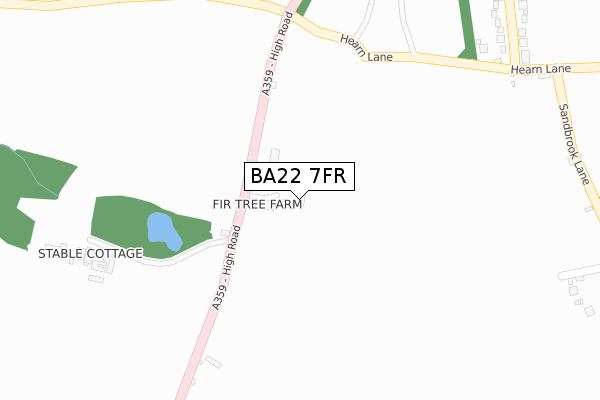
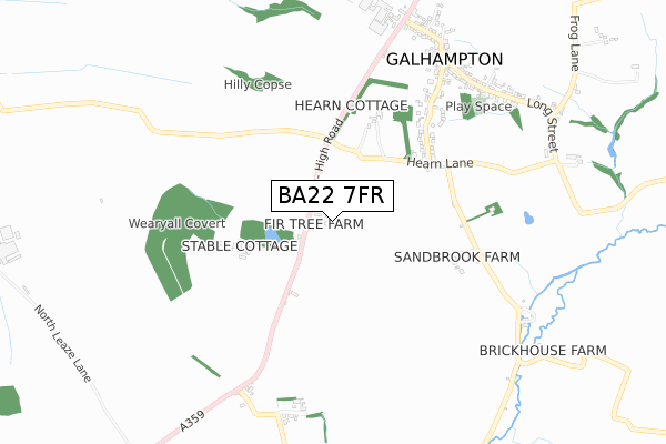
BA22 7FR maps


Source: OS Open Zoomstack (Ordnance Survey)
Licence: Open Government Licence (requires attribution)
Attribution: Contains OS data © Crown copyright and database right 2025
Source: Open Postcode Geo
Licence: Open Government Licence (requires attribution)
Attribution: Contains OS data © Crown copyright and database right 2025; Contains Royal Mail data © Royal Mail copyright and database right 2025; Source: Office for National Statistics licensed under the Open Government Licence v.3.0
Licence: Open Government Licence (requires attribution)
Attribution: Contains OS data © Crown copyright and database right 2025
Source: Open Postcode Geo
Licence: Open Government Licence (requires attribution)
Attribution: Contains OS data © Crown copyright and database right 2025; Contains Royal Mail data © Royal Mail copyright and database right 2025; Source: Office for National Statistics licensed under the Open Government Licence v.3.0
BA22 7FR geodata
| Easting | 363211 |
| Northing | 129086 |
| Latitude | 51.059920 |
| Longitude | -2.526328 |
Where is BA22 7FR?
| Country | England |
| Postcode District | BA22 |
Politics
| Ward | Castle Cary |
|---|---|
| Constituency | Somerton And Frome |
Transport
Nearest bus stops to BA22 7FR
| Harvester (A359) | Galhampton | 865m |
| Harvester (A359) | Galhampton | 867m |
Nearest railway stations to BA22 7FR
| Castle Cary Station | 4.4km |
Deprivation
37.8% of English postcodes are less deprived than BA22 7FR:Food Standards Agency
Three nearest food hygiene ratings to BA22 7FR (metres)
Galhampton Country Store

High Road
134m
The Orchard Inn

High Road
829m
Dorset Delights Catering

Pippins
1,370m
➜ Get more ratings from the Food Standards Agency
Nearest post box to BA22 7FR
| Last Collection | |||
|---|---|---|---|
| Location | Mon-Fri | Sat | Distance |
| Torbay Road | 11:10 | 09:30 | 3,334m |
| Fishermans Hut | 12:00 | 11:30 | 3,404m |
| South Cadbury | 16:15 | 09:00 | 3,478m |
BA22 7FR ITL and BA22 7FR LAU
The below table lists the International Territorial Level (ITL) codes (formerly Nomenclature of Territorial Units for Statistics (NUTS) codes) and Local Administrative Units (LAU) codes for BA22 7FR:
| ITL 1 Code | Name |
|---|---|
| TLK | South West (England) |
| ITL 2 Code | Name |
| TLK2 | Dorset and Somerset |
| ITL 3 Code | Name |
| TLK23 | Somerset CC |
| LAU 1 Code | Name |
| E07000189 | South Somerset |
BA22 7FR census areas
The below table lists the Census Output Area (OA), Lower Layer Super Output Area (LSOA), and Middle Layer Super Output Area (MSOA) for BA22 7FR:
| Code | Name | |
|---|---|---|
| OA | E00148585 | |
| LSOA | E01029166 | South Somerset 002A |
| MSOA | E02006076 | South Somerset 002 |
Nearest postcodes to BA22 7FR
| BA22 7BE | High Road | 349m |
| BA22 7AU | 397m | |
| BA22 7AN | March Lane | 472m |
| BA22 7AW | 482m | |
| BA22 7BG | 556m | |
| BA22 7AP | Middle Street | 628m |
| BA22 7BB | 650m | |
| BA22 7BU | Three Ashes | 711m |
| BA22 7BX | 744m | |
| BA22 7AS | St Helens | 758m |