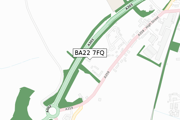
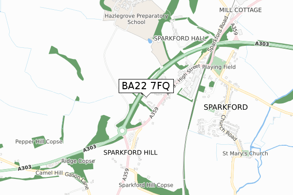
BA22 7FQ is located in the Castle Cary electoral ward, within the unitary authority of Somerset and the English Parliamentary constituency of Somerton and Frome. The Sub Integrated Care Board (ICB) Location is NHS Somerset ICB - 11X and the police force is Avon and Somerset. This postcode has been in use since September 2019.


GetTheData
Source: OS Open Zoomstack (Ordnance Survey)
Licence: Open Government Licence (requires attribution)
Attribution: Contains OS data © Crown copyright and database right 2025
Source: Open Postcode Geo
Licence: Open Government Licence (requires attribution)
Attribution: Contains OS data © Crown copyright and database right 2025; Contains Royal Mail data © Royal Mail copyright and database right 2025; Source: Office for National Statistics licensed under the Open Government Licence v.3.0
| Easting | 360109 |
| Northing | 126184 |
| Latitude | 51.033619 |
| Longitude | -2.570270 |
GetTheData
Source: Open Postcode Geo
Licence: Open Government Licence
| Country | England |
| Postcode District | BA22 |
➜ See where BA22 is on a map ➜ Where is Sparkford? | |
GetTheData
Source: Land Registry Price Paid Data
Licence: Open Government Licence
| Ward | Castle Cary |
| Constituency | Somerton And Frome |
GetTheData
Source: ONS Postcode Database
Licence: Open Government Licence
| Sparkford Inn | Sparkford | 306m |
| Sparkford Inn (High Street) | Sparkford | 318m |
| Wolfester Terrace | Sparkford | 387m |
| Wolfester Terrace | Sparkford | 390m |
| The Avenue (Church Road) | Sparkford | 680m |
GetTheData
Source: NaPTAN
Licence: Open Government Licence
GetTheData
Source: ONS Postcode Database
Licence: Open Government Licence


➜ Get more ratings from the Food Standards Agency
GetTheData
Source: Food Standards Agency
Licence: FSA terms & conditions
| Last Collection | |||
|---|---|---|---|
| Location | Mon-Fri | Sat | Distance |
| Hazelgrove Service Station | 16:15 | 12:00 | 410m |
| South Cadbury | 16:15 | 09:00 | 3,186m |
| Lower Foddington | 11:15 | 11:15 | 3,805m |
GetTheData
Source: Dracos
Licence: Creative Commons Attribution-ShareAlike
The below table lists the International Territorial Level (ITL) codes (formerly Nomenclature of Territorial Units for Statistics (NUTS) codes) and Local Administrative Units (LAU) codes for BA22 7FQ:
| ITL 1 Code | Name |
|---|---|
| TLK | South West (England) |
| ITL 2 Code | Name |
| TLK2 | Dorset and Somerset |
| ITL 3 Code | Name |
| TLK23 | Somerset CC |
| LAU 1 Code | Name |
| E07000189 | South Somerset |
GetTheData
Source: ONS Postcode Directory
Licence: Open Government Licence
The below table lists the Census Output Area (OA), Lower Layer Super Output Area (LSOA), and Middle Layer Super Output Area (MSOA) for BA22 7FQ:
| Code | Name | |
|---|---|---|
| OA | E00148565 | |
| LSOA | E01029164 | South Somerset 006A |
| MSOA | E02006080 | South Somerset 006 |
GetTheData
Source: ONS Postcode Directory
Licence: Open Government Licence
| BA22 7JG | High Street | 135m |
| BA22 7JH | High Street | 147m |
| BA22 7JQ | Hardwarden Terrace | 261m |
| BA22 7JL | The Avenue | 474m |
| BA22 7JE | 488m | |
| BA22 7AT | Cherry Pie Lane | 510m |
| BA22 7JT | Ainstey Drive | 515m |
| BA22 7LD | 525m | |
| BA22 7JW | Twines Close | 574m |
| BA22 7JU | Orchard Close | 587m |
GetTheData
Source: Open Postcode Geo; Land Registry Price Paid Data
Licence: Open Government Licence