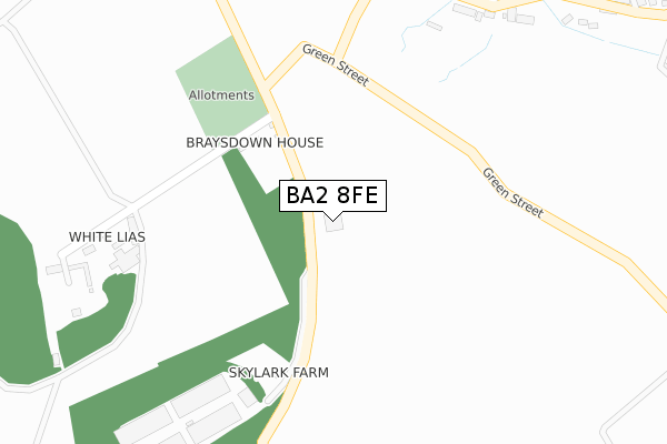
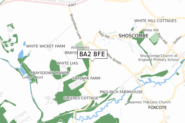
BA2 8FE is located in the Bathavon South electoral ward, within the unitary authority of Bath and North East Somerset and the English Parliamentary constituency of North East Somerset. The Sub Integrated Care Board (ICB) Location is NHS Bath and North East Somerset, Swindon and Wiltshire ICB - 92 and the police force is Avon and Somerset. This postcode has been in use since December 2019.


GetTheData
Source: OS Open Zoomstack (Ordnance Survey)
Licence: Open Government Licence (requires attribution)
Attribution: Contains OS data © Crown copyright and database right 2025
Source: Open Postcode Geo
Licence: Open Government Licence (requires attribution)
Attribution: Contains OS data © Crown copyright and database right 2025; Contains Royal Mail data © Royal Mail copyright and database right 2025; Source: Office for National Statistics licensed under the Open Government Licence v.3.0
| Easting | 370796 |
| Northing | 156122 |
| Latitude | 51.303459 |
| Longitude | -2.420303 |
GetTheData
Source: Open Postcode Geo
Licence: Open Government Licence
| Country | England |
| Postcode District | BA2 |
➜ See where BA2 is on a map | |
GetTheData
Source: Land Registry Price Paid Data
Licence: Open Government Licence
| Ward | Bathavon South |
| Constituency | North East Somerset |
GetTheData
Source: ONS Postcode Database
Licence: Open Government Licence
| Shoscombe Turn (Green Street) | Shoscombe Vale | 237m |
| Montague Road (Rag Hill) | Shoscombe Vale | 388m |
| Montague Road (Rag Hill) | Shoscombe Vale | 401m |
| Applecroft (White Hill) | White Hill | 659m |
| Applecroft (White Hill) | White Hill | 661m |
GetTheData
Source: NaPTAN
Licence: Open Government Licence
GetTheData
Source: ONS Postcode Database
Licence: Open Government Licence


➜ Get more ratings from the Food Standards Agency
GetTheData
Source: Food Standards Agency
Licence: FSA terms & conditions
| Last Collection | |||
|---|---|---|---|
| Location | Mon-Fri | Sat | Distance |
| Frederick Avenue | 17:30 | 10:00 | 1,147m |
| Peasedown St John Post Office | 17:30 | 11:30 | 1,425m |
| Ashgrove | 17:30 | 11:00 | 1,630m |
GetTheData
Source: Dracos
Licence: Creative Commons Attribution-ShareAlike
The below table lists the International Territorial Level (ITL) codes (formerly Nomenclature of Territorial Units for Statistics (NUTS) codes) and Local Administrative Units (LAU) codes for BA2 8FE:
| ITL 1 Code | Name |
|---|---|
| TLK | South West (England) |
| ITL 2 Code | Name |
| TLK1 | Gloucestershire, Wiltshire and Bath/Bristol area |
| ITL 3 Code | Name |
| TLK12 | Bath and North East Somerset, North Somerset and South Gloucestershire |
| LAU 1 Code | Name |
| E06000022 | Bath and North East Somerset |
GetTheData
Source: ONS Postcode Directory
Licence: Open Government Licence
The below table lists the Census Output Area (OA), Lower Layer Super Output Area (LSOA), and Middle Layer Super Output Area (MSOA) for BA2 8FE:
| Code | Name | |
|---|---|---|
| OA | E00072619 | |
| LSOA | E01033079 | Bath and North East Somerset 010H |
| MSOA | E02002994 | Bath and North East Somerset 010 |
GetTheData
Source: ONS Postcode Directory
Licence: Open Government Licence
| BA2 8LL | Braysdown | 300m |
| BA2 8LP | 377m | |
| BA2 8LR | Montague Road | 475m |
| BA2 8LW | Woodborough | 490m |
| BA2 8LS | 529m | |
| BA2 8NQ | 552m | |
| BA2 8LT | Shoscombe Farm Cottages | 557m |
| BA2 8NF | Railway Terrace | 644m |
| BA2 8LU | 692m | |
| BA2 8NG | Foxcote | 740m |
GetTheData
Source: Open Postcode Geo; Land Registry Price Paid Data
Licence: Open Government Licence