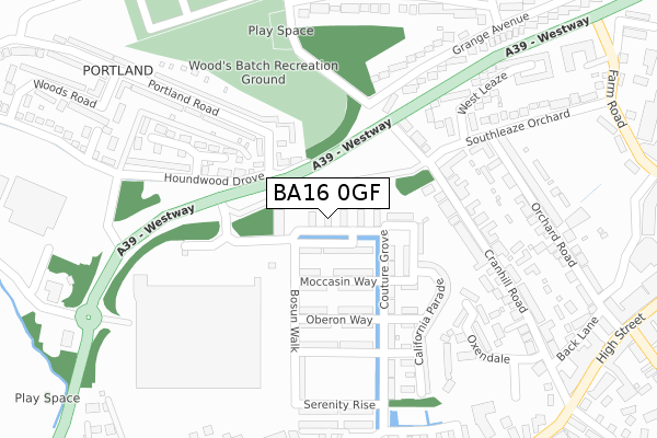
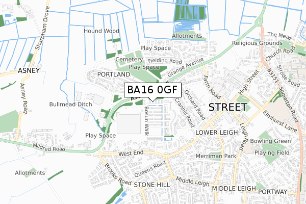
BA16 0GF is located in the Street electoral ward, within the unitary authority of Somerset and the English Parliamentary constituency of Wells. The Sub Integrated Care Board (ICB) Location is NHS Somerset ICB - 11X and the police force is Avon and Somerset. This postcode has been in use since November 2017.


GetTheData
Source: OS Open Zoomstack (Ordnance Survey)
Licence: Open Government Licence (requires attribution)
Attribution: Contains OS data © Crown copyright and database right 2025
Source: Open Postcode Geo
Licence: Open Government Licence (requires attribution)
Attribution: Contains OS data © Crown copyright and database right 2025; Contains Royal Mail data © Royal Mail copyright and database right 2025; Source: Office for National Statistics licensed under the Open Government Licence v.3.0
| Easting | 347714 |
| Northing | 136690 |
| Latitude | 51.127084 |
| Longitude | -2.748546 |
GetTheData
Source: Open Postcode Geo
Licence: Open Government Licence
| Country | England |
| Postcode District | BA16 |
➜ See where BA16 is on a map ➜ Where is Street? | |
GetTheData
Source: Land Registry Price Paid Data
Licence: Open Government Licence
| Ward | Street |
| Constituency | Wells |
GetTheData
Source: ONS Postcode Database
Licence: Open Government Licence
| Houndwood Close (Houndwood Drove) | Street | 324m |
| Houndwood Close (Houndwood Drove) | Street | 333m |
| Woods Road (Portland Road) | Street | 339m |
| Woods Road (Portland Road) | Street | 341m |
| Fielding Road | Street | 347m |
GetTheData
Source: NaPTAN
Licence: Open Government Licence
| Percentage of properties with Next Generation Access | 100.0% |
| Percentage of properties with Superfast Broadband | 100.0% |
| Percentage of properties with Ultrafast Broadband | 0.0% |
| Percentage of properties with Full Fibre Broadband | 0.0% |
Superfast Broadband is between 30Mbps and 300Mbps
Ultrafast Broadband is > 300Mbps
| Median download speed | 40.0Mbps |
| Average download speed | 38.8Mbps |
| Maximum download speed | 54.51Mbps |
| Median upload speed | 8.0Mbps |
| Average upload speed | 7.3Mbps |
| Maximum upload speed | 10.82Mbps |
| Percentage of properties unable to receive 2Mbps | 0.0% |
| Percentage of properties unable to receive 5Mbps | 0.0% |
| Percentage of properties unable to receive 10Mbps | 0.0% |
| Percentage of properties unable to receive 30Mbps | 0.0% |
GetTheData
Source: Ofcom
Licence: Ofcom Terms of Use (requires attribution)
GetTheData
Source: ONS Postcode Database
Licence: Open Government Licence


➜ Get more ratings from the Food Standards Agency
GetTheData
Source: Food Standards Agency
Licence: FSA terms & conditions
| Last Collection | |||
|---|---|---|---|
| Location | Mon-Fri | Sat | Distance |
| Cranhill Road | 16:00 | 11:30 | 272m |
| Street Post Office | 18:00 | 12:00 | 578m |
| Clarks Village | 16:00 | 11:30 | 586m |
GetTheData
Source: Dracos
Licence: Creative Commons Attribution-ShareAlike
The below table lists the International Territorial Level (ITL) codes (formerly Nomenclature of Territorial Units for Statistics (NUTS) codes) and Local Administrative Units (LAU) codes for BA16 0GF:
| ITL 1 Code | Name |
|---|---|
| TLK | South West (England) |
| ITL 2 Code | Name |
| TLK2 | Dorset and Somerset |
| ITL 3 Code | Name |
| TLK23 | Somerset CC |
| LAU 1 Code | Name |
| E07000187 | Mendip |
GetTheData
Source: ONS Postcode Directory
Licence: Open Government Licence
The below table lists the Census Output Area (OA), Lower Layer Super Output Area (LSOA), and Middle Layer Super Output Area (MSOA) for BA16 0GF:
| Code | Name | |
|---|---|---|
| OA | E00148067 | |
| LSOA | E01029070 | Mendip 014A |
| MSOA | E02006060 | Mendip 014 |
GetTheData
Source: ONS Postcode Directory
Licence: Open Government Licence
| BA16 0GB | Moonraker Square | 78m |
| BA16 9PN | Houndwood Drove | 103m |
| BA16 0GL | Flotilla Promenade | 128m |
| BA16 0BH | Woods Batch | 183m |
| BA16 0GA | Couture Grove | 185m |
| BA16 0GE | Caribee Quarter | 192m |
| BA16 0BZ | Cranhill Road | 205m |
| BA16 0FZ | Californian Parade | 220m |
| BA16 0GP | Clipper Court | 229m |
| BA16 9PY | Deerswood Gardens | 251m |
GetTheData
Source: Open Postcode Geo; Land Registry Price Paid Data
Licence: Open Government Licence