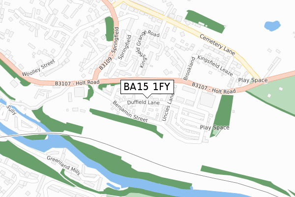
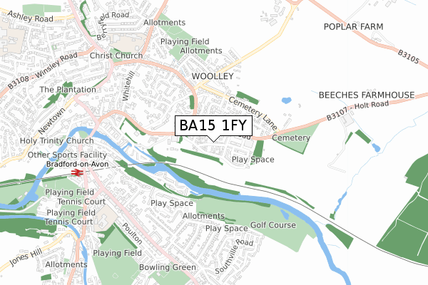
BA15 1FY is located in the Bradford-on-Avon North electoral ward, within the unitary authority of Wiltshire and the English Parliamentary constituency of Chippenham. The Sub Integrated Care Board (ICB) Location is NHS Bath and North East Somerset, Swindon and Wiltshire ICB - 92 and the police force is Wiltshire. This postcode has been in use since October 2017.


GetTheData
Source: OS Open Zoomstack (Ordnance Survey)
Licence: Open Government Licence (requires attribution)
Attribution: Contains OS data © Crown copyright and database right 2025
Source: Open Postcode Geo
Licence: Open Government Licence (requires attribution)
Attribution: Contains OS data © Crown copyright and database right 2025; Contains Royal Mail data © Royal Mail copyright and database right 2025; Source: Office for National Statistics licensed under the Open Government Licence v.3.0
| Easting | 383322 |
| Northing | 160848 |
| Latitude | 51.346462 |
| Longitude | -2.240846 |
GetTheData
Source: Open Postcode Geo
Licence: Open Government Licence
| Country | England |
| Postcode District | BA15 |
➜ See where BA15 is on a map ➜ Where is Bradford-on-Avon? | |
GetTheData
Source: Land Registry Price Paid Data
Licence: Open Government Licence
| Ward | Bradford-on-avon North |
| Constituency | Chippenham |
GetTheData
Source: ONS Postcode Database
Licence: Open Government Licence
18, DUFFIELD LANE, BRADFORD-ON-AVON, BA15 1FY 2024 18 NOV £765,000 |
31, DUFFIELD LANE, BRADFORD-ON-AVON, BA15 1FY 2018 30 NOV £650,000 |
6, DUFFIELD LANE, BRADFORD-ON-AVON, BA15 1FY 2018 10 SEP £675,000 |
18, DUFFIELD LANE, BRADFORD-ON-AVON, BA15 1FY 2018 20 JUL £575,000 |
14, DUFFIELD LANE, BRADFORD-ON-AVON, BA15 1FY 2018 29 JUN £578,000 |
4, DUFFIELD LANE, BRADFORD-ON-AVON, BA15 1FY 2018 22 MAR £538,000 |
17, DUFFIELD LANE, BRADFORD-ON-AVON, BA15 1FY 2017 27 SEP £525,000 |
19, DUFFIELD LANE, BRADFORD-ON-AVON, BA15 1FY 2017 27 SEP £650,000 |
➜ Bradford-on-Avon house prices
GetTheData
Source: HM Land Registry Price Paid Data
Licence: Contains HM Land Registry data © Crown copyright and database right 2025. This data is licensed under the Open Government Licence v3.0.
| Springfield Road (Holt Road) | Bradford-on-avon | 136m |
| Springfield Road (Holt Road) | Bradford-on-avon | 172m |
| The Green (Springfield) | Bradford-on-avon | 216m |
| The Green (Springfield) | Bradford-on-avon | 229m |
| Cemetery (Holt Road) | Bradford-on-avon | 336m |
| Bradford-on-Avon Station | 0.8km |
| Avoncliff Station | 2.9km |
| Trowbridge Station | 3.5km |
GetTheData
Source: NaPTAN
Licence: Open Government Licence
| Percentage of properties with Next Generation Access | 100.0% |
| Percentage of properties with Superfast Broadband | 100.0% |
| Percentage of properties with Ultrafast Broadband | 100.0% |
| Percentage of properties with Full Fibre Broadband | 100.0% |
Superfast Broadband is between 30Mbps and 300Mbps
Ultrafast Broadband is > 300Mbps
| Percentage of properties unable to receive 2Mbps | 0.0% |
| Percentage of properties unable to receive 5Mbps | 0.0% |
| Percentage of properties unable to receive 10Mbps | 0.0% |
| Percentage of properties unable to receive 30Mbps | 0.0% |
GetTheData
Source: Ofcom
Licence: Ofcom Terms of Use (requires attribution)
GetTheData
Source: ONS Postcode Database
Licence: Open Government Licence

➜ Get more ratings from the Food Standards Agency
GetTheData
Source: Food Standards Agency
Licence: FSA terms & conditions
| Last Collection | |||
|---|---|---|---|
| Location | Mon-Fri | Sat | Distance |
| Woolley Street | 16:00 | 11:30 | 379m |
| Trowbridge Road | 17:15 | 12:15 | 620m |
| Bradford On Avon Post Office | 17:15 | 12:15 | 715m |
GetTheData
Source: Dracos
Licence: Creative Commons Attribution-ShareAlike
The below table lists the International Territorial Level (ITL) codes (formerly Nomenclature of Territorial Units for Statistics (NUTS) codes) and Local Administrative Units (LAU) codes for BA15 1FY:
| ITL 1 Code | Name |
|---|---|
| TLK | South West (England) |
| ITL 2 Code | Name |
| TLK1 | Gloucestershire, Wiltshire and Bath/Bristol area |
| ITL 3 Code | Name |
| TLK15 | Wiltshire |
| LAU 1 Code | Name |
| E06000054 | Wiltshire |
GetTheData
Source: ONS Postcode Directory
Licence: Open Government Licence
The below table lists the Census Output Area (OA), Lower Layer Super Output Area (LSOA), and Middle Layer Super Output Area (MSOA) for BA15 1FY:
| Code | Name | |
|---|---|---|
| OA | E00163479 | |
| LSOA | E01032050 | Wiltshire 027F |
| MSOA | E02006682 | Wiltshire 027 |
GetTheData
Source: ONS Postcode Directory
Licence: Open Government Licence
| BA15 1TR | Holt Road | 149m |
| BA15 1BE | Kingsfield Grange Road | 186m |
| BA15 1BA | Springfield | 200m |
| BA15 1BB | Springfield | 246m |
| BA15 1AZ | Woolley Terrace | 290m |
| BA15 1AF | Woolley Street | 302m |
| BA15 1AY | Woolley Terrace | 311m |
| BA15 1BL | Greenland Mills | 330m |
| BA15 1BD | Luccombe Quarry | 340m |
| BA15 1BH | Woolley Close | 352m |
GetTheData
Source: Open Postcode Geo; Land Registry Price Paid Data
Licence: Open Government Licence