BA14 7XG maps, stats, and open data
BA14 7XG is located in the Hilperton electoral ward, within the unitary authority of Wiltshire and the English Parliamentary constituency of Chippenham. The Sub Integrated Care Board (ICB) Location is NHS Bath and North East Somerset, Swindon and Wiltshire ICB - 92 and the police force is Wiltshire. This postcode has been in use since July 2019.
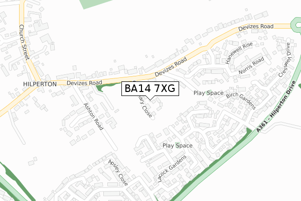
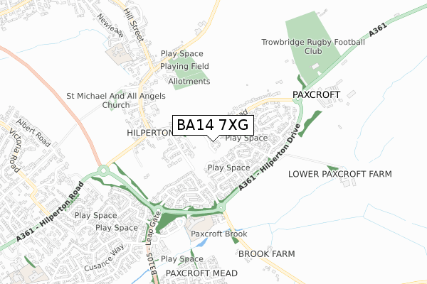
BA14 7XG maps


Licence: Open Government Licence (requires attribution)
Attribution: Contains OS data © Crown copyright and database right 2025
Source: Open Postcode Geo
Licence: Open Government Licence (requires attribution)
Attribution: Contains OS data © Crown copyright and database right 2025; Contains Royal Mail data © Royal Mail copyright and database right 2025; Source: Office for National Statistics licensed under the Open Government Licence v.3.0
BA14 7XG geodata
| Easting | 387639 |
| Northing | 158972 |
| Latitude | 51.329705 |
| Longitude | -2.178796 |
Where is BA14 7XG?
| Country | England |
| Postcode District | BA14 |
Politics
| Ward | Hilperton |
|---|---|
| Constituency | Chippenham |
House Prices
Sales of detached houses in BA14 7XG
2022 7 DEC £650,000 |
10, CENTENARY CLOSE, HILPERTON, TROWBRIDGE, BA14 7XG 2021 30 APR £550,000 |
5, CENTENARY CLOSE, HILPERTON, TROWBRIDGE, BA14 7XG 2021 11 FEB £565,000 |
2021 14 JAN £565,000 |
11, CENTENARY CLOSE, HILPERTON, TROWBRIDGE, BA14 7XG 2020 18 DEC £435,000 |
9, CENTENARY CLOSE, HILPERTON, TROWBRIDGE, BA14 7XG 2020 28 AUG £440,000 |
12, CENTENARY CLOSE, HILPERTON, TROWBRIDGE, BA14 7XG 2020 31 MAR £450,000 |
3, CENTENARY CLOSE, HILPERTON, TROWBRIDGE, BA14 7XG 2019 28 OCT £445,000 |
4, CENTENARY CLOSE, HILPERTON, TROWBRIDGE, BA14 7XG 2019 11 OCT £585,000 |
16, CENTENARY CLOSE, HILPERTON, TROWBRIDGE, BA14 7XG 2019 16 AUG £585,000 |
Licence: Contains HM Land Registry data © Crown copyright and database right 2025. This data is licensed under the Open Government Licence v3.0.
Transport
Nearest bus stops to BA14 7XG
| Church Street | Hilperton | 380m |
| Church Street | Hilperton | 390m |
| Helps Well Road (Hilperton Drive) | Paxcroft Mead | 413m |
| Trowbridge Road | Hilperton | 418m |
| Helps Well Road (Hilperton Drive) | Paxcroft Mead | 423m |
Nearest railway stations to BA14 7XG
| Trowbridge Station | 2.7km |
Broadband
Broadband access in BA14 7XG (2020 data)
| Percentage of properties with Next Generation Access | 100.0% |
| Percentage of properties with Superfast Broadband | 100.0% |
| Percentage of properties with Ultrafast Broadband | 0.0% |
| Percentage of properties with Full Fibre Broadband | 0.0% |
Superfast Broadband is between 30Mbps and 300Mbps
Ultrafast Broadband is > 300Mbps
Broadband limitations in BA14 7XG (2020 data)
| Percentage of properties unable to receive 2Mbps | 0.0% |
| Percentage of properties unable to receive 5Mbps | 0.0% |
| Percentage of properties unable to receive 10Mbps | 0.0% |
| Percentage of properties unable to receive 30Mbps | 0.0% |
Deprivation
4.6% of English postcodes are less deprived than BA14 7XG:Food Standards Agency
Three nearest food hygiene ratings to BA14 7XG (metres)


➜ Get more ratings from the Food Standards Agency
Nearest post box to BA14 7XG
| Last Collection | |||
|---|---|---|---|
| Location | Mon-Fri | Sat | Distance |
| Devizes Road | 12:00 | 12:00 | 148m |
| Painters Mead | 16:45 | 11:15 | 718m |
| Victoria Road | 17:30 | 11:30 | 1,145m |
BA14 7XG ITL and BA14 7XG LAU
The below table lists the International Territorial Level (ITL) codes (formerly Nomenclature of Territorial Units for Statistics (NUTS) codes) and Local Administrative Units (LAU) codes for BA14 7XG:
| ITL 1 Code | Name |
|---|---|
| TLK | South West (England) |
| ITL 2 Code | Name |
| TLK1 | Gloucestershire, Wiltshire and Bath/Bristol area |
| ITL 3 Code | Name |
| TLK15 | Wiltshire |
| LAU 1 Code | Name |
| E06000054 | Wiltshire |
BA14 7XG census areas
The below table lists the Census Output Area (OA), Lower Layer Super Output Area (LSOA), and Middle Layer Super Output Area (MSOA) for BA14 7XG:
| Code | Name | |
|---|---|---|
| OA | E00163608 | |
| LSOA | E01032080 | Wiltshire 030D |
| MSOA | E02006683 | Wiltshire 030 |
Nearest postcodes to BA14 7XG
| BA14 7QJ | Devizes Road | 58m |
| BA14 7FQ | Cannings Close | 155m |
| BA14 7QR | Devizes Road | 156m |
| BA14 7QY | Ashton Road | 169m |
| BA14 7US | Leventon Place | 202m |
| BA14 7TY | Stourton Park | 229m |
| BA14 7TF | Lacock Gardens | 241m |
| BA14 7QZ | Ashton Rise | 252m |
| BA14 7TG | Lacock Gardens | 262m |
| BA14 7RD | Apsley Close | 265m |