BA13 4FH maps, stats, and open data
BA13 4FH is located in the Ethandune electoral ward, within the unitary authority of Wiltshire and the English Parliamentary constituency of South West Wiltshire. The Sub Integrated Care Board (ICB) Location is NHS Bath and North East Somerset, Swindon and Wiltshire ICB - 92 and the police force is Wiltshire. This postcode has been in use since February 2018.
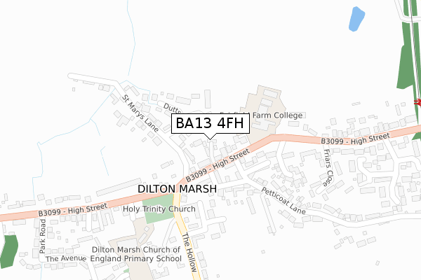
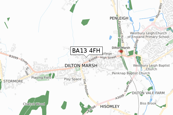
BA13 4FH maps


Licence: Open Government Licence (requires attribution)
Attribution: Contains OS data © Crown copyright and database right 2025
Source: Open Postcode Geo
Licence: Open Government Licence (requires attribution)
Attribution: Contains OS data © Crown copyright and database right 2025; Contains Royal Mail data © Royal Mail copyright and database right 2025; Source: Office for National Statistics licensed under the Open Government Licence v.3.0
BA13 4FH geodata
| Easting | 385076 |
| Northing | 149972 |
| Latitude | 51.248716 |
| Longitude | -2.215203 |
Where is BA13 4FH?
| Country | England |
| Postcode District | BA13 |
Politics
| Ward | Ethandune |
|---|---|
| Constituency | South West Wiltshire |
House Prices
Sales of detached houses in BA13 4FH
2, WEAVERS CLOSE, DILTON MARSH, WESTBURY, BA13 4FH 2019 26 APR £423,000 |
Licence: Contains HM Land Registry data © Crown copyright and database right 2025. This data is licensed under the Open Government Licence v3.0.
Transport
Nearest bus stops to BA13 4FH
| Memorial Hall (High Street) | Dilton Marsh | 54m |
| Memorial Hall (High Street) | Dilton Marsh | 66m |
| Holy Trinity Church (High Street) | Dilton Marsh | 186m |
| Holy Trinity Church (High Street) | Dilton Marsh | 193m |
| Railway Bridge (High Street) | Dilton Marsh | 426m |
Nearest railway stations to BA13 4FH
| Dilton Marsh Station | 0.5km |
| Westbury (Wilts) Station | 2.3km |
| Warminster Station | 5.4km |
Broadband
Broadband access in BA13 4FH (2020 data)
| Percentage of properties with Next Generation Access | 100.0% |
| Percentage of properties with Superfast Broadband | 100.0% |
| Percentage of properties with Ultrafast Broadband | 0.0% |
| Percentage of properties with Full Fibre Broadband | 0.0% |
Superfast Broadband is between 30Mbps and 300Mbps
Ultrafast Broadband is > 300Mbps
Broadband limitations in BA13 4FH (2020 data)
| Percentage of properties unable to receive 2Mbps | 0.0% |
| Percentage of properties unable to receive 5Mbps | 0.0% |
| Percentage of properties unable to receive 10Mbps | 0.0% |
| Percentage of properties unable to receive 30Mbps | 0.0% |
Deprivation
11.5% of English postcodes are less deprived than BA13 4FH:Food Standards Agency
Three nearest food hygiene ratings to BA13 4FH (metres)


➜ Get more ratings from the Food Standards Agency
Nearest post box to BA13 4FH
| Last Collection | |||
|---|---|---|---|
| Location | Mon-Fri | Sat | Distance |
| High Street | 12:00 | 09:45 | 43m |
| High Street (East) | 12:00 | 10:00 | 696m |
| Hisomley | 12:00 | 10:15 | 697m |
BA13 4FH ITL and BA13 4FH LAU
The below table lists the International Territorial Level (ITL) codes (formerly Nomenclature of Territorial Units for Statistics (NUTS) codes) and Local Administrative Units (LAU) codes for BA13 4FH:
| ITL 1 Code | Name |
|---|---|
| TLK | South West (England) |
| ITL 2 Code | Name |
| TLK1 | Gloucestershire, Wiltshire and Bath/Bristol area |
| ITL 3 Code | Name |
| TLK15 | Wiltshire |
| LAU 1 Code | Name |
| E06000054 | Wiltshire |
BA13 4FH census areas
The below table lists the Census Output Area (OA), Lower Layer Super Output Area (LSOA), and Middle Layer Super Output Area (MSOA) for BA13 4FH:
| Code | Name | |
|---|---|---|
| OA | E00163488 | |
| LSOA | E01032052 | Wiltshire 039A |
| MSOA | E02006690 | Wiltshire 039 |
Nearest postcodes to BA13 4FH
| BA13 4DW | High Street | 46m |
| BA13 4DN | High Street | 62m |
| BA13 4DT | High Street | 81m |
| BA13 4BP | The Dutts | 102m |
| BA13 4DJ | Whitecroft | 125m |
| BA13 4DQ | Silver Street | 136m |
| BA13 4BL | St Marys Lane | 155m |
| BA13 4JH | Lansdowne Close | 203m |
| BA13 4BE | Orchard Close | 204m |
| BA13 4FE | School Lane | 240m |