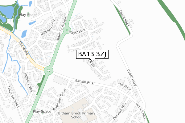
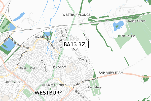
BA13 3ZJ is located in the Westbury East electoral ward, within the unitary authority of Wiltshire and the English Parliamentary constituency of South West Wiltshire. The Sub Integrated Care Board (ICB) Location is NHS Bath and North East Somerset, Swindon and Wiltshire ICB - 92 and the police force is Wiltshire. This postcode has been in use since March 2019.


GetTheData
Source: OS Open Zoomstack (Ordnance Survey)
Licence: Open Government Licence (requires attribution)
Attribution: Contains OS data © Crown copyright and database right 2025
Source: Open Postcode Geo
Licence: Open Government Licence (requires attribution)
Attribution: Contains OS data © Crown copyright and database right 2025; Contains Royal Mail data © Royal Mail copyright and database right 2025; Source: Office for National Statistics licensed under the Open Government Licence v.3.0
| Easting | 387756 |
| Northing | 152021 |
| Latitude | 51.267205 |
| Longitude | -2.176875 |
GetTheData
Source: Open Postcode Geo
Licence: Open Government Licence
| Country | England |
| Postcode District | BA13 |
➜ See where BA13 is on a map ➜ Where is Westbury? | |
GetTheData
Source: Land Registry Price Paid Data
Licence: Open Government Licence
| Ward | Westbury East |
| Constituency | South West Wiltshire |
GetTheData
Source: ONS Postcode Database
Licence: Open Government Licence
2024 11 NOV £400,000 |
2024 12 APR £315,000 |
2023 6 OCT £470,000 |
2022 1 FEB £310,000 |
2021 23 JUL £298,224 |
9, CHEVIOT ROAD, WESTBURY, BA13 3ZJ 2021 25 JUN £330,000 |
2021 19 MAR £325,000 |
15, CHEVIOT ROAD, WESTBURY, BA13 3ZJ 2021 12 MAR £405,000 |
17, CHEVIOT ROAD, WESTBURY, BA13 3ZJ 2021 26 FEB £327,500 |
69, CHEVIOT ROAD, WESTBURY, BA13 3ZJ 2020 17 DEC £407,000 |
GetTheData
Source: HM Land Registry Price Paid Data
Licence: Contains HM Land Registry data © Crown copyright and database right 2025. This data is licensed under the Open Government Licence v3.0.
| Bitham Park | Westbury | 161m |
| Co-op Supermarket (Trwobridge Road) | Westbury | 326m |
| The Mead | Westbury | 393m |
| The Mead | Westbury | 412m |
| Cemetery (Bratton Road) | Westbury | 548m |
| Westbury (Wilts) Station | 1.6km |
| Dilton Marsh Station | 3km |
GetTheData
Source: NaPTAN
Licence: Open Government Licence
| Percentage of properties with Next Generation Access | 100.0% |
| Percentage of properties with Superfast Broadband | 100.0% |
| Percentage of properties with Ultrafast Broadband | 95.8% |
| Percentage of properties with Full Fibre Broadband | 95.8% |
Superfast Broadband is between 30Mbps and 300Mbps
Ultrafast Broadband is > 300Mbps
| Percentage of properties unable to receive 2Mbps | 0.0% |
| Percentage of properties unable to receive 5Mbps | 0.0% |
| Percentage of properties unable to receive 10Mbps | 0.0% |
| Percentage of properties unable to receive 30Mbps | 0.0% |
GetTheData
Source: Ofcom
Licence: Ofcom Terms of Use (requires attribution)
GetTheData
Source: ONS Postcode Database
Licence: Open Government Licence


➜ Get more ratings from the Food Standards Agency
GetTheData
Source: Food Standards Agency
Licence: FSA terms & conditions
| Last Collection | |||
|---|---|---|---|
| Location | Mon-Fri | Sat | Distance |
| Arundell Close | 17:00 | 12:15 | 174m |
| The Mead | 17:00 | 12:15 | 519m |
| Market Place | 17:30 | 12:00 | 644m |
GetTheData
Source: Dracos
Licence: Creative Commons Attribution-ShareAlike
The below table lists the International Territorial Level (ITL) codes (formerly Nomenclature of Territorial Units for Statistics (NUTS) codes) and Local Administrative Units (LAU) codes for BA13 3ZJ:
| ITL 1 Code | Name |
|---|---|
| TLK | South West (England) |
| ITL 2 Code | Name |
| TLK1 | Gloucestershire, Wiltshire and Bath/Bristol area |
| ITL 3 Code | Name |
| TLK15 | Wiltshire |
| LAU 1 Code | Name |
| E06000054 | Wiltshire |
GetTheData
Source: ONS Postcode Directory
Licence: Open Government Licence
The below table lists the Census Output Area (OA), Lower Layer Super Output Area (LSOA), and Middle Layer Super Output Area (MSOA) for BA13 3ZJ:
| Code | Name | |
|---|---|---|
| OA | E00163840 | |
| LSOA | E01032121 | Wiltshire 039E |
| MSOA | E02006690 | Wiltshire 039 |
GetTheData
Source: ONS Postcode Directory
Licence: Open Government Licence
| BA13 3XY | Nightingale Drive | 206m |
| BA13 3UB | The Knoll | 232m |
| BA13 3UA | Arundell Close | 237m |
| BA13 3UE | Danvers Way | 304m |
| BA13 3XL | Teal Close | 319m |
| BA13 3XR | Mallard Close | 339m |
| BA13 3XE | Hampshire Gardens | 344m |
| BA13 3XW | Kingfisher Drive | 355m |
| BA13 3XP | Pintail Way | 397m |
| BA13 3UG | Windsor Drive | 399m |
GetTheData
Source: Open Postcode Geo; Land Registry Price Paid Data
Licence: Open Government Licence