Property/Postcode Data Search:
B95 5DW maps, stats, and open data
B95 5DW is located in the Wootton Wawen electoral ward, within the local authority district of Stratford-on-Avon and the English Parliamentary constituency of Stratford-on-Avon. The Sub Integrated Care Board (ICB) Location is NHS Coventry and Warwickshire ICB - B2M3M and the police force is Warwickshire. This postcode has been in use since August 2019.
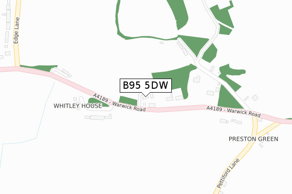
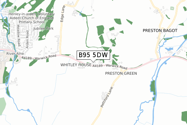
B95 5DW maps


Source: OS Open Zoomstack (Ordnance Survey)
Licence: Open Government Licence (requires attribution)
Attribution: Contains OS data © Crown copyright and database right 2025
Source: Open Postcode Geo
Licence: Open Government Licence (requires attribution)
Attribution: Contains OS data © Crown copyright and database right 2025; Contains Royal Mail data © Royal Mail copyright and database right 2025; Source: Office for National Statistics licensed under the Open Government Licence v.3.0
Licence: Open Government Licence (requires attribution)
Attribution: Contains OS data © Crown copyright and database right 2025
Source: Open Postcode Geo
Licence: Open Government Licence (requires attribution)
Attribution: Contains OS data © Crown copyright and database right 2025; Contains Royal Mail data © Royal Mail copyright and database right 2025; Source: Office for National Statistics licensed under the Open Government Licence v.3.0
B95 5DW geodata
| Easting | 416407 |
| Northing | 265340 |
| Latitude | 52.285972 |
| Longitude | -1.760890 |
Where is B95 5DW?
| Country | England |
| Postcode District | B95 |
Politics
| Ward | Wootton Wawen |
|---|---|
| Constituency | Stratford-on-avon |
Transport
Nearest bus stops to B95 5DW
| Preston Green (Warwick Road) | Preston Bagot | 294m |
| Crabmill (Warwick Road) | Preston Bagot | 832m |
| Crabmill (Warwick Road) | Preston Bagot | 837m |
| Blackford Pastures (Warwick Road) | Henley-in-arden | 954m |
| Arden Road (Castle Road) | Henley-in-arden | 999m |
Nearest railway stations to B95 5DW
| Henley-in-Arden Station | 1.7km |
| Wootton Wawen Station | 2.7km |
| Claverdon Station | 4.5km |
Deprivation
30.4% of English postcodes are less deprived than B95 5DW:Food Standards Agency
Three nearest food hygiene ratings to B95 5DW (metres)
Henley In Arden CofE Primary

Henley-in-Arden CE Primary School
1,058m
AIP C/O St Mary's Catholic Primary School - Henley

Henley-in-Arden CE Primary School
1,058m
Breakfast Club And Discovery Den

Henley-in-Arden CE Primary School
1,058m
➜ Get more ratings from the Food Standards Agency
Nearest post box to B95 5DW
| Last Collection | |||
|---|---|---|---|
| Location | Mon-Fri | Sat | Distance |
| Top Of Whitley Hill Warwick Road | 10:00 | 07:30 | 341m |
| Henley In Arden Post Office | 17:30 | 11:00 | 1,485m |
| Wooton Wawen Post Office | 16:15 | 08:00 | 2,157m |
B95 5DW ITL and B95 5DW LAU
The below table lists the International Territorial Level (ITL) codes (formerly Nomenclature of Territorial Units for Statistics (NUTS) codes) and Local Administrative Units (LAU) codes for B95 5DW:
| ITL 1 Code | Name |
|---|---|
| TLG | West Midlands (England) |
| ITL 2 Code | Name |
| TLG1 | Herefordshire, Worcestershire and Warwickshire |
| ITL 3 Code | Name |
| TLG13 | Warwickshire CC |
| LAU 1 Code | Name |
| E07000221 | Stratford-on-Avon |
B95 5DW census areas
The below table lists the Census Output Area (OA), Lower Layer Super Output Area (LSOA), and Middle Layer Super Output Area (MSOA) for B95 5DW:
| Code | Name | |
|---|---|---|
| OA | E00159082 | |
| LSOA | E01031204 | Stratford-on-Avon 002D |
| MSOA | E02006505 | Stratford-on-Avon 002 |
Nearest postcodes to B95 5DW
| B95 5DL | Whitley Hill | 117m |
| B95 5DJ | Whitley Hill | 238m |
| B95 5DR | 246m | |
| B95 6AH | Pettiford Lane | 418m |
| B95 5DS | Edge Lane | 532m |
| B95 5DQ | Blackford Hill | 615m |
| B95 5DT | Edge Lane | 734m |
| B95 5LX | Chingley Bank | 841m |
| B95 5LR | Castle Close | 895m |
| B95 5LJ | Whitley Road | 914m |