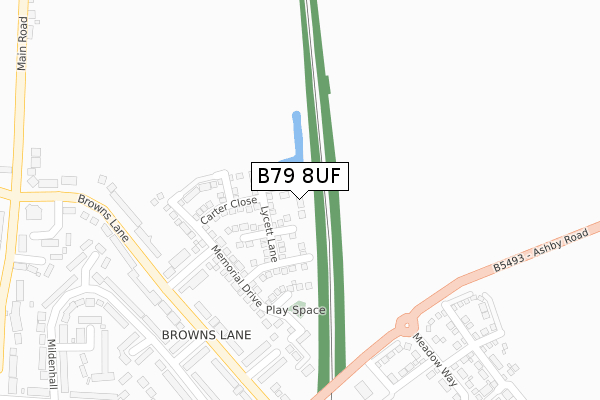
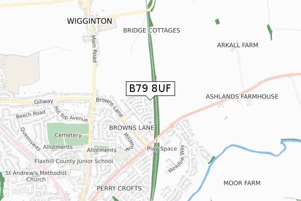
B79 8UF is located in the Whittington & Streethay electoral ward, within the local authority district of Lichfield and the English Parliamentary constituency of Tamworth. The Sub Integrated Care Board (ICB) Location is NHS Staffordshire and Stoke-on-Trent ICB - 05Q and the police force is Staffordshire. This postcode has been in use since January 2019.


GetTheData
Source: OS Open Zoomstack (Ordnance Survey)
Licence: Open Government Licence (requires attribution)
Attribution: Contains OS data © Crown copyright and database right 2025
Source: Open Postcode Geo
Licence: Open Government Licence (requires attribution)
Attribution: Contains OS data © Crown copyright and database right 2025; Contains Royal Mail data © Royal Mail copyright and database right 2025; Source: Office for National Statistics licensed under the Open Government Licence v.3.0
| Easting | 421416 |
| Northing | 305874 |
| Latitude | 52.650197 |
| Longitude | -1.684873 |
GetTheData
Source: Open Postcode Geo
Licence: Open Government Licence
| Country | England |
| Postcode District | B79 |
➜ See where B79 is on a map ➜ Where is Tamworth? | |
GetTheData
Source: Land Registry Price Paid Data
Licence: Open Government Licence
| Ward | Whittington & Streethay |
| Constituency | Tamworth |
GetTheData
Source: ONS Postcode Database
Licence: Open Government Licence
| Manston View (Browns Lane) | Borough Park | 261m |
| Benson View (Brown's Lane) | Borough Park | 290m |
| Lyneham Close (Brown's Lane) | Borough Park | 303m |
| Browns Lane (Ashby Rd) | Borough Park | 351m |
| Browns Lane (Ashby Rd) | Borough Park | 392m |
| Tamworth High Level Station | 1.4km |
| Tamworth Station | 1.4km |
| Wilnecote (Staffs) Station | 4.4km |
GetTheData
Source: NaPTAN
Licence: Open Government Licence
| Percentage of properties with Next Generation Access | 100.0% |
| Percentage of properties with Superfast Broadband | 100.0% |
| Percentage of properties with Ultrafast Broadband | 0.0% |
| Percentage of properties with Full Fibre Broadband | 0.0% |
Superfast Broadband is between 30Mbps and 300Mbps
Ultrafast Broadband is > 300Mbps
| Median download speed | 55.8Mbps |
| Average download speed | 44.8Mbps |
| Maximum download speed | 78.12Mbps |
| Median upload speed | 14.8Mbps |
| Average upload speed | 11.3Mbps |
| Maximum upload speed | 19.53Mbps |
| Percentage of properties unable to receive 2Mbps | 0.0% |
| Percentage of properties unable to receive 5Mbps | 0.0% |
| Percentage of properties unable to receive 10Mbps | 0.0% |
| Percentage of properties unable to receive 30Mbps | 0.0% |
GetTheData
Source: Ofcom
Licence: Ofcom Terms of Use (requires attribution)
GetTheData
Source: ONS Postcode Database
Licence: Open Government Licence


➜ Get more ratings from the Food Standards Agency
GetTheData
Source: Food Standards Agency
Licence: FSA terms & conditions
| Last Collection | |||
|---|---|---|---|
| Location | Mon-Fri | Sat | Distance |
| Mildenhall Off Wigginton Road | 17:15 | 11:30 | 357m |
| Wiggington Post Office | 17:00 | 09:00 | 559m |
| Perrycrofts Crescent / Farm Cl | 17:15 | 11:30 | 831m |
GetTheData
Source: Dracos
Licence: Creative Commons Attribution-ShareAlike
The below table lists the International Territorial Level (ITL) codes (formerly Nomenclature of Territorial Units for Statistics (NUTS) codes) and Local Administrative Units (LAU) codes for B79 8UF:
| ITL 1 Code | Name |
|---|---|
| TLG | West Midlands (England) |
| ITL 2 Code | Name |
| TLG2 | Shropshire and Staffordshire |
| ITL 3 Code | Name |
| TLG24 | Staffordshire CC |
| LAU 1 Code | Name |
| E07000194 | Lichfield |
GetTheData
Source: ONS Postcode Directory
Licence: Open Government Licence
The below table lists the Census Output Area (OA), Lower Layer Super Output Area (LSOA), and Middle Layer Super Output Area (MSOA) for B79 8UF:
| Code | Name | |
|---|---|---|
| OA | E00150403 | |
| LSOA | E01029517 | Lichfield 008B |
| MSOA | E02006153 | Lichfield 008 |
GetTheData
Source: ONS Postcode Directory
Licence: Open Government Licence
| B79 8TH | Manston View | 226m |
| B79 8TD | Benson View | 265m |
| B79 8TE | Browns Lane | 266m |
| B79 8TF | Browns Lane | 296m |
| B79 8TA | Browns Lane | 305m |
| B79 8SD | Scampton Way | 311m |
| B79 8RZ | Mildenhall | 330m |
| B79 8TB | Browns Lane | 334m |
| B79 8SH | Helston Close | 370m |
| B79 8SJ | Yeovilton | 375m |
GetTheData
Source: Open Postcode Geo; Land Registry Price Paid Data
Licence: Open Government Licence