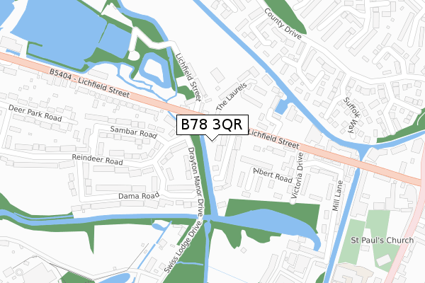
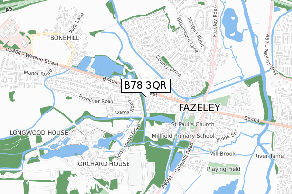
B78 3QR is located in the Fazeley electoral ward, within the local authority district of Lichfield and the English Parliamentary constituency of Tamworth. The Sub Integrated Care Board (ICB) Location is NHS Staffordshire and Stoke-on-Trent ICB - 05Q and the police force is Staffordshire. This postcode has been in use since May 2018.


GetTheData
Source: OS Open Zoomstack (Ordnance Survey)
Licence: Open Government Licence (requires attribution)
Attribution: Contains OS data © Crown copyright and database right 2025
Source: Open Postcode Geo
Licence: Open Government Licence (requires attribution)
Attribution: Contains OS data © Crown copyright and database right 2025; Contains Royal Mail data © Royal Mail copyright and database right 2025; Source: Office for National Statistics licensed under the Open Government Licence v.3.0
| Easting | 419983 |
| Northing | 302017 |
| Latitude | 52.615579 |
| Longitude | -1.706288 |
GetTheData
Source: Open Postcode Geo
Licence: Open Government Licence
| Country | England |
| Postcode District | B78 |
➜ See where B78 is on a map ➜ Where is Fazeley? | |
GetTheData
Source: Land Registry Price Paid Data
Licence: Open Government Licence
| Ward | Fazeley |
| Constituency | Tamworth |
GetTheData
Source: ONS Postcode Database
Licence: Open Government Licence
2018 3 AUG £318,000 |
1, LITTLEFIELD CLOSE, FAZELEY, TAMWORTH, B78 3QR 2018 2 MAR £347,000 |
2016 24 MAR £245,000 |
2000 19 JUN £82,000 |
GetTheData
Source: HM Land Registry Price Paid Data
Licence: Contains HM Land Registry data © Crown copyright and database right 2025. This data is licensed under the Open Government Licence v3.0.
| Fallow Road (Lichfield Street) | Fazeley | 54m |
| Fallow Road (Lichfield Street) | Fazeley | 124m |
| Lakeside Industrial Park (A5 Lichfield Street) | Bonehill | 384m |
| Lakeside Industrial Park (A5 Lichfield Street) | Bonehill | 414m |
| The Square (Lichfield Street) | Fazeley | 416m |
| Wilnecote (Staffs) Station | 1.9km |
| Tamworth Station | 2.8km |
| Tamworth High Level Station | 2.8km |
GetTheData
Source: NaPTAN
Licence: Open Government Licence
| Percentage of properties with Next Generation Access | 100.0% |
| Percentage of properties with Superfast Broadband | 100.0% |
| Percentage of properties with Ultrafast Broadband | 100.0% |
| Percentage of properties with Full Fibre Broadband | 0.0% |
Superfast Broadband is between 30Mbps and 300Mbps
Ultrafast Broadband is > 300Mbps
| Percentage of properties unable to receive 2Mbps | 0.0% |
| Percentage of properties unable to receive 5Mbps | 0.0% |
| Percentage of properties unable to receive 10Mbps | 0.0% |
| Percentage of properties unable to receive 30Mbps | 0.0% |
GetTheData
Source: Ofcom
Licence: Ofcom Terms of Use (requires attribution)
GetTheData
Source: ONS Postcode Database
Licence: Open Government Licence


➜ Get more ratings from the Food Standards Agency
GetTheData
Source: Food Standards Agency
Licence: FSA terms & conditions
| Last Collection | |||
|---|---|---|---|
| Location | Mon-Fri | Sat | Distance |
| Manor Drive / Fallow Road | 16:45 | 07:00 | 76m |
| Fazeley Post Office | 17:20 | 11:30 | 478m |
| Manor Road Mile Oak | 16:45 | 07:00 | 854m |
GetTheData
Source: Dracos
Licence: Creative Commons Attribution-ShareAlike
The below table lists the International Territorial Level (ITL) codes (formerly Nomenclature of Territorial Units for Statistics (NUTS) codes) and Local Administrative Units (LAU) codes for B78 3QR:
| ITL 1 Code | Name |
|---|---|
| TLG | West Midlands (England) |
| ITL 2 Code | Name |
| TLG2 | Shropshire and Staffordshire |
| ITL 3 Code | Name |
| TLG24 | Staffordshire CC |
| LAU 1 Code | Name |
| E07000194 | Lichfield |
GetTheData
Source: ONS Postcode Directory
Licence: Open Government Licence
The below table lists the Census Output Area (OA), Lower Layer Super Output Area (LSOA), and Middle Layer Super Output Area (MSOA) for B78 3QR:
| Code | Name | |
|---|---|---|
| OA | E00150329 | |
| LSOA | E01029504 | Lichfield 012D |
| MSOA | E02006157 | Lichfield 012 |
GetTheData
Source: ONS Postcode Directory
Licence: Open Government Licence
| B78 3QL | Broomfield Avenue | 67m |
| B78 3SH | Drayton Manor Drive | 86m |
| B78 3SL | Reindeer Road | 96m |
| B78 3QE | Lichfield Street | 106m |
| B78 3EH | The Laurels | 135m |
| B78 3QJ | Albert Road | 145m |
| B78 3EJ | The Laurels | 161m |
| B78 3SX | Mayama Road | 162m |
| B78 3QY | Evans Croft | 172m |
| B78 3SS | Sambar Road | 210m |
GetTheData
Source: Open Postcode Geo; Land Registry Price Paid Data
Licence: Open Government Licence