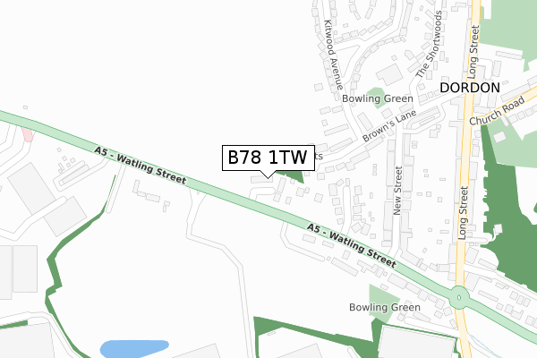
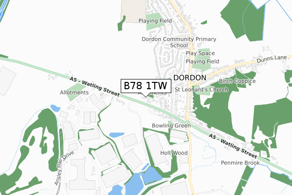
B78 1TW is located in the Dordon electoral ward, within the local authority district of North Warwickshire and the English Parliamentary constituency of North Warwickshire. The Sub Integrated Care Board (ICB) Location is NHS Coventry and Warwickshire ICB - B2M3M and the police force is Warwickshire. This postcode has been in use since October 2017.


GetTheData
Source: OS Open Zoomstack (Ordnance Survey)
Licence: Open Government Licence (requires attribution)
Attribution: Contains OS data © Crown copyright and database right 2025
Source: Open Postcode Geo
Licence: Open Government Licence (requires attribution)
Attribution: Contains OS data © Crown copyright and database right 2025; Contains Royal Mail data © Royal Mail copyright and database right 2025; Source: Office for National Statistics licensed under the Open Government Licence v.3.0
| Easting | 425825 |
| Northing | 300291 |
| Latitude | 52.599818 |
| Longitude | -1.620137 |
GetTheData
Source: Open Postcode Geo
Licence: Open Government Licence
| Country | England |
| Postcode District | B78 |
➜ See where B78 is on a map ➜ Where is Dordon? | |
GetTheData
Source: Land Registry Price Paid Data
Licence: Open Government Licence
| Ward | Dordon |
| Constituency | North Warwickshire |
GetTheData
Source: ONS Postcode Database
Licence: Open Government Licence
| Hall End Business Park (Watling Street) | Dordon | 104m |
| Ashlea (Kitwood Avenue) | Dordon | 179m |
| Browns Lane (New Street) | Dordon | 234m |
| Dukes Road (Kitwood Avenue) | Dordon | 259m |
| New Street (Watling Street) | Dordon | 269m |
| Polesworth Station | 3km |
| Wilnecote (Staffs) Station | 4.2km |
| Atherstone Station | 5.1km |
GetTheData
Source: NaPTAN
Licence: Open Government Licence
| Percentage of properties with Next Generation Access | 100.0% |
| Percentage of properties with Superfast Broadband | 100.0% |
| Percentage of properties with Ultrafast Broadband | 100.0% |
| Percentage of properties with Full Fibre Broadband | 0.0% |
Superfast Broadband is between 30Mbps and 300Mbps
Ultrafast Broadband is > 300Mbps
| Median download speed | 90.0Mbps |
| Average download speed | 143.8Mbps |
| Maximum download speed | 350.00Mbps |
| Median upload speed | 13.9Mbps |
| Average upload speed | 11.5Mbps |
| Maximum upload speed | 20.00Mbps |
| Percentage of properties unable to receive 2Mbps | 0.0% |
| Percentage of properties unable to receive 5Mbps | 0.0% |
| Percentage of properties unable to receive 10Mbps | 0.0% |
| Percentage of properties unable to receive 30Mbps | 0.0% |
GetTheData
Source: Ofcom
Licence: Ofcom Terms of Use (requires attribution)
GetTheData
Source: ONS Postcode Database
Licence: Open Government Licence


➜ Get more ratings from the Food Standards Agency
GetTheData
Source: Food Standards Agency
Licence: FSA terms & conditions
| Last Collection | |||
|---|---|---|---|
| Location | Mon-Fri | Sat | Distance |
| Birchmoor Post Office | 17:00 | 10:30 | 1,316m |
| Granada Services | 17:30 | 11:00 | 1,654m |
| Boot Hill | 16:40 | 11:15 | 1,871m |
GetTheData
Source: Dracos
Licence: Creative Commons Attribution-ShareAlike
The below table lists the International Territorial Level (ITL) codes (formerly Nomenclature of Territorial Units for Statistics (NUTS) codes) and Local Administrative Units (LAU) codes for B78 1TW:
| ITL 1 Code | Name |
|---|---|
| TLG | West Midlands (England) |
| ITL 2 Code | Name |
| TLG1 | Herefordshire, Worcestershire and Warwickshire |
| ITL 3 Code | Name |
| TLG13 | Warwickshire CC |
| LAU 1 Code | Name |
| E07000218 | North Warwickshire |
GetTheData
Source: ONS Postcode Directory
Licence: Open Government Licence
The below table lists the Census Output Area (OA), Lower Layer Super Output Area (LSOA), and Middle Layer Super Output Area (MSOA) for B78 1TW:
| Code | Name | |
|---|---|---|
| OA | E00158157 | |
| LSOA | E01031025 | North Warwickshire 002B |
| MSOA | E02006469 | North Warwickshire 002 |
GetTheData
Source: ONS Postcode Directory
Licence: Open Government Licence
| B78 1TJ | Browns Lane | 150m |
| B78 1TE | Watling Street | 156m |
| B78 1TH | Vicarage Close | 167m |
| B78 1TG | New Street | 227m |
| B78 1TQ | New Street | 259m |
| B78 1SY | Watling Street | 301m |
| B78 1TF | Watling Street | 304m |
| B78 1TR | Browns Lane | 317m |
| B78 1TL | Browns Lane | 320m |
| B78 1PE | Kitwood Avenue | 342m |
GetTheData
Source: Open Postcode Geo; Land Registry Price Paid Data
Licence: Open Government Licence