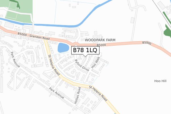
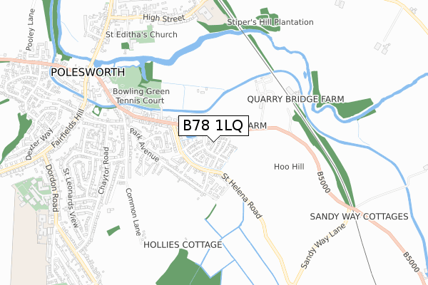
B78 1LQ maps, stats, and open data
B78 1LQ is located in the Polesworth East electoral ward, within the local authority district of North Warwickshire and the English Parliamentary constituency of North Warwickshire. The Sub Integrated Care Board (ICB) Location is NHS Coventry and Warwickshire ICB - B2M3M and the police force is Warwickshire. This postcode has been in use since August 2017.
B78 1LQ maps


Licence: Open Government Licence (requires attribution)
Attribution: Contains OS data © Crown copyright and database right 2025
Source: Open Postcode Geo
Licence: Open Government Licence (requires attribution)
Attribution: Contains OS data © Crown copyright and database right 2025; Contains Royal Mail data © Royal Mail copyright and database right 2025; Source: Office for National Statistics licensed under the Open Government Licence v.3.0
B78 1LQ geodata
| Easting | 426801 |
| Northing | 301837 |
| Latitude | 52.613669 |
| Longitude | -1.605604 |
Where is B78 1LQ?
| Country | England |
| Postcode District | B78 |
Politics
| Ward | Polesworth East |
|---|---|
| Constituency | North Warwickshire |
House Prices
Sales of detached houses in B78 1LQ
2024 5 JAN £405,000 |
2021 12 MAR £339,950 |
2020 4 DEC £340,000 |
2019 8 OCT £278,000 |
2017 29 NOV £334,995 |
12, KNIGHT CLOSE, POLESWORTH, TAMWORTH, B78 1LQ 2017 24 NOV £294,995 |
15, KNIGHT CLOSE, POLESWORTH, TAMWORTH, B78 1LQ 2017 27 OCT £289,995 |
2017 29 SEP £327,995 |
10, KNIGHT CLOSE, POLESWORTH, TAMWORTH, B78 1LQ 2017 29 SEP £338,995 |
2017 29 SEP £289,995 |
Licence: Contains HM Land Registry data © Crown copyright and database right 2025. This data is licensed under the Open Government Licence v3.0.
Transport
Nearest bus stops to B78 1LQ
| Potters Lane (Chaytor Road) | Polesworth | 620m |
| Potters Lane (Chaytor Road) | Polesworth | 635m |
| Gulf Garage (Grendon Road) | Polesworth | 747m |
| Waterside (Grendon Road) | Polesworth | 760m |
| Morris Hill (Bardon View Road) | Dordon | 761m |
Nearest railway stations to B78 1LQ
| Polesworth Station | 1.4km |
| Atherstone Station | 5.3km |
Broadband
Broadband access in B78 1LQ (2020 data)
| Percentage of properties with Next Generation Access | 100.0% |
| Percentage of properties with Superfast Broadband | 100.0% |
| Percentage of properties with Ultrafast Broadband | 0.0% |
| Percentage of properties with Full Fibre Broadband | 0.0% |
Superfast Broadband is between 30Mbps and 300Mbps
Ultrafast Broadband is > 300Mbps
Broadband speed in B78 1LQ (2019 data)
Download
| Median download speed | 29.8Mbps |
| Average download speed | 26.1Mbps |
| Maximum download speed | 46.59Mbps |
Upload
| Median upload speed | 4.7Mbps |
| Average upload speed | 4.2Mbps |
| Maximum upload speed | 7.95Mbps |
Broadband limitations in B78 1LQ (2020 data)
| Percentage of properties unable to receive 2Mbps | 0.0% |
| Percentage of properties unable to receive 5Mbps | 0.0% |
| Percentage of properties unable to receive 10Mbps | 0.0% |
| Percentage of properties unable to receive 30Mbps | 0.0% |
Deprivation
55.6% of English postcodes are less deprived than B78 1LQ:Food Standards Agency
Three nearest food hygiene ratings to B78 1LQ (metres)


➜ Get more ratings from the Food Standards Agency
Nearest post box to B78 1LQ
| Last Collection | |||
|---|---|---|---|
| Location | Mon-Fri | Sat | Distance |
| Polesworth Post Office | 17:00 | 11:00 | 916m |
| Birchmoor Post Office | 17:00 | 10:30 | 1,658m |
| Opp 1 Little Warton Road | 16:45 | 07:00 | 2,407m |
B78 1LQ ITL and B78 1LQ LAU
The below table lists the International Territorial Level (ITL) codes (formerly Nomenclature of Territorial Units for Statistics (NUTS) codes) and Local Administrative Units (LAU) codes for B78 1LQ:
| ITL 1 Code | Name |
|---|---|
| TLG | West Midlands (England) |
| ITL 2 Code | Name |
| TLG1 | Herefordshire, Worcestershire and Warwickshire |
| ITL 3 Code | Name |
| TLG13 | Warwickshire CC |
| LAU 1 Code | Name |
| E07000218 | North Warwickshire |
B78 1LQ census areas
The below table lists the Census Output Area (OA), Lower Layer Super Output Area (LSOA), and Middle Layer Super Output Area (MSOA) for B78 1LQ:
| Code | Name | |
|---|---|---|
| OA | E00158237 | |
| LSOA | E01031037 | North Warwickshire 001C |
| MSOA | E02006468 | North Warwickshire 001 |
Nearest postcodes to B78 1LQ
| B78 1NS | Grendon Road | 105m |
| B78 1NJ | St Helena Road | 184m |
| B78 1NT | Grendon Road | 196m |
| B78 1NR | Grendon Road | 206m |
| B78 1NW | St Helena Road | 213m |
| B78 1NL | Park Road | 220m |
| B78 1NN | St Helena Road | 231m |
| B78 1NP | Abbey View | 253m |
| B78 1NH | Hollies Road | 253m |
| B78 1LW | Sunfields Close | 280m |