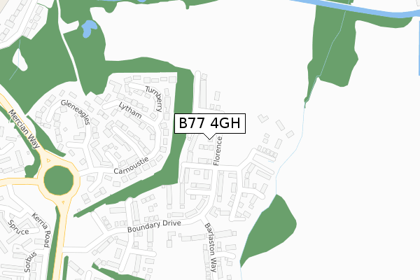
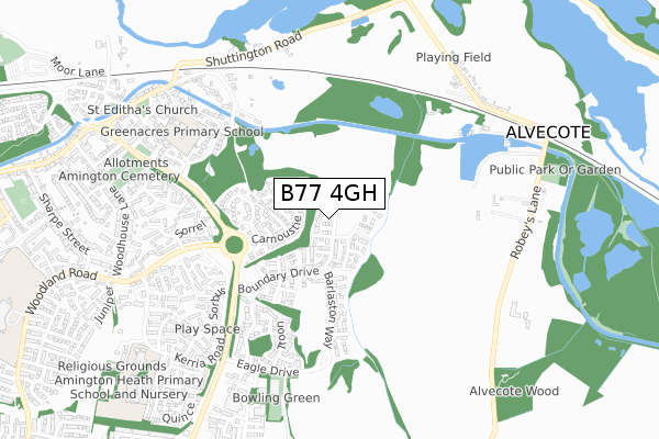
B77 4GH is located in the Amington electoral ward, within the local authority district of Tamworth and the English Parliamentary constituency of Tamworth. The Sub Integrated Care Board (ICB) Location is NHS Staffordshire and Stoke-on-Trent ICB - 05Q and the police force is Staffordshire. This postcode has been in use since August 2019.


GetTheData
Source: OS Open Zoomstack (Ordnance Survey)
Licence: Open Government Licence (requires attribution)
Attribution: Contains OS data © Crown copyright and database right 2025
Source: Open Postcode Geo
Licence: Open Government Licence (requires attribution)
Attribution: Contains OS data © Crown copyright and database right 2025; Contains Royal Mail data © Royal Mail copyright and database right 2025; Source: Office for National Statistics licensed under the Open Government Licence v.3.0
| Easting | 424230 |
| Northing | 304109 |
| Latitude | 52.634213 |
| Longitude | -1.643408 |
GetTheData
Source: Open Postcode Geo
Licence: Open Government Licence
| Country | England |
| Postcode District | B77 |
➜ See where B77 is on a map ➜ Where is Tamworth? | |
GetTheData
Source: Land Registry Price Paid Data
Licence: Open Government Licence
| Ward | Amington |
| Constituency | Tamworth |
GetTheData
Source: ONS Postcode Database
Licence: Open Government Licence
2, FLORENCE DRIVE, AMINGTON, TAMWORTH, B77 4GH 2024 27 SEP £395,000 |
8, FLORENCE DRIVE, AMINGTON, TAMWORTH, B77 4GH 2024 2 SEP £400,000 |
6, FLORENCE DRIVE, AMINGTON, TAMWORTH, B77 4GH 2024 27 AUG £400,000 |
4, FLORENCE DRIVE, AMINGTON, TAMWORTH, B77 4GH 2024 16 AUG £409,000 |
10, FLORENCE DRIVE, AMINGTON, TAMWORTH, B77 4GH 2024 19 JUL £425,000 |
12, FLORENCE DRIVE, AMINGTON, TAMWORTH, B77 4GH 2024 17 MAY £430,000 |
14, FLORENCE DRIVE, AMINGTON, TAMWORTH, B77 4GH 2023 22 SEP £412,797 |
2021 9 AUG £389,995 |
17, FLORENCE DRIVE, AMINGTON, TAMWORTH, B77 4GH 2020 21 FEB £339,995 |
1, FLORENCE DRIVE, AMINGTON, TAMWORTH, B77 4GH 2019 13 DEC £359,995 |
GetTheData
Source: HM Land Registry Price Paid Data
Licence: Contains HM Land Registry data © Crown copyright and database right 2025. This data is licensed under the Open Government Licence v3.0.
| Woodland Road (Mercian Way) | Amington | 440m |
| Woodland Road (Mercian Way) | Amington | 447m |
| Spruce (Kerria Rd) | Amington | 484m |
| Salbus (Kerria Rd) | Amington | 512m |
| Sorbus (Kerria Rd) | Amington | 512m |
| Polesworth Station | 2.4km |
| Tamworth High Level Station | 2.9km |
| Tamworth Station | 2.9km |
GetTheData
Source: NaPTAN
Licence: Open Government Licence
GetTheData
Source: ONS Postcode Database
Licence: Open Government Licence


➜ Get more ratings from the Food Standards Agency
GetTheData
Source: Food Standards Agency
Licence: FSA terms & conditions
| Last Collection | |||
|---|---|---|---|
| Location | Mon-Fri | Sat | Distance |
| Pennymoor | 17:00 | 11:30 | 1,492m |
| Silver Link Post Office | 17:15 | 11:30 | 1,933m |
| Malham Road / Lowforce | 18:00 | 11:30 | 2,062m |
GetTheData
Source: Dracos
Licence: Creative Commons Attribution-ShareAlike
The below table lists the International Territorial Level (ITL) codes (formerly Nomenclature of Territorial Units for Statistics (NUTS) codes) and Local Administrative Units (LAU) codes for B77 4GH:
| ITL 1 Code | Name |
|---|---|
| TLG | West Midlands (England) |
| ITL 2 Code | Name |
| TLG2 | Shropshire and Staffordshire |
| ITL 3 Code | Name |
| TLG24 | Staffordshire CC |
| LAU 1 Code | Name |
| E07000199 | Tamworth |
GetTheData
Source: ONS Postcode Directory
Licence: Open Government Licence
The below table lists the Census Output Area (OA), Lower Layer Super Output Area (LSOA), and Middle Layer Super Output Area (MSOA) for B77 4GH:
| Code | Name | |
|---|---|---|
| OA | E00151966 | |
| LSOA | E01029820 | Tamworth 003A |
| MSOA | E02006219 | Tamworth 003 |
GetTheData
Source: ONS Postcode Directory
Licence: Open Government Licence
| B77 4NR | Turnberry | 159m |
| B77 4NN | Carnoustie | 183m |
| B77 4NW | Sunningdale | 193m |
| B77 4QA | Lytham | 225m |
| B77 4NP | Muirfield | 228m |
| B77 4NT | Hoylake | 310m |
| B77 4NS | Gleneagles | 311m |
| B77 4HD | Sorrel | 501m |
| B77 4RA | St Andrews | 508m |
| B77 4RB | Troon | 529m |
GetTheData
Source: Open Postcode Geo; Land Registry Price Paid Data
Licence: Open Government Licence