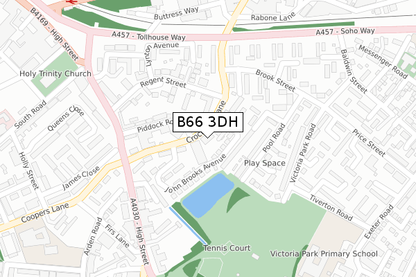
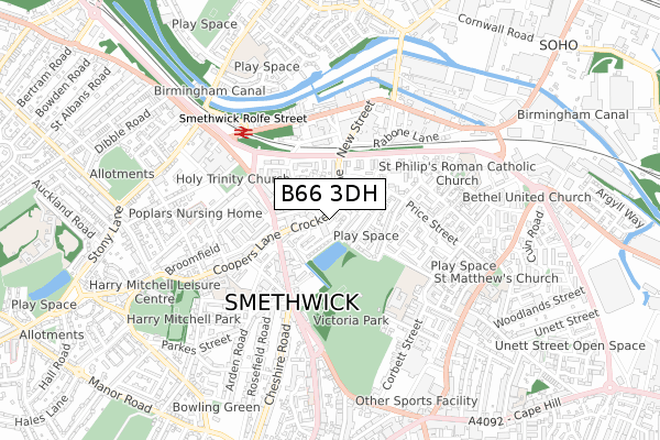
B66 3DH is located in the Soho and Victoria electoral ward, within the metropolitan district of Sandwell and the English Parliamentary constituency of Warley. The Sub Integrated Care Board (ICB) Location is NHS Black Country ICB - D2P2L and the police force is West Midlands. This postcode has been in use since October 2019.


GetTheData
Source: OS Open Zoomstack (Ordnance Survey)
Licence: Open Government Licence (requires attribution)
Attribution: Contains OS data © Crown copyright and database right 2025
Source: Open Postcode Geo
Licence: Open Government Licence (requires attribution)
Attribution: Contains OS data © Crown copyright and database right 2025; Contains Royal Mail data © Royal Mail copyright and database right 2025; Source: Office for National Statistics licensed under the Open Government Licence v.3.0
| Easting | 402431 |
| Northing | 288402 |
| Latitude | 52.493538 |
| Longitude | -1.965618 |
GetTheData
Source: Open Postcode Geo
Licence: Open Government Licence
| Country | England |
| Postcode District | B66 |
➜ See where B66 is on a map ➜ Where is Smethwick? | |
GetTheData
Source: Land Registry Price Paid Data
Licence: Open Government Licence
| Ward | Soho And Victoria |
| Constituency | Warley |
GetTheData
Source: ONS Postcode Database
Licence: Open Government Licence
| Piddock Road (Crocketts Lane) | Smethwick | 79m |
| Piddock Road (Crocketts Lane) | Smethwick | 97m |
| Crocketts Lane (Brook St) | Smethwick | 179m |
| Crocketts Lane (Brook St) | Smethwick | 191m |
| Smethwick Council House (High St) | Smethwick | 222m |
| Handsworth Booth Street (Midland Metro Stop) (Booth Street) | Handsworth | 1,309m |
| The Hawthorns (Midland Metro Stop) (Middlemore Lane) | Smethwick | 1,360m |
| Smethwick Rolfe Street Station | 0.5km |
| The Hawthorns Station | 1.3km |
| Smethwick Galton Bridge Station | 1.4km |
GetTheData
Source: NaPTAN
Licence: Open Government Licence
| Percentage of properties with Next Generation Access | 100.0% |
| Percentage of properties with Superfast Broadband | 100.0% |
| Percentage of properties with Ultrafast Broadband | 0.0% |
| Percentage of properties with Full Fibre Broadband | 0.0% |
Superfast Broadband is between 30Mbps and 300Mbps
Ultrafast Broadband is > 300Mbps
| Percentage of properties unable to receive 2Mbps | 0.0% |
| Percentage of properties unable to receive 5Mbps | 0.0% |
| Percentage of properties unable to receive 10Mbps | 0.0% |
| Percentage of properties unable to receive 30Mbps | 0.0% |
GetTheData
Source: Ofcom
Licence: Ofcom Terms of Use (requires attribution)
GetTheData
Source: ONS Postcode Database
Licence: Open Government Licence


➜ Get more ratings from the Food Standards Agency
GetTheData
Source: Food Standards Agency
Licence: FSA terms & conditions
| Last Collection | |||
|---|---|---|---|
| Location | Mon-Fri | Sat | Distance |
| Crocketts Lane / Regent St | 17:30 | 12:00 | 76m |
| Victoria Park Post Office | 17:15 | 12:00 | 365m |
| Rolfe St / Engine St | 18:30 | 12:00 | 399m |
GetTheData
Source: Dracos
Licence: Creative Commons Attribution-ShareAlike
The below table lists the International Territorial Level (ITL) codes (formerly Nomenclature of Territorial Units for Statistics (NUTS) codes) and Local Administrative Units (LAU) codes for B66 3DH:
| ITL 1 Code | Name |
|---|---|
| TLG | West Midlands (England) |
| ITL 2 Code | Name |
| TLG3 | West Midlands |
| ITL 3 Code | Name |
| TLG37 | Sandwell |
| LAU 1 Code | Name |
| E08000028 | Sandwell |
GetTheData
Source: ONS Postcode Directory
Licence: Open Government Licence
The below table lists the Census Output Area (OA), Lower Layer Super Output Area (LSOA), and Middle Layer Super Output Area (MSOA) for B66 3DH:
| Code | Name | |
|---|---|---|
| OA | E00050899 | |
| LSOA | E01010064 | Sandwell 026E |
| MSOA | E02002068 | Sandwell 026 |
GetTheData
Source: ONS Postcode Directory
Licence: Open Government Licence
| B66 3BF | Regent Street | 87m |
| B66 3BX | Crocketts Lane | 103m |
| B66 3BL | Piddock Road | 123m |
| B66 3DB | Pool Road | 131m |
| B66 3BE | Crocketts Lane | 152m |
| B66 3BG | Regent Street | 162m |
| B66 3BD | Chamberlain Walk | 162m |
| B66 3BP | George Bird Close | 164m |
| B66 3AB | Amity Close | 169m |
| B66 3BN | Sketchley Close | 178m |
GetTheData
Source: Open Postcode Geo; Land Registry Price Paid Data
Licence: Open Government Licence