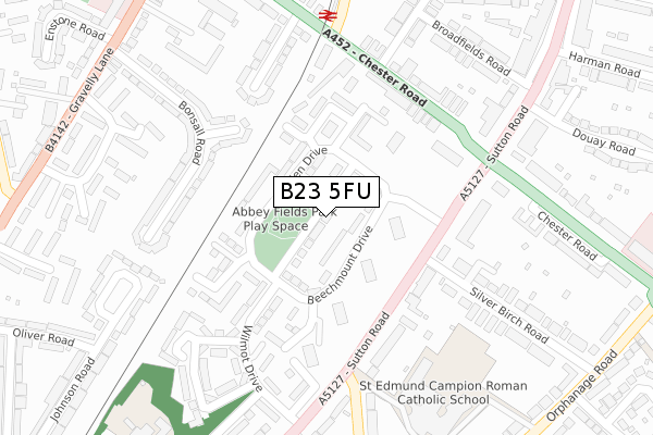
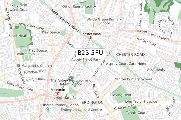
B23 5FU is located in the Erdington electoral ward, within the metropolitan district of Birmingham and the English Parliamentary constituency of Birmingham, Erdington. The Sub Integrated Care Board (ICB) Location is NHS Birmingham and Solihull ICB - 15E and the police force is West Midlands. This postcode has been in use since December 2017.


GetTheData
Source: OS Open Zoomstack (Ordnance Survey)
Licence: Open Government Licence (requires attribution)
Attribution: Contains OS data © Crown copyright and database right 2025
Source: Open Postcode Geo
Licence: Open Government Licence (requires attribution)
Attribution: Contains OS data © Crown copyright and database right 2025; Contains Royal Mail data © Royal Mail copyright and database right 2025; Source: Office for National Statistics licensed under the Open Government Licence v.3.0
| Easting | 411445 |
| Northing | 292765 |
| Latitude | 52.532648 |
| Longitude | -1.832705 |
GetTheData
Source: Open Postcode Geo
Licence: Open Government Licence
| Country | England |
| Postcode District | B23 |
➜ See where B23 is on a map ➜ Where is Birmingham? | |
GetTheData
Source: Land Registry Price Paid Data
Licence: Open Government Licence
| Ward | Erdington |
| Constituency | Birmingham, Erdington |
GetTheData
Source: ONS Postcode Database
Licence: Open Government Licence
2023 30 NOV £335,000 |
2022 1 NOV £330,000 |
2021 26 MAR £290,000 |
2018 12 MAR £250,000 |
21, ABBEY WAY, BIRMINGHAM, B23 5FU 2018 7 MAR £250,000 |
2018 2 MAR £250,000 |
GetTheData
Source: HM Land Registry Price Paid Data
Licence: Contains HM Land Registry data © Crown copyright and database right 2025. This data is licensed under the Open Government Licence v3.0.
| Holly Lane (Sutton Rd) | Yenton | 184m |
| The Yenton (Sutton Rd) | Yenton | 188m |
| The Yenton (Sutton Rd) | Yenton | 206m |
| Holly Lane (Sutton Rd) | Yenton | 227m |
| Chester Rd (Florence Rd) | Yenton | 277m |
| Chester Road Station | 0.3km |
| Erdington Station | 0.7km |
| Wylde Green Station | 1.5km |
GetTheData
Source: NaPTAN
Licence: Open Government Licence
| Percentage of properties with Next Generation Access | 0.0% |
| Percentage of properties with Superfast Broadband | 0.0% |
| Percentage of properties with Ultrafast Broadband | 0.0% |
| Percentage of properties with Full Fibre Broadband | 0.0% |
Superfast Broadband is between 30Mbps and 300Mbps
Ultrafast Broadband is > 300Mbps
| Median download speed | 14.1Mbps |
| Average download speed | 13.7Mbps |
| Maximum download speed | 16.89Mbps |
| Median upload speed | 1.0Mbps |
| Average upload speed | 1.0Mbps |
| Maximum upload speed | 1.28Mbps |
| Percentage of properties unable to receive 2Mbps | 0.0% |
| Percentage of properties unable to receive 5Mbps | 0.0% |
| Percentage of properties unable to receive 10Mbps | 40.0% |
| Percentage of properties unable to receive 30Mbps | 100.0% |
GetTheData
Source: Ofcom
Licence: Ofcom Terms of Use (requires attribution)
GetTheData
Source: ONS Postcode Database
Licence: Open Government Licence


➜ Get more ratings from the Food Standards Agency
GetTheData
Source: Food Standards Agency
Licence: FSA terms & conditions
| Last Collection | |||
|---|---|---|---|
| Location | Mon-Fri | Sat | Distance |
| Opposite School Rowden Drive | 17:30 | 12:15 | 89m |
| Chester Road Station | 17:15 | 12:00 | 304m |
| Sutton Road Opp Orchard Road | 17:30 | 12:15 | 331m |
GetTheData
Source: Dracos
Licence: Creative Commons Attribution-ShareAlike
The below table lists the International Territorial Level (ITL) codes (formerly Nomenclature of Territorial Units for Statistics (NUTS) codes) and Local Administrative Units (LAU) codes for B23 5FU:
| ITL 1 Code | Name |
|---|---|
| TLG | West Midlands (England) |
| ITL 2 Code | Name |
| TLG3 | West Midlands |
| ITL 3 Code | Name |
| TLG31 | Birmingham |
| LAU 1 Code | Name |
| E08000025 | Birmingham |
GetTheData
Source: ONS Postcode Directory
Licence: Open Government Licence
The below table lists the Census Output Area (OA), Lower Layer Super Output Area (LSOA), and Middle Layer Super Output Area (MSOA) for B23 5FU:
| Code | Name | |
|---|---|---|
| OA | E00175739 | |
| LSOA | E01033632 | Birmingham 023F |
| MSOA | E02001849 | Birmingham 023 |
GetTheData
Source: ONS Postcode Directory
Licence: Open Government Licence
| B23 5UG | Beechmount Drive | 49m |
| B23 5UH | Rowden Drive | 68m |
| B23 5UR | Rowden Drive | 125m |
| B23 5UT | Rogerfield Road | 141m |
| B23 5UD | Portfield Grove | 144m |
| B23 5DZ | Stonnal Grove | 163m |
| B23 5SZ | Bretby Grove | 184m |
| B23 5TZ | Wilmot Drive | 188m |
| B23 5UJ | Banners Grove | 190m |
| B23 5SY | Bonsall Road | 199m |
GetTheData
Source: Open Postcode Geo; Land Registry Price Paid Data
Licence: Open Government Licence