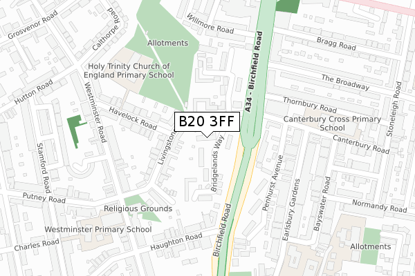
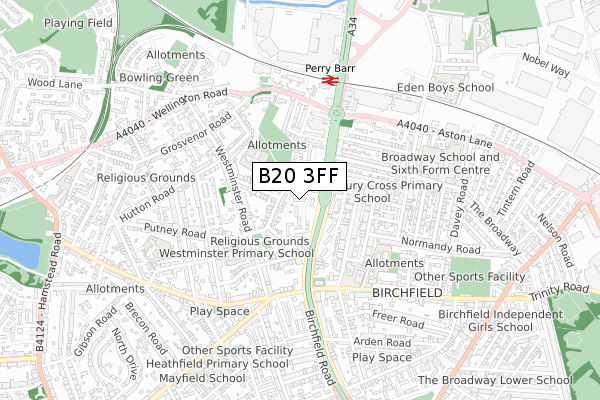
B20 3FF is located in the Birchfield electoral ward, within the metropolitan district of Birmingham and the English Parliamentary constituency of Birmingham, Perry Barr. The Sub Integrated Care Board (ICB) Location is NHS Birmingham and Solihull ICB - 15E and the police force is West Midlands. This postcode has been in use since September 2018.


GetTheData
Source: OS Open Zoomstack (Ordnance Survey)
Licence: Open Government Licence (requires attribution)
Attribution: Contains OS data © Crown copyright and database right 2025
Source: Open Postcode Geo
Licence: Open Government Licence (requires attribution)
Attribution: Contains OS data © Crown copyright and database right 2025; Contains Royal Mail data © Royal Mail copyright and database right 2025; Source: Office for National Statistics licensed under the Open Government Licence v.3.0
| Easting | 406615 |
| Northing | 290450 |
| Latitude | 52.511916 |
| Longitude | -1.903954 |
GetTheData
Source: Open Postcode Geo
Licence: Open Government Licence
| Country | England |
| Postcode District | B20 |
➜ See where B20 is on a map ➜ Where is Birmingham? | |
GetTheData
Source: Land Registry Price Paid Data
Licence: Open Government Licence
| Ward | Birchfield |
| Constituency | Birmingham, Perry Barr |
GetTheData
Source: ONS Postcode Database
Licence: Open Government Licence
| Livingstone Rd (Birchfield Rd) | Perry Barr | 87m |
| Heathfield Rd (Birchfield Rd) | Birchfield | 222m |
| Livingstone Rd (Birchfield Rd) | Perry Barr | 281m |
| Heathfield Rd (Birchfield Rd) | Birchfield | 298m |
| Heathfield Rd (Birchfield Rd) | Birchfield | 327m |
| Perry Barr Station | 0.5km |
| Witton (West Midlands) Station | 1.3km |
| Aston Station | 2.3km |
GetTheData
Source: NaPTAN
Licence: Open Government Licence
| Percentage of properties with Next Generation Access | 0.0% |
| Percentage of properties with Superfast Broadband | 0.0% |
| Percentage of properties with Ultrafast Broadband | 0.0% |
| Percentage of properties with Full Fibre Broadband | 0.0% |
Superfast Broadband is between 30Mbps and 300Mbps
Ultrafast Broadband is > 300Mbps
| Percentage of properties unable to receive 2Mbps | 0.0% |
| Percentage of properties unable to receive 5Mbps | 0.0% |
| Percentage of properties unable to receive 10Mbps | 0.0% |
| Percentage of properties unable to receive 30Mbps | 100.0% |
GetTheData
Source: Ofcom
Licence: Ofcom Terms of Use (requires attribution)
GetTheData
Source: ONS Postcode Database
Licence: Open Government Licence


➜ Get more ratings from the Food Standards Agency
GetTheData
Source: Food Standards Agency
Licence: FSA terms & conditions
| Last Collection | |||
|---|---|---|---|
| Location | Mon-Fri | Sat | Distance |
| Police Station Canterbury Road | 17:30 | 12:30 | 238m |
| Westminister Road / Livingstone | 17:30 | 12:30 | 246m |
| Perry Barr Post Office | 17:45 | 12:30 | 377m |
GetTheData
Source: Dracos
Licence: Creative Commons Attribution-ShareAlike
The below table lists the International Territorial Level (ITL) codes (formerly Nomenclature of Territorial Units for Statistics (NUTS) codes) and Local Administrative Units (LAU) codes for B20 3FF:
| ITL 1 Code | Name |
|---|---|
| TLG | West Midlands (England) |
| ITL 2 Code | Name |
| TLG3 | West Midlands |
| ITL 3 Code | Name |
| TLG31 | Birmingham |
| LAU 1 Code | Name |
| E08000025 | Birmingham |
GetTheData
Source: ONS Postcode Directory
Licence: Open Government Licence
The below table lists the Census Output Area (OA), Lower Layer Super Output Area (LSOA), and Middle Layer Super Output Area (MSOA) for B20 3FF:
| Code | Name | |
|---|---|---|
| OA | E00045916 | |
| LSOA | E01033621 | Birmingham 035G |
| MSOA | E02001861 | Birmingham 035 |
GetTheData
Source: ONS Postcode Directory
Licence: Open Government Licence
| B20 3LN | Livingstone Road | 76m |
| B20 3JU | Bridgelands Way | 106m |
| B20 3LL | Livingstone Road | 111m |
| B20 3DG | Birchfield Road | 139m |
| B20 3JW | Ashcroft Grove | 147m |
| B20 3LS | Livingstone Road | 148m |
| B20 3BG | Penshurst Avenue | 171m |
| B20 3LA | Birchfield Road | 187m |
| B20 3ND | Apollo Way | 189m |
| B20 3LR | Havelock Road | 201m |
GetTheData
Source: Open Postcode Geo; Land Registry Price Paid Data
Licence: Open Government Licence