Property/Postcode Data Search:
B18 9JZ maps, stats, and open data
B18 9JZ is located in the Soho & Jewellery Quarter electoral ward, within the metropolitan district of Birmingham and the English Parliamentary constituency of Birmingham, Ladywood. The Sub Integrated Care Board (ICB) Location is NHS Birmingham and Solihull ICB - 15E and the police force is West Midlands. This postcode has been in use since December 2019.
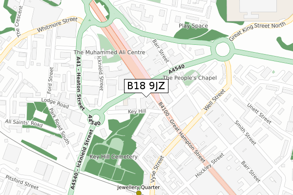
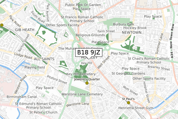
B18 9JZ maps


Source: OS Open Zoomstack (Ordnance Survey)
Licence: Open Government Licence (requires attribution)
Attribution: Contains OS data © Crown copyright and database right 2025
Source: Open Postcode Geo
Licence: Open Government Licence (requires attribution)
Attribution: Contains OS data © Crown copyright and database right 2025; Contains Royal Mail data © Royal Mail copyright and database right 2025; Source: Office for National Statistics licensed under the Open Government Licence v.3.0
Licence: Open Government Licence (requires attribution)
Attribution: Contains OS data © Crown copyright and database right 2025
Source: Open Postcode Geo
Licence: Open Government Licence (requires attribution)
Attribution: Contains OS data © Crown copyright and database right 2025; Contains Royal Mail data © Royal Mail copyright and database right 2025; Source: Office for National Statistics licensed under the Open Government Licence v.3.0
B18 9JZ geodata
| Easting | 406010 |
| Northing | 288305 |
| Latitude | 52.492639 |
| Longitude | -1.912907 |
Where is B18 9JZ?
| Country | England |
| Postcode District | B18 |
Politics
| Ward | Soho & Jewellery Quarter |
|---|---|
| Constituency | Birmingham, Ladywood |
Transport
Nearest bus stops to B18 9JZ
| Great King St (Hockley Hill) | Hockley | 50m |
| Great King St (Hockley Hill) | Hockley | 62m |
| Great King St (Hockley Hill) | Hockley | 63m |
| Great King St (Hockley Hill) | Hockley | 79m |
| Barr Street (New John St West) | Hockley | 204m |
Nearest underground/metro/tram to B18 9JZ
| Jewellery Quarter (Midland Metro Stop) (Vyse St Hockley) | Jewellery Quarter | 330m |
| St Paul's (Midland Metro Stop) (Livery Street) | Jewellery Quarter | 902m |
| Soho Benson Road (Midland Metro Stop) (Benson Road) | Winson Green | 1,326m |
| Snow Hill (Midland Metro Stop) (Colmore Row) | Birmingham | 1,373m |
| Bull Street (Midland Metro Stop) (Bull Street) | Birmingham | 1,644m |
Nearest railway stations to B18 9JZ
| Jewellery Quarter Station | 0.4km |
| Birmingham Snow Hill Station | 1.4km |
| Birmingham New Street Station | 1.9km |
Deprivation
57.2% of English postcodes are less deprived than B18 9JZ:Food Standards Agency
Three nearest food hygiene ratings to B18 9JZ (metres)
Values Academy

Part Ground Floor
76m
The Kulture Bar & Restaurant

Ground Floor
78m
Nevin Day centre

20-22 Key Hill
96m
➜ Get more ratings from the Food Standards Agency
Nearest post box to B18 9JZ
| Last Collection | |||
|---|---|---|---|
| Location | Mon-Fri | Sat | Distance |
| Hockley Post Office | 18:30 | 12:30 | 121m |
| New John St West / Hockley Hil | 18:30 | 12:30 | 244m |
| Cornwall St Heaton St | 17:45 | 12:30 | 252m |
B18 9JZ ITL and B18 9JZ LAU
The below table lists the International Territorial Level (ITL) codes (formerly Nomenclature of Territorial Units for Statistics (NUTS) codes) and Local Administrative Units (LAU) codes for B18 9JZ:
| ITL 1 Code | Name |
|---|---|
| TLG | West Midlands (England) |
| ITL 2 Code | Name |
| TLG3 | West Midlands |
| ITL 3 Code | Name |
| TLG31 | Birmingham |
| LAU 1 Code | Name |
| E08000025 | Birmingham |
B18 9JZ census areas
The below table lists the Census Output Area (OA), Lower Layer Super Output Area (LSOA), and Middle Layer Super Output Area (MSOA) for B18 9JZ:
| Code | Name | |
|---|---|---|
| OA | E00175610 | |
| LSOA | E01033559 | Birmingham 049E |
| MSOA | E02001875 | Birmingham 049 |
Nearest postcodes to B18 9JZ
| B18 5NX | Key Hill | 63m |
| B19 3AE | Barr Street | 114m |
| B18 5NY | Key Hill Drive | 120m |
| B18 5AA | Hockley Hill | 133m |
| B18 6HN | Hylton Street | 178m |
| B18 6HR | Vyse Street | 183m |
| B19 3ES | Stainsby Avenue | 189m |
| B18 6EW | Great Hampton Street | 212m |
| B18 6EL | Great Hampton Street | 257m |
| B19 3EN | Smith Street | 271m |