B16 0AE maps, stats, and open data
- Home
- Postcode
- B
- B16
- B16 0
B16 0AE is located in the Ladywood electoral ward, within the metropolitan district of Birmingham and the English Parliamentary constituency of Birmingham, Ladywood. The Sub Integrated Care Board (ICB) Location is NHS Birmingham and Solihull ICB - 15E and the police force is West Midlands. This postcode has been in use since September 2019.
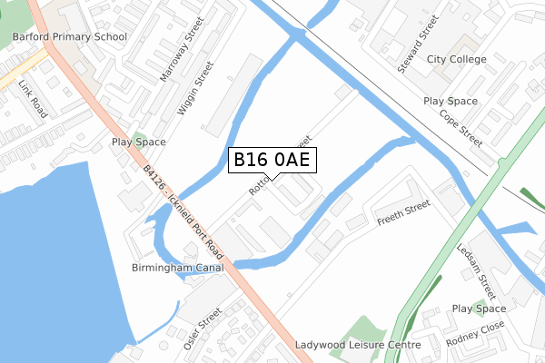
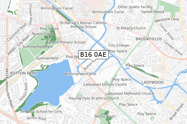
B16 0AE maps


Source: OS Open Zoomstack (Ordnance Survey)
Licence: Open Government Licence (requires attribution)
Attribution: Contains OS data © Crown copyright and database right 2025
Source: Open Postcode GeoLicence: Open Government Licence (requires attribution)
Attribution: Contains OS data © Crown copyright and database right 2025; Contains Royal Mail data © Royal Mail copyright and database right 2025; Source: Office for National Statistics licensed under the Open Government Licence v.3.0
B16 0AE geodata
| Easting | 404930 |
| Northing | 287170 |
| Latitude | 52.482446 |
| Longitude | -1.928829 |
Where is B16 0AE?
| Country | England |
| Postcode District | B16 |
Politics
| Ward | Ladywood |
|---|
| Constituency | Birmingham, Ladywood |
|---|
Transport
Nearest bus stops to B16 0AE
| Osler St (Icknield Port Rd) | Ladywood | 275m |
| Wiggin St (Icknield Port Rd) | Rotton Park | 277m |
| Osler St (Icknield Port Rd) | Ladywood | 303m |
| Ledsam St (Ladywood Middleway) | Ladywood | 308m |
| Wiggin St (Icknield Port Rd) | Rotton Park | 311m |
Nearest underground/metro/tram to B16 0AE
| Jewellery Quarter (Midland Metro Stop) (Vyse St Hockley) | Jewellery Quarter | 1,333m |
Nearest railway stations to B16 0AE
| Jewellery Quarter Station | 1.3km |
| Five Ways Station | 1.7km |
| Birmingham New Street Station | 2km |
Broadband
Broadband access in B16 0AE (2020 data)
| Percentage of properties with Next Generation Access | 100.0% |
| Percentage of properties with Superfast Broadband | 100.0% |
| Percentage of properties with Ultrafast Broadband | 100.0% |
| Percentage of properties with Full Fibre Broadband | 100.0% |
Superfast Broadband is between 30Mbps and 300Mbps
Ultrafast Broadband is > 300Mbps
Broadband limitations in B16 0AE (2020 data)
| Percentage of properties unable to receive 2Mbps | 0.0% |
| Percentage of properties unable to receive 5Mbps | 0.0% |
| Percentage of properties unable to receive 10Mbps | 0.0% |
| Percentage of properties unable to receive 30Mbps | 0.0% |
Deprivation
91.9% of English postcodes are less deprived than
B16 0AE:
Food Standards Agency
Three nearest food hygiene ratings to B16 0AE (metres)
Yard Art House
BCG FOOD PANTRY/Community Hub & Cafe
VIP
➜ Get more ratings from the Food Standards Agency
Nearest post box to B16 0AE
| | Last Collection | |
|---|
| Location | Mon-Fri | Sat | Distance |
|---|
| Icknield Port Road / Rotton Park | 17:30 | 12:30 | 254m |
| Ladywood Road | 17:30 | 12:30 | 393m |
| Rotton Park Road / Portland Ro | 17:30 | 12:30 | 512m |
B16 0AE ITL and B16 0AE LAU
The below table lists the International Territorial Level (ITL) codes (formerly Nomenclature of Territorial Units for Statistics (NUTS) codes) and Local Administrative Units (LAU) codes for B16 0AE:
| ITL 1 Code | Name |
|---|
| TLG | West Midlands (England) |
| ITL 2 Code | Name |
|---|
| TLG3 | West Midlands |
| ITL 3 Code | Name |
|---|
| TLG31 | Birmingham |
| LAU 1 Code | Name |
|---|
| E08000025 | Birmingham |
B16 0AE census areas
The below table lists the Census Output Area (OA), Lower Layer Super Output Area (LSOA), and Middle Layer Super Output Area (MSOA) for B16 0AE:
| Code | Name |
|---|
| OA | E00046423 | |
|---|
| LSOA | E01009153 | Birmingham 053C |
|---|
| MSOA | E02001879 | Birmingham 053 |
|---|
Nearest postcodes to B16 0AE


