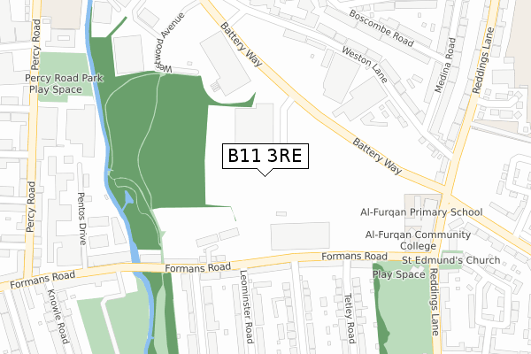
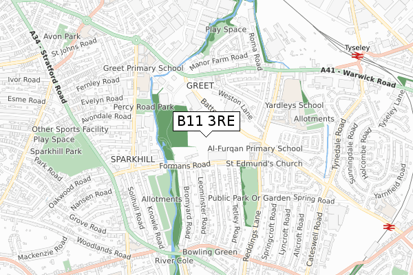
B11 3RE is located in the Hall Green North electoral ward, within the metropolitan district of Birmingham and the English Parliamentary constituency of Birmingham, Hall Green. The Sub Integrated Care Board (ICB) Location is NHS Birmingham and Solihull ICB - 15E and the police force is West Midlands. This postcode has been in use since March 2019.


GetTheData
Source: OS Open Zoomstack (Ordnance Survey)
Licence: Open Government Licence (requires attribution)
Attribution: Contains OS data © Crown copyright and database right 2025
Source: Open Postcode Geo
Licence: Open Government Licence (requires attribution)
Attribution: Contains OS data © Crown copyright and database right 2025; Contains Royal Mail data © Royal Mail copyright and database right 2025; Source: Office for National Statistics licensed under the Open Government Licence v.3.0
| Easting | 410157 |
| Northing | 283521 |
| Latitude | 52.449570 |
| Longitude | -1.851972 |
GetTheData
Source: Open Postcode Geo
Licence: Open Government Licence
| Country | England |
| Postcode District | B11 |
➜ See where B11 is on a map ➜ Where is Birmingham? | |
GetTheData
Source: Land Registry Price Paid Data
Licence: Open Government Licence
| Ward | Hall Green North |
| Constituency | Birmingham, Hall Green |
GetTheData
Source: ONS Postcode Database
Licence: Open Government Licence
| Leominster Rd (Formans Rd) | Sparkhill | 163m |
| Tetley Rd (Formans Rd) | Greet | 184m |
| Leominster Rd (Formans Rd) | Sparkhill | 193m |
| Tetley Rd (Formans Rd) | Greet | 255m |
| St Edmunds Church (Reddings Lane) | Greet | 348m |
| Tyseley Station | 1km |
| Spring Road Station | 1.2km |
| Hall Green Station | 1.5km |
GetTheData
Source: NaPTAN
Licence: Open Government Licence
GetTheData
Source: ONS Postcode Database
Licence: Open Government Licence


➜ Get more ratings from the Food Standards Agency
GetTheData
Source: Food Standards Agency
Licence: FSA terms & conditions
| Last Collection | |||
|---|---|---|---|
| Location | Mon-Fri | Sat | Distance |
| Runnymede Road / Foremans Road | 17:45 | 12:30 | 175m |
| Reddings Lane Post Office | 17:30 | 12:30 | 345m |
| Manor Farm Road / Warwick Road | 17:30 | 12:30 | 424m |
GetTheData
Source: Dracos
Licence: Creative Commons Attribution-ShareAlike
The below table lists the International Territorial Level (ITL) codes (formerly Nomenclature of Territorial Units for Statistics (NUTS) codes) and Local Administrative Units (LAU) codes for B11 3RE:
| ITL 1 Code | Name |
|---|---|
| TLG | West Midlands (England) |
| ITL 2 Code | Name |
| TLG3 | West Midlands |
| ITL 3 Code | Name |
| TLG31 | Birmingham |
| LAU 1 Code | Name |
| E08000025 | Birmingham |
GetTheData
Source: ONS Postcode Directory
Licence: Open Government Licence
The below table lists the Census Output Area (OA), Lower Layer Super Output Area (LSOA), and Middle Layer Super Output Area (MSOA) for B11 3RE:
| Code | Name | |
|---|---|---|
| OA | E00045792 | |
| LSOA | E01033641 | Birmingham 140G |
| MSOA | E02006901 | Birmingham 140 |
GetTheData
Source: ONS Postcode Directory
Licence: Open Government Licence
| B11 3BL | Formans Road | 177m |
| B11 3AX | Formans Road | 184m |
| B11 3BP | Formans Road | 192m |
| B11 3BD | Formans Road | 210m |
| B11 3BY | Formans Road | 249m |
| B11 3RR | Weston Lane | 265m |
| B11 3RP | Weston Lane | 265m |
| B11 3RX | Weston Lane | 292m |
| B11 3RU | Weston Lane | 296m |
| B11 3HD | Reddings Lane | 326m |
GetTheData
Source: Open Postcode Geo; Land Registry Price Paid Data
Licence: Open Government Licence